


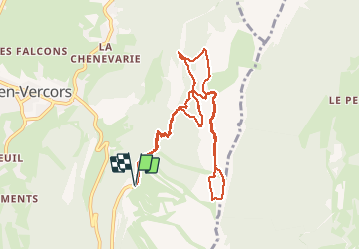

9.1 km | 13.8 km-effort

User


FREE GPS app for hiking
 SityTrail
IGN / Geographical institutes
SityTrail World
The world is yours!
Trail Snowshoes of 10.3 km to be discovered at Auvergne-Rhône-Alpes, Isère, Lans-en-Vercors. This trail is proposed by patjobou.
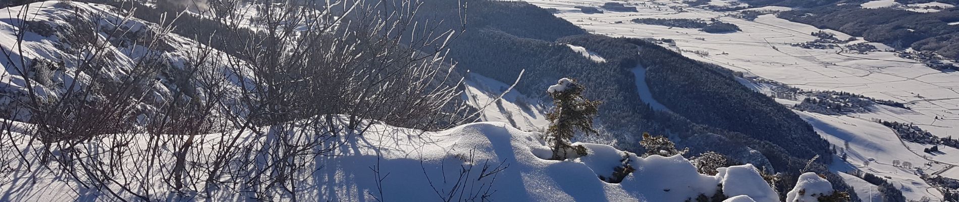
Une belle boucle dans une neige presque vierge avec un retour par la Croix des Ramées pour profiter d'une belle journée ensoleillée.


Nordic walking

Walking

Snowshoes

Walking

Walking

Walking

Snowshoes

Walking

Walking