10.3 km | 13.4 km-effort
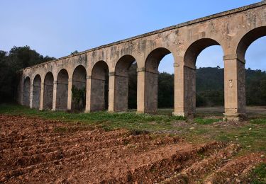
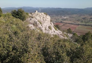
Le grand Peylougier
essius
User
Length
6.7 km
Max alt
168 m
Uphill gradient
198 m
Km-Effort
9.3 km
Min alt
62 m
Downhill gradient
197 m
Boucle
Yes
Creation date :
2019-12-10 13:07:59.23
Updated on :
2019-12-10 16:13:18.807
2h31
Difficulty : Medium
FREE GPS app for hiking
About
Trail Walking of 6.7 km to be discovered at Provence-Alpes-Côte d'Azur, Var, Vidauban. This trail is proposed by essius.
Positioning
Country:
France
Region :
Provence-Alpes-Côte d'Azur
Department/Province :
Var
Municipality :
Vidauban
Location:
Unknown
Start:(Dec)
Start:(UTM)
293229 ; 4811421 (32T) N.
Comments
Trails nearby
LES ARC SUR ARGENS-Fond du Loup-LA bergerie -DRI
Walking
Difficult
(1)
Les Arcs-sur-Argens,
Provence-Alpes-Côte d'Azur,
Var,
France
3h 2min
Yes
vidauban l'Aille
Walking
Medium
(1)
Vidauban,
Provence-Alpes-Côte d'Azur,
Var,
France
13 km | 14.9 km-effort
4h 0min
Yes
Vidauban
Cycle
Medium
(1)
Vidauban,
Provence-Alpes-Côte d'Azur,
Var,
France
30 km | 36 km-effort
2h 0min
No
z cascade de l'Aille
Walking
Easy
Vidauban,
Provence-Alpes-Côte d'Azur,
Var,
France
3.7 km | 4.2 km-effort
1h 26min
No
Vidauban - Château d'Astros - Chapelle St Lambert
Walking
Easy
Vidauban,
Provence-Alpes-Côte d'Azur,
Var,
France
14.8 km | 19.2 km-effort
3h 10min
Yes
l'aille
Walking
Very easy
Vidauban,
Provence-Alpes-Côte d'Azur,
Var,
France
10.6 km | 12.1 km-effort
2h 51min
Yes
20201007 Taradeau les Arcs 3
Walking
Medium
Taradeau,
Provence-Alpes-Côte d'Azur,
Var,
France
13.1 km | 17.7 km-effort
6h 1min
No
Vidauban
Walking
Easy
Vidauban,
Provence-Alpes-Côte d'Azur,
Var,
France
18.2 km | 24 km-effort
4h 6min
Yes
taradel
Walking
Very easy
Taradeau,
Provence-Alpes-Côte d'Azur,
Var,
France
4.5 km | 6.4 km-effort
1h 48min
Yes
Nous n'avons pas pu mener à bien cette balade car arrivés au niveau de l'écopont : 1) nous n'avons pas trouvé le sentier prévu pour gravir le grand Peyloubier 2) la suite de la randonnée prévoit le franchissement de l'écopont. Or, il est interdit de le traverser. Nous avons donc du faire demi-tour.