Trail Mountain bike Lezoux - lexoux 24kms - Photo
© OpenStreetMap contributors
Length
Length
23 km
Max alt
Max alt
457 m
Uphill gradient
Uphill gradient
294 m
Km-Effort
Km-Effort  
27 km
Min alt
Min alt
310 m
Downhill gradient
Downhill gradient
293 m
Boucle
Boucle
Yes
Creation date :
2019-11-25 13:15:28.399
Updated on :
2019-11-25 15:53:07.694

(0 Reviews)

Mountain bike
Mountain bike
1h48
Difficulty : Medium
Electric bike
Electric bike
1h51
Difficulty : Very easy

Scan this QR Code to open this trail in the SityTrail application

FREE GPS app for hiking

Logo SityTrail SityTrail

IGN / Geographical institutes

Download SityTrail from the App Store Download SityTrail from Google Play

Logo SityTrail SityTrail World

The world is yours!

Download SityTrail from the App Store Download SityTrail from Google Play Download SityTrail on Huawei AppGallery

About

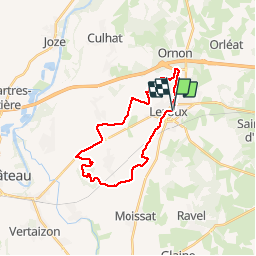
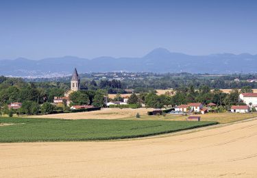
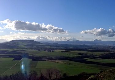
Trail Mountain bike of 23 km to be discovered at Auvergne-Rhône-Alpes, Puy-de-Dôme, Lezoux. This trail is proposed by loursblanc.

Description

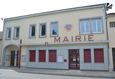
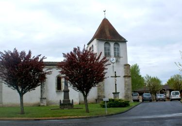
Au départ de Lezoux Place de la Mairie ou Parking proche du Musée de la poterie.
Parcours facile la seule difficulté est la montée du puy Courcourt.
KMs 11 a 13 prendre le chemin parallèle a la route.

Elevation profile

Positioning

Country:
France
Region :
Auvergne-Rhône-Alpes
Department/Province :
Puy-de-Dôme
Municipality :
Lezoux
Location:
Unknown
Start:(UTM)
529810 ; 5075042 (31T) N.

Trails nearby

Trail On foot Orléat - lezoux cote nature - Photo
On foot
PRO

On foot

Easy
Orléat, Auvergne-Rhône-Alpes, Puy-de-Dôme, France
14.1 km | 15.9 km-effort
3h 36min
Yes
Trail On foot Ravel - La Morille - Photo
On foot
PRO

On foot

Easy
Ravel, Auvergne-Rhône-Alpes, Puy-de-Dôme, France
6 km | 7.2 km-effort
1h 38min
Yes
Trail Walking Culhat - les Berges du Litroux, 7km300,59m - Photo
Walking
gergovie

Walking

Easy
Culhat, Auvergne-Rhône-Alpes, Puy-de-Dôme, France
7.3 km | 8.1 km-effort
1h 50min
Yes
Trail Walking Ravel - Ravel_Morille - Photo
Walking
GUIDE
jagarnier

Walking

Medium
Ravel, Auvergne-Rhône-Alpes, Puy-de-Dôme, France
5.9 km | 7.1 km-effort
1h 36min
Yes
Trail On foot Culhat - Les berges du litroux - Photo
On foot
PRO

On foot

Easy
Culhat, Auvergne-Rhône-Alpes, Puy-de-Dôme, France
7.3 km | 8.1 km-effort
1h 50min
Yes
Trail On foot Seychalles - La Tour de Courcourt - Photo
On foot
PRO

On foot

Easy
Seychalles, Auvergne-Rhône-Alpes, Puy-de-Dôme, France
8.2 km | 10.2 km-effort
2h 18min
Yes
Trail Walking Culhat - Culhat_Berges_Litroux - Photo
Walking
GUIDE
jagarnier

Walking

Easy
Culhat, Auvergne-Rhône-Alpes, Puy-de-Dôme, France
7.2 km | 8 km-effort
2h 15min
Yes
Trail Walking Seychalles - Seychalles_Courcourt - Photo
Walking
GUIDE
jagarnier

Walking

Easy
Seychalles, Auvergne-Rhône-Alpes, Puy-de-Dôme, France
7.7 km | 9.7 km-effort
2h 15min
Yes
Trail Walking Saint-Jean-d'Heurs - St_Jean_Balad_Heurs - Photo
Walking
GUIDE
jagarnier

Walking

Easy
Saint-Jean-d'Heurs, Auvergne-Rhône-Alpes, Puy-de-Dôme, France
12.1 km | 14.1 km-effort
3h 30min
Yes


Close
My subscriptions