Rabat SityTrail > Trails > Outdoor > Morocco > Rabat-Salé-Kenitra > pachalik de Rabat > Hassan حسان SityTrail > Trails > Outdoor > Morocco > Rabat-Salé-Kenitra > pachalik de Rabat > Hassan حسان Rabat jcm17 User 3D © OpenStreetMap contributors Length 28 km Max alt 67 m Uphill gradient 260 m Km-Effort 32 km Min alt 1 m Downhill gradient 270 m Boucle No Creation date : 2019-11-21 14:59:56.435 Updated on : 2019-11-21 21:42:07.939 (0 Reviews) Walking 2h35 Difficulty : Very easy FREE GPS app for hiking SityTrail IGN / Geographical institutes SityTrail World The world is yours! About 
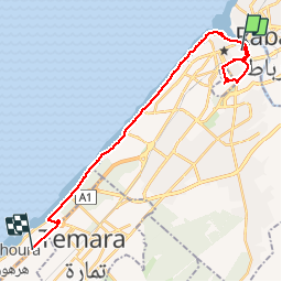
Trail Walking of 28 km to be discovered at Rabat-Salé-Kenitra, pachalik de Rabat, Hassan حسان. This trail is proposed by jcm17. Legends | More details (PDF) Elevation profile Legends > 15% 15% - 10% 10% - 5% flat 5% - 10% 10% - 15% 15% - 30% > 30% Positioning Country: Morocco Region : Rabat-Salé-Kenitra Department/Province : pachalik de Rabat Municipality : Hassan حسان Location: Unknown Start:(Dec) 34.022592 / -6.82347888 Start:(UTM) 700962 ; 3766797 (29S) N. Comments Please log in to post a review or rate the element Trails nearby psesjs riad Rabat Walking Very easy Hassan حسان, Rabat-Salé-Kenitra, pachalik de Rabat, Morocco 980 m | 1 km-effort 16min No