61 km | 71 km-effort
46_Montdoumerc
jab31
User
Length
16.6 km
Max alt
266 m
Uphill gradient
244 m
Km-Effort
19.9 km
Min alt
189 m
Downhill gradient
242 m
Boucle
Yes
Creation date :
2019-11-21 08:42:47.871
Updated on :
2019-11-21 20:02:20.023
4h42
Difficulty : Medium
FREE GPS app for hiking
About
Trail Walking of 16.6 km to be discovered at Occitania, Lot, Montdoumerc. This trail is proposed by jab31.
Description
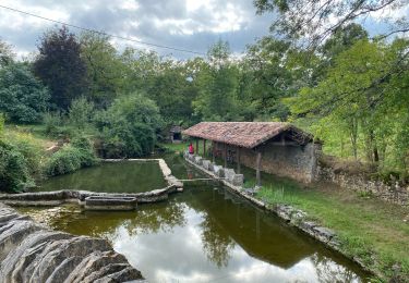
Le lac de Lartigue
Positioning
Country:
France
Region :
Occitania
Department/Province :
Lot
Municipality :
Montdoumerc
Location:
Unknown
Start:(Dec)
Start:(UTM)
379928 ; 4904298 (31T) N.
Comments
Trails nearby
La baraque - gare de borredon
sport
Very easy
Montpezat-de-Quercy,
Occitania,
Tarn-et-Garonne,
France
Unknown
No
Boucle montdoumerc
sport
Very easy
Montdoumerc,
Occitania,
Lot,
France
51 km | 60 km-effort
Unknown
Yes
Montpezat lalbenque pilou
Road bike
Difficult
Montpezat-de-Quercy,
Occitania,
Tarn-et-Garonne,
France
30 km | 35 km-effort
2h 27min
No
Fontanes rando du souffle
Electric bike
Fontanes,
Occitania,
Lot,
France
48 km | 58 km-effort
2h 42min
Yes
Fontanes circuit des saveurs
Walking
Very easy
Fontanes,
Occitania,
Lot,
France
11.5 km | 13.9 km-effort
2h 52min
Yes
PR3 Montpezat - eglise Saux
Walking
Easy
(1)
Montpezat-de-Quercy,
Occitania,
Tarn-et-Garonne,
France
9.3 km | 11.9 km-effort
2h 22min
Yes
la balade poliac
Walking
Very easy
Lalbenque,
Occitania,
Lot,
France
15.1 km | 17.6 km-effort
4h 52min
Yes
arpillen / laburgade
Mountain bike
Very easy
Fontanes,
Occitania,
Lot,
France
24 km | 28 km-effort
1h 50min
Yes
boucle vtt arpillen / les gaillardous
Mountain bike
Very easy
Fontanes,
Occitania,
Lot,
France
18 km | 21 km-effort
1h 24min
Yes