Trail Walking Nideggen - Niddeggen - Photo
© OpenStreetMap contributors
Length
Length
25 km
Max alt
Max alt
435 m
Uphill gradient
Uphill gradient
838 m
Km-Effort
Km-Effort  
36 km
Min alt
Min alt
176 m
Downhill gradient
Downhill gradient
836 m
Boucle
Boucle
Yes
Creation date :
2019-11-16 10:36:36.348
Updated on :
2019-11-16 11:43:01.875

(0 Reviews)

Walking
Walking
7h33
Difficulty : Very difficult

Scan this QR Code to open this trail in the SityTrail application

FREE GPS app for hiking

Logo SityTrail SityTrail

IGN / Geographical institutes

Download SityTrail from the App Store Download SityTrail from Google Play

Logo SityTrail SityTrail World

The world is yours!

Download SityTrail from the App Store Download SityTrail from Google Play Download SityTrail on Huawei AppGallery

About

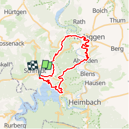
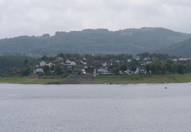
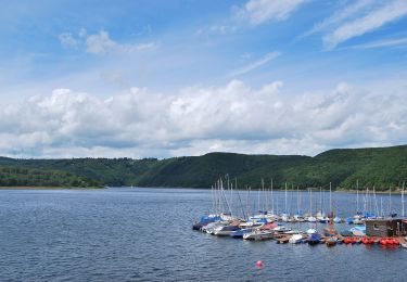
Trail Walking of 25 km to be discovered at North Rhine-Westphalia, Kreis Düren, Nideggen. This trail is proposed by mfrederich.

Description

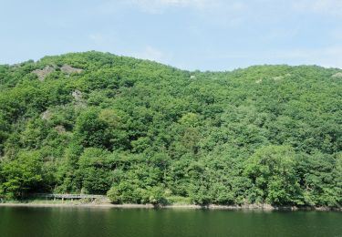
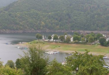
Du lac de la Rhur au château de Nideggen

Elevation profile

Positioning

Country:
Germany
Region :
North Rhine-Westphalia
Department/Province :
Kreis Düren
Municipality :
Nideggen
Location:
Unknown
Start:(UTM)
317324 ; 5614849 (32U) N.

Trails nearby

Trail On foot Heimbach - Meuchelberg - Photo
On foot
PRO

On foot

Easy
Heimbach, North Rhine-Westphalia, Kreis Düren, Germany
4.9 km | 7.6 km-effort
1h 44min
Yes
Trail On foot Simmerath - Dorfrundgang Rurberg - Photo
On foot
PRO

On foot

Easy
Simmerath, North Rhine-Westphalia, Städteregion Aachen, Germany
4.2 km | 5.4 km-effort
1h 13min
Yes
Trail On foot Simmerath - Dorfrundgang Steckenborn - Photo
On foot
PRO

On foot

Easy
Simmerath, North Rhine-Westphalia, Städteregion Aachen, Germany
5.9 km | 7.9 km-effort
1h 48min
No
Trail On foot Nideggen - Rundweg 7 Simonskall - Photo
On foot
PRO

On foot

Easy
Nideggen, North Rhine-Westphalia, Kreis Düren, Germany
4 km | 5.1 km-effort
1h 8min
No
Trail On foot Hürtgenwald - Rundweg 3 Simonskall - Photo
On foot
PRO

On foot

Easy
Hürtgenwald, North Rhine-Westphalia, Kreis Düren, Germany
4.4 km | 5.9 km-effort
1h 19min
No
Trail On foot Simmerath - Zur Jungenheck - Photo
On foot
PRO

On foot

Easy
Simmerath, North Rhine-Westphalia, Städteregion Aachen, Germany
4.4 km | 6.4 km-effort
1h 26min
Yes
Trail On foot Simmerath - Von Woffelsbach nach Klaus - Photo
On foot
PRO

On foot

Easy
Simmerath, North Rhine-Westphalia, Städteregion Aachen, Germany
9.1 km | 12.7 km-effort
2h 53min
No
Trail On foot Simmerath - Von Woffelsbach über Schmidt nach Schwammenauel - Photo
On foot
PRO

On foot

Easy
Simmerath, North Rhine-Westphalia, Städteregion Aachen, Germany
11.9 km | 16.1 km-effort
3h 40min
No
Trail On foot Simmerath - Panoramaweg um den Gansberg - Photo
On foot
PRO

On foot

Easy
Simmerath, North Rhine-Westphalia, Städteregion Aachen, Germany
5.9 km | 8 km-effort
1h 48min
Yes


Close
My subscriptions