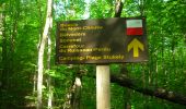
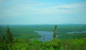
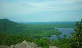
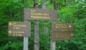
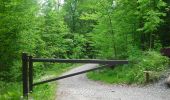
Trail On foot Orford - Boucle du mont chauve - Photo

Boucle du mont chauve

Attache ta tuque avec de la broche !

© OpenStreetMap contributors
Length
Length
9.2 km
Max alt
Max alt
590 m
Uphill gradient
Uphill gradient
359 m
Km-Effort
Km-Effort  
14 km
Min alt
Min alt
296 m
Downhill gradient
Downhill gradient
360 m
Boucle
Boucle
Yes
Creation date :
2019-11-10 15:38:19.515
Updated on :
2019-11-10 15:45:58.753

(2 Reviews)

On foot
On foot
4h30
Difficulty : Medium
Snowshoes
Snowshoes
7h45
Difficulty : Difficult

Scan this QR Code to open this trail in the SityTrail application

FREE GPS app for hiking

Logo SityTrail SityTrail
IGN / Geographical institutes

Download SityTrail from the App Store Download SityTrail from Google Play

Logo SityTrail SityTrail World
The world is yours!

Download SityTrail from the App Store Download SityTrail from Google Play Download SityTrail on Huawei AppGallery

About

Trail On foot of 9.2 km to be discovered at Quebec, Memphrémagog, Orford. This trail is proposed by Alexhike - Hikster.

Description

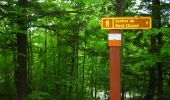
Parcourez ce sentier et accédez au sommet dénudé du mont Chauve qui s’élève à près de 600 mètres.
La longueur de ce sentier a été calculée à partir de la plage. On doit ajouter un bon 7 km si l'on part de l'accueil.

Parc du mont orford :

Ce parc national géré par la Sépaq, d’une superficie de 59,5 km², est caractérisé par ses deux massifs, les monts Orford et Chauve.

Il est ouvert toute l'année du lever au coucher du soleil.

Adulte (18 ans et plus) : 7,50$
Jeune (6 à 17 ans) : 3,25$
Enfant (0 à 5 ans) : gratuit
Famille (2 adultes) : 15,00$
Famille (1 adulte) : 10,75$
Laissez-passer annuel pour un parc : 37,50 $ (adulte)
Laissez-passer annuel pour l'ensemble des parcs nationaux du Québec : 67,50$ (adulte)

Autres tarifs et promotions disponibles

Elevation profile

Photos

Positioning

Country:
Canada
Region :
Quebec
Department/Province :
Memphrémagog
Municipality :
Orford
Location:
Unknown
Start:(UTM)
716924 ; 5026739 (18T) N.

Comments

Please log in to post a review or rate the element


Trails nearby

Trail Walking Orford - Z  - Photo
Walking
GUIDE
Alizée.pee

Walking

Easy
Orford, Quebec, Memphrémagog, Canada
8.7 km | 11.3 km-effort
2h 25min
Yes
Trail Walking Orford - 14-JUL-13 - Photo
Walking
GUIDE
Alizée.pee

Walking

Very difficult
Orford, Quebec, Memphrémagog, Canada
17 km | 27 km-effort
6h 0min
Yes
Trail Walking Orford - Wikiloc - Ruisseau David et Mont Chauve - Photo
Walking
GUIDE
Alizée.pee

Walking

Very difficult
Orford, Quebec, Memphrémagog, Canada
13.7 km | 21 km-effort
4h 22min
Yes
Trail Trail Orford - Ruisseau David - Photo
Trail
Phil Paquet

Trail

Medium
Orford, Quebec, Memphrémagog, Canada
4.9 km | 6.3 km-effort
1h 24min
No
Trail Trail Orford - avec zac - Photo
Trail
Phil Paquet

Trail

Difficult
Orford, Quebec, Memphrémagog, Canada
12.8 km | 19.9 km-effort
3h 52min
Yes
Trail Walking Orford - lol - Photo
Walking
Phil Paquet

Walking

Very easy
Orford, Quebec, Memphrémagog, Canada
4.3 km | 7.3 km-effort
1h 36min
No


Close
My subscriptions