![Trail Car Unknown - Kenya - Photo](https://media.geolcdn.com/t/1900/400/c7b95bfd-9e5d-458e-9074-521e7b5bbc2b.jpg&format=pjpeg&maxdim=2)
Kenya
bemo47
User
![Length](/images/other/stat-length.png)
Length
2.7 km
![Max alt](https://static1.geolcdn.com/siteimages/upload/files/1508320355ic_sort_altitude_max_24dp.png)
Max alt
2564 m
![Uphill gradient](https://static1.geolcdn.com/siteimages/upload/files/1508320355ic_sort_den_pos_24dp.png)
Uphill gradient
48 m
![Km-Effort](/images/other/stat-length.png)
Km-Effort
3.2 km
![Min alt](https://static1.geolcdn.com/siteimages/upload/files/1508320355ic_sort_altitude_min_24dp.png)
Min alt
2516 m
![Downhill gradient](https://static1.geolcdn.com/siteimages/upload/files/1508320355ic_sort_den_neg_24dp.png)
Downhill gradient
9 m
![Boucle](https://static1.geolcdn.com/siteimages/upload/files/16400158638029165_repeat_loop_refresh_sync_direction_icon.png)
Boucle
No
Creation date :
2019-11-07 04:49:28.721
Updated on :
2019-11-07 04:53:23.177
![Car](https://static1.geolcdn.com/sitytour/trail-icons/401.png)
3m
Difficulty : Very easy
![Scan this QR Code to open this trail in the SityTrail application](https://capi.geolives.com/qq0zvz2zws4bq2lad0pu/sitytour/trails/2258980/qr.png?size=200)
FREE GPS app for hiking
About
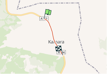
Trail Car of 2.7 km to be discovered at Nakuru. This trail is proposed by bemo47.
Positioning
Country:
Kenya
Region :
Nakuru
Department/Province :
Unknown
Municipality :
Unknown
Location:
Unknown
Start:(Dec)
Start:(UTM)
797183 ; 9990709 (36M) S.
Comments
Trails nearby