![](/images/other/stat-length.png)
![Trail Walking Vielle-Aure - 2019-11-02_20h13m30_-11.o - Photo](https://media.geolcdn.com/t/1900/400/ext.pjpeg?maxdim=2&url=https%3A%2F%2Fstatic1.geolcdn.com%2Fsiteimages%2Fupload%2Ffiles%2F1553511878bg_sport_marche.png)
2019-11-02_20h13m30_-11.o
dawed311
User
![Length](/images/other/stat-length.png)
![Max alt](https://static1.geolcdn.com/siteimages/upload/files/1508320355ic_sort_altitude_max_24dp.png)
![Uphill gradient](https://static1.geolcdn.com/siteimages/upload/files/1508320355ic_sort_den_pos_24dp.png)
![Km-Effort](/images/other/stat-length.png)
![Min alt](https://static1.geolcdn.com/siteimages/upload/files/1508320355ic_sort_altitude_min_24dp.png)
![Downhill gradient](https://static1.geolcdn.com/siteimages/upload/files/1508320355ic_sort_den_neg_24dp.png)
![Boucle](https://static1.geolcdn.com/siteimages/upload/files/16400158638029165_repeat_loop_refresh_sync_direction_icon.png)
![Walking](https://static1.geolcdn.com/sitytour/trail-icons/101.png)
2h27
Difficulty : Very easy
![Snowshoes](https://static1.geolcdn.com/sitytour/trail-icons/504.png)
2h27
Difficulty : Medium
![Scan this QR Code to open this trail in the SityTrail application](https://capi.geolives.com/qq0zvz2zws4bq2lad0pu/sitytour/trails/2256191/qr.png?size=200)
FREE GPS app for hiking
About
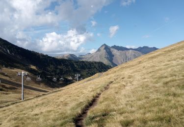
Trail Walking of 6.7 km to be discovered at Occitania, Hautespyrenees, Vielle-Aure. This trail is proposed by dawed311.
Description
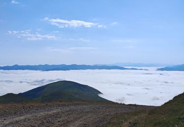
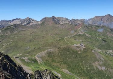
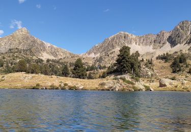
Randonnée faite d'abord en téléphérique jusqu'au col de Portet, puis en raquette. Pente raide sous le sommet, et neige dure, nous avons fini en crampons. Vue splendide au sommet sur le Bastan, la réserve du Néouvielle, mais aussi sur les pistes de ski toutes proches et bien désertes à cette époque. Le lac de l'Oule n'est pas visible du sommet, mais les lacs de Bastan, complètement enneigés, eux le sont. A refaire en été pour remise en forme. Randonnée notée très facile pour l'été, moyen pour l'hiver à cause de la pente raide et utilisation des crampons si neige dure.
Positioning
Comments
Trails nearby
![Trail Walking Saint-Lary-Soulan - refuge de bastan et lacs - Photo](https://media.geolcdn.com/t/375/260/39cee356-b9bc-4599-b9dd-36b8ef943f1a.jpg&format=jpg&maxdim=2)
![Walking Walking](https://static1.geolcdn.com/sitytour/trail-icons/101.png)
Walking
![](/images/other/stat-length.png)
![](https://static1.geolcdn.com/siteimages/upload/files/16400158638029165_repeat_loop_refresh_sync_direction_icon.png)
![Trail Walking Saint-Lary-Soulan - Pène-Male par les crêtes de Heche-Barrade - Photo](https://media.geolcdn.com/t/375/260/de632eea-ef64-4a92-92e4-bd24316e8942.jpg&format=jpg&maxdim=2)
![Walking Walking](https://static1.geolcdn.com/sitytour/trail-icons/101.png)
Walking
![](/images/other/stat-length.png)
![](https://static1.geolcdn.com/siteimages/upload/files/16400158638029165_repeat_loop_refresh_sync_direction_icon.png)
![Trail Walking Saint-Lary-Soulan - 2023-09-11 Col du Portet - Lac de l'Oule - Refuge de Bastan - Photo](https://media.geolcdn.com/t/375/260/063df153-8983-4dce-b8b6-891d73f87363.jpg&format=jpg&maxdim=2)
![Walking Walking](https://static1.geolcdn.com/sitytour/trail-icons/101.png)
Walking
![](/images/other/stat-length.png)
![](https://static1.geolcdn.com/siteimages/upload/files/16400158638029165_repeat_loop_refresh_sync_direction_icon.png)
![Trail Walking Saint-Lary-Soulan - Col Portet➡️ lac Bastan - Photo](https://media.geolcdn.com/t/375/260/8dd696dc-0c4b-408a-989a-cb4edb7898d5.jpg&format=jpg&maxdim=2)
![Walking Walking](https://static1.geolcdn.com/sitytour/trail-icons/101.png)
Walking
![](/images/other/stat-length.png)
![](https://static1.geolcdn.com/siteimages/upload/files/16400158638029165_repeat_loop_refresh_sync_direction_icon.png)
![Trail sport Tramezaïgues - Au dessus de tramezaigues - Photo](https://media.geolcdn.com/t/375/260/6241ad0b-d07e-4c7e-b6a4-b04d00176721.jpg&format=jpg&maxdim=2)
sport
![](/images/other/stat-length.png)
![](https://static1.geolcdn.com/siteimages/upload/files/16400158638029165_repeat_loop_refresh_sync_direction_icon.png)
![Trail On foot Aragnouet - Lacs de Bastan - Photo](https://media.geolcdn.com/t/375/260/8a4c791c-fa52-4ea3-bc46-ebf557b68975.jpeg&format=jpg&maxdim=2)
![On foot On foot](https://static1.geolcdn.com/sitytour/trail-icons/100.png)
On foot
![](/images/other/stat-length.png)
![](https://static1.geolcdn.com/siteimages/upload/files/16400158638029165_repeat_loop_refresh_sync_direction_icon.png)
![Trail Walking Aragnouet - Le lac de l'Oule variante en passant par le bas du barrage - Photo](https://media.geolcdn.com/t/375/260/d318441e-a86c-4066-9e34-374f8b617d7a.jpg&format=jpg&maxdim=2)
![Walking Walking](https://static1.geolcdn.com/sitytour/trail-icons/101.png)
Walking
![](/images/other/stat-length.png)
![](https://static1.geolcdn.com/siteimages/upload/files/16400158638029165_repeat_loop_refresh_sync_direction_icon.png)
![Trail Walking Aragnouet - Cabane d'Artigusse - Le lac de l'Oule - Photo](https://media.geolcdn.com/t/375/260/4d3ea36b-1a56-4250-a085-6e0e65a4cda4.jpg&format=jpg&maxdim=2)
![Walking Walking](https://static1.geolcdn.com/sitytour/trail-icons/101.png)
Walking
![](/images/other/stat-length.png)
![](https://static1.geolcdn.com/siteimages/upload/files/16400158638029165_repeat_loop_refresh_sync_direction_icon.png)
![Trail Walking Saint-Lary-Soulan - Soulan - les granges de Lias - Soulan - Photo](https://media.geolcdn.com/t/375/260/3bbe5244-bcfa-48ac-8df8-d0cf387d682b.jpg&format=jpg&maxdim=2)
![Walking Walking](https://static1.geolcdn.com/sitytour/trail-icons/101.png)
Walking
![](/images/other/stat-length.png)
![](https://static1.geolcdn.com/siteimages/upload/files/16400158638029165_repeat_loop_refresh_sync_direction_icon.png)