


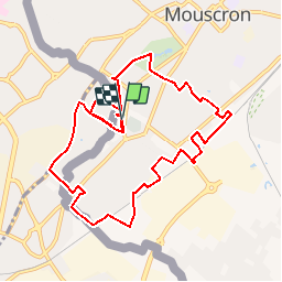

10.3 km | 11.2 km-effort


FREE GPS app for hiking
 SityTrail
IGN / Geographical institutes
SityTrail World
The world is yours!
Trail Walking of 9.3 km to be discovered at Wallonia, Hainaut, Mouscron. This trail is proposed by jacques.moulin@hotmail.com.
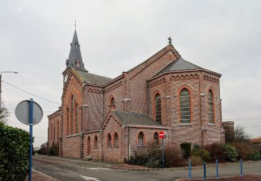
Le grand tour du Mont-à-leux en flirtant avec la frontière
On foot

Walking
Walking
Walking
Walking

Walking
Walking

Cycle
Walking