Trail Mountain bike Pourrières - Pourrieres - 20 km - Photo
 Lobin
Lobin

User

© OpenStreetMap contributors
Length
Length
20 km
Max alt
Max alt
562 m
Uphill gradient
Uphill gradient
428 m
Km-Effort
Km-Effort  
26 km
Min alt
Min alt
285 m
Downhill gradient
Downhill gradient
429 m
Boucle
Boucle
Yes
Creation date :
2019-10-29 09:25:20.0
Updated on :
2019-10-29 17:44:40.433

(0 Reviews)

Mountain bike
Mountain bike
1h58
Difficulty : Very difficult

Scan this QR Code to open this trail in the SityTrail application

FREE GPS app for hiking

Logo SityTrail SityTrail

IGN / Geographical institutes

Download SityTrail from the App Store Download SityTrail from Google Play

Logo SityTrail SityTrail World

The world is yours!

Download SityTrail from the App Store Download SityTrail from Google Play Download SityTrail on Huawei AppGallery

About

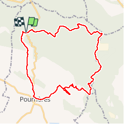
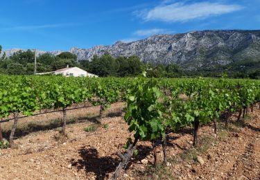
Trail Mountain bike of 20 km to be discovered at Provence-Alpes-Côte d'Azur, Var, Pourrières. This trail is proposed by Lobin.

Description

Prendre le départ à Pourrieres, pour éviter une montée en fin de parcours.
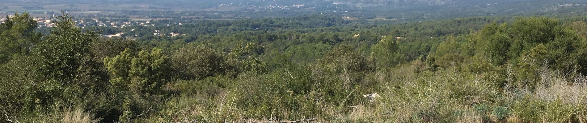
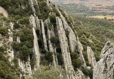
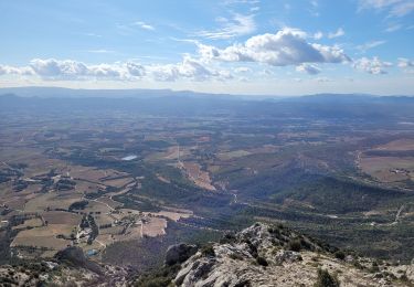
De belles vues sur les collines et la Sainte victoire
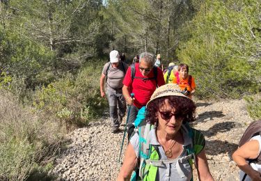
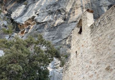
Des cailloux tout le long de la randonnée.

Elevation profile

Photos

Positioning

Country:
France
Region :
Provence-Alpes-Côte d'Azur
Department/Province :
Var
Municipality :
Pourrières
Location:
Unknown
Start:(UTM)
720452 ; 4824164 (31T) N.

Trails nearby

Trail Walking Puyloubier - 2023-02-03 Sainte Victoire - Le Pic des Mouches - Photo
Walking
GUIDE
Kargil

Walking

Difficult
Puyloubier, Provence-Alpes-Côte d'Azur, Bouches-du-Rhône, France
10 km | 19 km-effort
3h 10min
Yes
Trail Walking Puyloubier - Puyloubier : St Ser-col des Portes - Photo
Walking
ETMU5496

Walking

Difficult
Puyloubier, Provence-Alpes-Côte d'Azur, Bouches-du-Rhône, France
21 km | 34 km-effort
7h 42min
Yes
Trail Walking Pourrières - Puyloubier  - Photo
Walking
gaggiroland

Walking

Medium
Pourrières, Provence-Alpes-Côte d'Azur, Var, France
12.3 km | 17.3 km-effort
5h 49min
Yes
Trail Walking Puyloubier - Ste Victoire (pic des Mouches et brèche du clapier) - Photo
Walking
ETMU5496

Walking

Very difficult
Puyloubier, Provence-Alpes-Côte d'Azur, Bouches-du-Rhône, France
18.4 km | 33 km-effort
5h 32min
Yes
Trail Walking Puyloubier - Ste victoire  - Photo
Walking
GUIDE
jouans

Walking

Very difficult
Puyloubier, Provence-Alpes-Côte d'Azur, Bouches-du-Rhône, France
18.5 km | 33 km-effort
5h 29min
Yes
Trail Walking Vauvenargues - le pic des mouches et la citadelle - Photo
Walking
GUIDE
amiral13

Walking

Easy
Vauvenargues, Provence-Alpes-Côte d'Azur, Bouches-du-Rhône, France
11.4 km | 18.3 km-effort
3h 53min
Yes
Trail Walking Puyloubier - La Ste Victoire-Citadelle-03-11-21 - Photo
Walking
Christiancordin

Walking

Difficult
Puyloubier, Provence-Alpes-Côte d'Azur, Bouches-du-Rhône, France
15.3 km | 27 km-effort
6h 16min
Yes
Trail Walking Puyloubier - Ste Victoire sud-03-06-21 - Photo
Walking
Christiancordin

Walking

Medium
Puyloubier, Provence-Alpes-Côte d'Azur, Bouches-du-Rhône, France
18.6 km | 29 km-effort
5h 36min
Yes
Trail Walking Pourrières - le pain de munition - Photo
Walking
GUIDE
amiral13

Walking

Easy
Pourrières, Provence-Alpes-Côte d'Azur, Var, France
11.1 km | 15.4 km-effort
3h 41min
Yes


Close
My subscriptions