


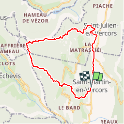

16.5 km | 34 km-effort


User


FREE GPS app for hiking
 SityTrail
IGN / Geographical institutes
SityTrail World
The world is yours!
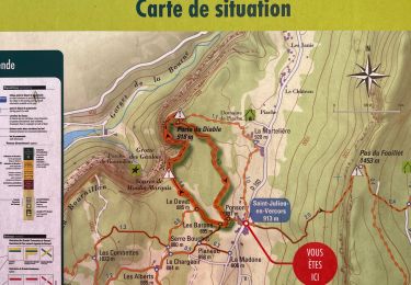
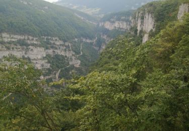
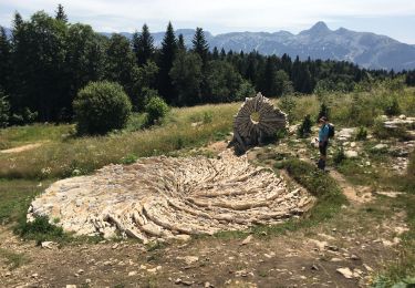
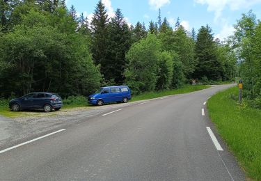
Trail Mountain bike of 15.5 km to be discovered at Auvergne-Rhône-Alpes, Drôme, Saint-Martin-en-Vercors. This trail is proposed by vercorse.
Départ St Martin en Vercors (place de l'Ours) passer par les Menuisiers, Sendron, Pas de l'Allier, petite Cournouze, les Combettes, Ponson puis retour à St Martin. Attention quelques passages techniques...

Walking

Walking

Walking

Other activity

sport
Walking
Walking
Walking
Walking