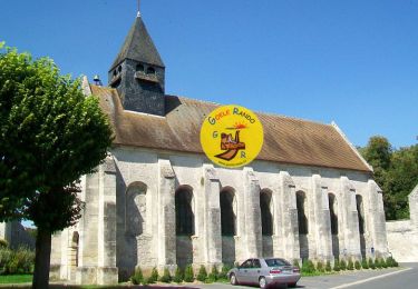
Trail Walking Chamant - Le Château d'eau de Chamant _ 10,6 km - Photo

Le Château d'eau de Chamant _ 10,6 km

© OpenStreetMap contributors
Length
Length
10.6 km
Max alt
Max alt
153 m
Uphill gradient
Uphill gradient
128 m
Km-Effort
Km-Effort  
12.3 km
Min alt
Min alt
76 m
Downhill gradient
Downhill gradient
128 m
Boucle
Boucle
Yes
Creation date :
2014-12-10 00:00:00.0
Updated on :
2014-12-10 00:00:00.0

(0 Reviews)

Walking
Walking
2h41
Difficulty : Easy

Scan this QR Code to open this trail in the SityTrail application

FREE GPS app for hiking

Logo SityTrail SityTrail

IGN / Geographical institutes

Download SityTrail from the App Store Download SityTrail from Google Play

Logo SityTrail SityTrail World

The world is yours!

Download SityTrail from the App Store Download SityTrail from Google Play Download SityTrail on Huawei AppGallery

About

Trail Walking of 10.6 km to be discovered at Hauts-de-France, Oise, Chamant. This trail is proposed by Pousscailleux.

Description

Départ de la Place des écoles à Chamant, rue Eugène Odent (N 49°13'14/E 002°36'39) ou sur le bord de la route de Compiègne (D932A), près du restaurant "A l'Ancien Piqueux" (N 49°13'22/ E 002°36'38).

Seul château d'eau métallique du nord de la France, il a été construit au 19ème siècle vraisemblablement par un élève de Gustave Eiffel. Haut de 30 m, il est constitué d'une cuve en plaques de tôles boulonnées supportée par six piliers en acier laminé. Il est surmonté d'un belvédère. Il a été inscrit aux monuments historiques en 1998.

Albert Menier (celui du chocolat) était propriétaire du Domaine de Chamant qui abritait son écurie de courses. Pour abreuver ses chevaux, il fit ériger dans la forêt d’Halatte ce château d’eau de 30 mètres de haut qui puise l’eau directement dans la nappe phréatique. Il est toujours en activité : il fournit l’eau à Chamant et au Plessis-Chamant.

Elevation profile

Points of interest

Point of interest Chamant - Château d'Eau - Photo
Pousscailleux

Positioning

Country:
France
Region :
Hauts-de-France
Department/Province :
Oise
Municipality :
Chamant
Location:
Unknown
Start:(UTM)
471672 ; 5452053 (31U) N.

Trails nearby

Trail Walking Villers-Saint-Frambourg-Ognon - MR_OGNON (par BALAGNY-sur-AUNETTE)_5.4Km - Photo
Walking

Walking

Medium
(3)
Villers-Saint-Frambourg-Ognon, Hauts-de-France, Oise, France
5.4 km | 6.4 km-effort
1h 27min
Yes
Trail Walking Senlis - SM_ERMENONVILLE Mais Forest BIAT_7.9Km - Photo
Walking
GR77LP

Walking

Medium
(3)
Senlis, Hauts-de-France, Oise, France
7.9 km | 8.9 km-effort
2h 1min
Yes
Trail Walking Mont-l'Évêque - SM_MONT-L'EVEQUE_8Km - Photo
Walking
GR77LP

Walking

Medium
(4)
Mont-l'Évêque, Hauts-de-France, Oise, France
8.1 km | 9.1 km-effort
1h 59min
Yes
Trail Walking Borest - SM_BOREST SUD_8Km - Photo
Walking
GR77LP

Walking

Medium
(7)
Borest, Hauts-de-France, Oise, France
8 km | 9 km-effort
1h 48min
Yes
Trail Walking Borest - V&D_BOREST-SUD_9.3Km - Photo
Walking
GR77LP

Walking

Medium
(4)
Borest, Hauts-de-France, Oise, France
9.3 km | 10.4 km-effort
2h 21min
Yes
Trail On foot Senlis - SENLIS CITE ROYALE(FFK) - Photo
On foot
GR77LP

On foot

Very easy
(1)
Senlis, Hauts-de-France, Oise, France
4.6 km | 5.2 km-effort
2h 0min
Yes
Trail Walking Fleurines - Fleurines Grand parcours - Photo
Walking
CC.RIDER

Walking

Easy
(1)
Fleurines, Hauts-de-France, Oise, France
20 km | 24 km-effort
5h 8min
Yes
Trail Walking Chamant - Chamant Supermini-rando - Photo
Walking
CC.RIDER

Walking

Easy
(8)
Chamant, Hauts-de-France, Oise, France
8 km | 9.3 km-effort
2h 7min
Yes
Trail On foot Senlis - De Orrouy à Coye - Photo
On foot
GUIDE+

On foot

Easy
Senlis, Hauts-de-France, Oise, France
10.1 km | 11.2 km-effort
2h 33min
No


Close
My subscriptions