Trail Running Saint-Gence - 5800 m La chatre plane - Photo

5800 m La chatre plane

 yobuli
yobuli

User

© OpenStreetMap contributors
Length
Length
5.8 km
Max alt
Max alt
346 m
Uphill gradient
Uphill gradient
55 m
Km-Effort
Km-Effort  
6.6 km
Min alt
Min alt
299 m
Downhill gradient
Downhill gradient
56 m
Boucle
Boucle
Yes
Creation date :
2014-12-10 00:00:00.0
Updated on :
2014-12-10 00:00:00.0

(0 Reviews)

Running
Running
30m
Difficulty : Very easy

Scan this QR Code to open this trail in the SityTrail application

FREE GPS app for hiking

Logo SityTrail SityTrail

IGN / Geographical institutes

Download SityTrail from the App Store Download SityTrail from Google Play

Logo SityTrail SityTrail World

The world is yours!

Download SityTrail from the App Store Download SityTrail from Google Play Download SityTrail on Huawei AppGallery

About

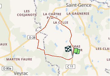
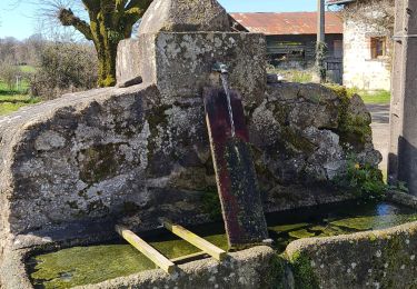
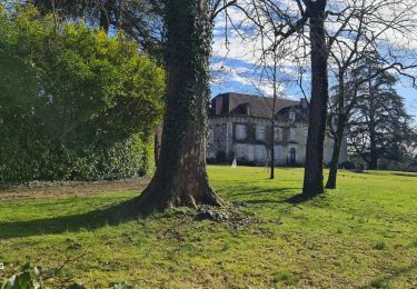
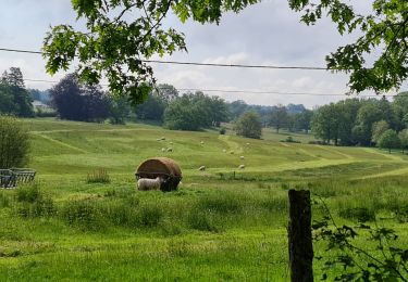
Trail Running of 5.8 km to be discovered at New Aquitaine, Haute-Vienne, Saint-Gence. This trail is proposed by yobuli.

Elevation profile

Positioning

Country:
France
Region :
New Aquitaine
Department/Province :
Haute-Vienne
Municipality :
Saint-Gence
Location:
Unknown
Start:(UTM)
355308 ; 5084753 (31T) N.

Trails nearby

Trail Walking Nieul - Autour des étangs -Château de Nieul - Photo
Walking
tracegps

Walking

Medium
(2)
Nieul, New Aquitaine, Haute-Vienne, France
10.2 km | 12.8 km-effort
2h 30min
Yes
Trail Walking Veyrac - Peury - Photo
Walking
coeurdom

Walking

Medium
Veyrac, New Aquitaine, Haute-Vienne, France
7.3 km | 8.5 km-effort
1h 28min
Yes
Trail Walking Nieul - Nieul - Photo
Walking
coeurdom

Walking

Easy
Nieul, New Aquitaine, Haute-Vienne, France
19.1 km | 23 km-effort
1h 30min
No
Trail Walking Veyrac - peury - Photo
Walking
coeurdom

Walking

Easy
Veyrac, New Aquitaine, Haute-Vienne, France
3.7 km | 4.3 km-effort
50min
No
Trail Walking Saint-Gence - Boschauderier - Photo
Walking
coeurdom

Walking

Medium
Saint-Gence, New Aquitaine, Haute-Vienne, France
7 km | 8.3 km-effort
1h 28min
Yes
Trail Walking Veyrac - Veyrac - Photo
Walking
coeurdom

Walking

Medium
Veyrac, New Aquitaine, Haute-Vienne, France
7.5 km | 8.6 km-effort
1h 31min
Yes
Trail Walking Veyrac - m'as doumy veyrac - Photo
Walking
coeurdom

Walking

Medium
Veyrac, New Aquitaine, Haute-Vienne, France
8.7 km | 10.2 km-effort
1h 45min
Yes
Trail Walking Saint-Gence - la ribière du theil - Photo
Walking
coeurdom

Walking

Medium
Saint-Gence, New Aquitaine, Haute-Vienne, France
7.2 km | 8.5 km-effort
1h 30min
Yes
Trail Walking Verneuil-sur-Vienne - trachepie - Photo
Walking
coeurdom

Walking

Medium
Verneuil-sur-Vienne, New Aquitaine, Haute-Vienne, France
8.2 km | 9.7 km-effort
1h 36min
Yes


Close
My subscriptions