Trail Walking Cléden-Cap-Sizun - CLEDEN CAP SIZUN - Photo
© OpenStreetMap contributors
Length
Length
18.3 km
Max alt
Max alt
84 m
Uphill gradient
Uphill gradient
248 m
Km-Effort
Km-Effort  
22 km
Min alt
Min alt
10 m
Downhill gradient
Downhill gradient
248 m
Boucle
Boucle
Yes
Creation date :
2019-10-10 08:09:43.116
Updated on :
2019-10-28 09:25:33.666

(0 Reviews)

Walking
Walking
5h14
Difficulty : Medium

Scan this QR Code to open this trail in the SityTrail application

FREE GPS app for hiking

Logo SityTrail SityTrail

IGN / Geographical institutes

Download SityTrail from the App Store Download SityTrail from Google Play

Logo SityTrail SityTrail World

The world is yours!

Download SityTrail from the App Store Download SityTrail from Google Play Download SityTrail on Huawei AppGallery

About

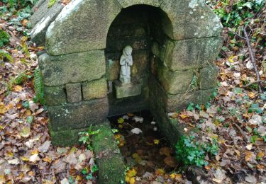
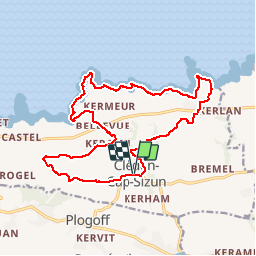
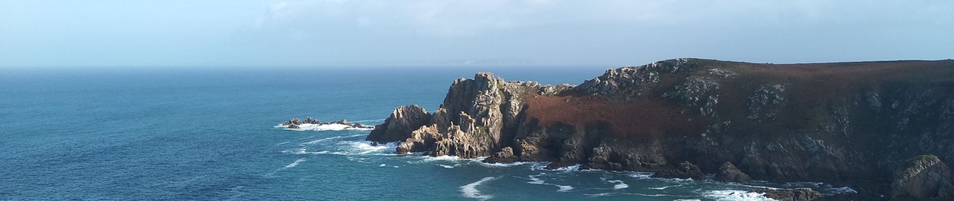
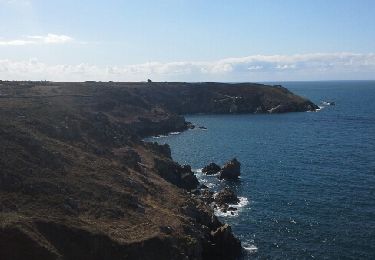
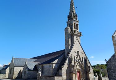
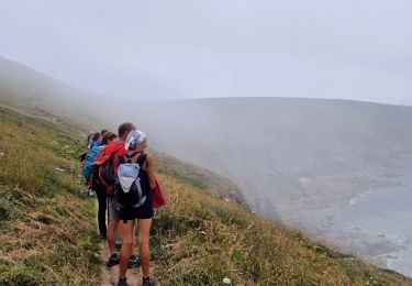
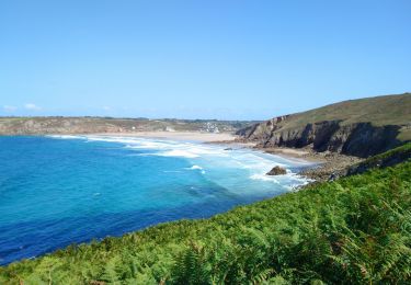
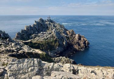
Trail Walking of 18.3 km to be discovered at Brittany, Finistère, Cléden-Cap-Sizun. This trail is proposed by RonanDAGORN.

Description

Randonnée rallongée par rapport à celle figurant dans le topo guide de la FFRP "Le pays bigouden, le pays de Douarnenez et le Cap Sizun à pied"

Elevation profile

Photos

Positioning

Country:
France
Region :
Brittany
Department/Province :
Finistère
Municipality :
Cléden-Cap-Sizun
Location:
Unknown
Start:(UTM)
377041 ; 5322998 (30U) N.

Trails nearby

Trail Other activity Goulien - gr34 - Photo
Other activity
kikietsab

Other activity

Very easy
(1)
Goulien, Brittany, Finistère, France
9.5 km | 12.2 km-effort
2h 39min
No
Trail Walking Plogoff - plogoff loual - Photo
Walking
fl29790

Walking

Easy
(1)
Plogoff, Brittany, Finistère, France
4.1 km | 5 km-effort
1h 8min
Yes
Trail Walking Cléden-Cap-Sizun - point du van - Photo
Walking
jlesacher

Walking

Medium
(1)
Cléden-Cap-Sizun, Brittany, Finistère, France
10.6 km | 13.9 km-effort
Unknown
Yes
Trail Walking Cléden-Cap-Sizun - POINTE DU RAZ - Photo
Walking
Miclm

Walking

Easy
Cléden-Cap-Sizun, Brittany, Finistère, France
15.7 km | 20 km-effort
4h 38min
Yes
Trail Walking Goulien - GOULIEN - Photo
Walking
RonanDAGORN

Walking

Difficult
Goulien, Brittany, Finistère, France
19.6 km | 25 km-effort
5h 38min
Yes
Trail Walking Plogoff - TREK RCY GR34 J4 2022 Pointe du Raz/ baie des trépassés - Photo
Walking
chessyca

Walking

Easy
Plogoff, Brittany, Finistère, France
13.9 km | 18.3 km-effort
3h 42min
No
Trail Walking Plogoff - pointe du Raz - Photo
Walking
apa

Walking

Medium
Plogoff, Brittany, Finistère, France
6.4 km | 8.6 km-effort
2h 18min
Yes
Trail On foot Plogoff - Circuit de la Pointe du Raz - Photo
On foot
PRO

On foot

Easy
(1)
Plogoff, Brittany, Finistère, France
8.8 km | 11.8 km-effort
2h 40min
Yes
Trail Walking Plogoff - Fumoir  - Photo
Walking
GUIDE
antignacs

Walking

Very easy
Plogoff, Brittany, Finistère, France
5.4 km | 6.6 km-effort
1h 43min
Yes


Close
My subscriptions