![](/images/other/stat-length.png)
![Trail On foot Chancelade - Randonnée pour Octobre rose - 8 km - Photo](https://media.geolcdn.com/t/1900/400/ext.pjpeg?maxdim=2&url=https%3A%2F%2Fstatic1.geolcdn.com%2Fsiteimages%2Fupload%2Ffiles%2F1545311037marcheuse_200dpi.jpg)
Randonnée pour Octobre rose - 8 km
Les Ardents du pied
Club de randonnées
![Length](/images/other/stat-length.png)
Length
8.4 km
![Max alt](https://static1.geolcdn.com/siteimages/upload/files/1508320355ic_sort_altitude_max_24dp.png)
Max alt
185 m
![Uphill gradient](https://static1.geolcdn.com/siteimages/upload/files/1508320355ic_sort_den_pos_24dp.png)
Uphill gradient
188 m
![Km-Effort](/images/other/stat-length.png)
Km-Effort
10.9 km
![Min alt](https://static1.geolcdn.com/siteimages/upload/files/1508320355ic_sort_altitude_min_24dp.png)
Min alt
89 m
![Downhill gradient](https://static1.geolcdn.com/siteimages/upload/files/1508320355ic_sort_den_neg_24dp.png)
Downhill gradient
188 m
![Boucle](https://static1.geolcdn.com/siteimages/upload/files/16400158638029165_repeat_loop_refresh_sync_direction_icon.png)
Boucle
Yes
Creation date :
2019-10-10 16:10:12.28
Updated on :
2019-10-10 16:17:01.602
![On foot](https://static1.geolcdn.com/sitytour/trail-icons/100.png)
2h10
Difficulty : Medium
![Walking](https://static1.geolcdn.com/sitytour/trail-icons/101.png)
2h20
Difficulty : Medium
![Scan this QR Code to open this trail in the SityTrail application](https://capi.geolives.com/qq0zvz2zws4bq2lad0pu/sitytour/trails/2226681/qr.png?size=200)
FREE GPS app for hiking
About
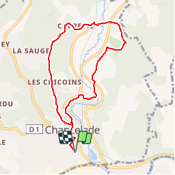
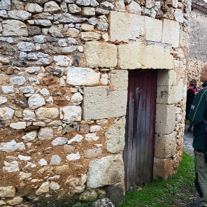
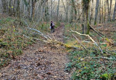
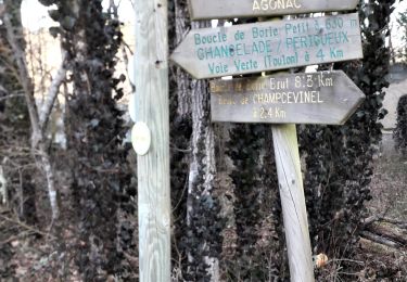
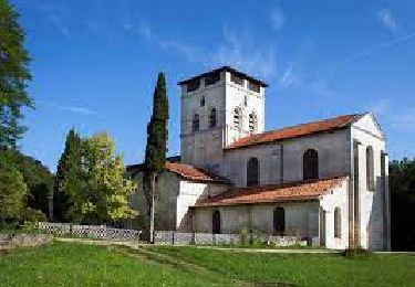
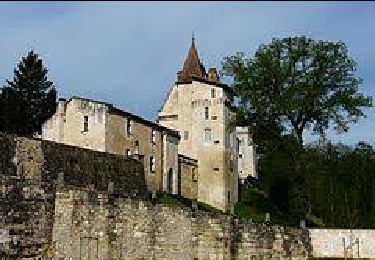
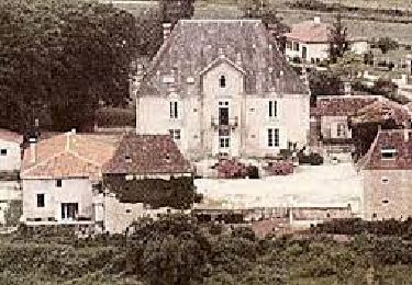
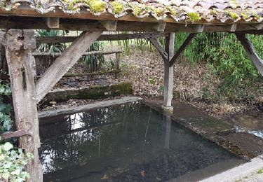
Trail On foot of 8.4 km to be discovered at New Aquitaine, Dordogne, Chancelade. This trail is proposed by Les Ardents du pied.
Description
Randonnée sur le même circuit que celui de 12 km avec retour par Maison carrée, après traversée de la route d'Angoulême pour rejoindre le hameau de Beauronne.
Positioning
Country:
France
Region :
New Aquitaine
Department/Province :
Dordogne
Municipality :
Chancelade
Location:
Unknown
Start:(Dec)
Start:(UTM)
316755 ; 5008085 (31T) N.
Comments
Trails nearby
![Trail Walking La Chapelle-Gonaguet - La Chapelle Gonaguet 9 km - Photo](https://media.geolcdn.com/t/375/260/2419184c-9d78-41af-8bf7-802b3e84ff48.jpg&format=jpg&maxdim=2)
![Walking Walking](https://static1.geolcdn.com/sitytour/trail-icons/101.png)
La Chapelle Gonaguet 9 km
Walking
Medium
La Chapelle-Gonaguet,
New Aquitaine,
Dordogne,
France
![](/images/other/stat-length.png)
9 km | 10.7 km-effort
2h 26min
![](https://static1.geolcdn.com/siteimages/upload/files/16400158638029165_repeat_loop_refresh_sync_direction_icon.png)
Yes
![Trail Walking Champcevinel - champcevinel - Photo](https://media.geolcdn.com/t/375/260/ee6533d5-1951-437a-84ea-112f8c5e298d.jpg&format=jpg&maxdim=2)
![Walking Walking](https://static1.geolcdn.com/sitytour/trail-icons/101.png)
champcevinel
Walking
Difficult
Champcevinel,
New Aquitaine,
Dordogne,
France
![](/images/other/stat-length.png)
9.7 km | 12.3 km-effort
2h 48min
![](https://static1.geolcdn.com/siteimages/upload/files/16400158638029165_repeat_loop_refresh_sync_direction_icon.png)
Yes
![Trail Walking Chancelade - Circuit de l'Abbaye de Chancelade - Photo](https://media.geolcdn.com/t/375/260/16bcd257-155c-4b42-a479-9684c98ab4d4.jpg&format=jpg&maxdim=2)
![Walking Walking](https://static1.geolcdn.com/sitytour/trail-icons/101.png)
Circuit de l'Abbaye de Chancelade
Walking
Difficult
Chancelade,
New Aquitaine,
Dordogne,
France
![](/images/other/stat-length.png)
12.8 km | 18.3 km-effort
4h 9min
![](https://static1.geolcdn.com/siteimages/upload/files/16400158638029165_repeat_loop_refresh_sync_direction_icon.png)
Yes
![Trail Walking Château-l'Évêque - Boucle du bois de Lavergne - Photo](https://media.geolcdn.com/t/375/260/6537e41d-5ba3-471f-b695-a5c123990690.jpg&format=jpg&maxdim=2)
![Walking Walking](https://static1.geolcdn.com/sitytour/trail-icons/101.png)
Boucle du bois de Lavergne
Walking
Difficult
Château-l'Évêque,
New Aquitaine,
Dordogne,
France
![](/images/other/stat-length.png)
14.1 km | 17.8 km-effort
4h 2min
![](https://static1.geolcdn.com/siteimages/upload/files/16400158638029165_repeat_loop_refresh_sync_direction_icon.png)
Yes
![Trail Walking Chancelade - Boucle des Andrivaux - Photo](https://media.geolcdn.com/t/375/260/3a7f865a-dc4d-41a4-a258-9294003c8232.jpg&format=jpg&maxdim=2)
![Walking Walking](https://static1.geolcdn.com/sitytour/trail-icons/101.png)
Boucle des Andrivaux
Walking
Very difficult
Chancelade,
New Aquitaine,
Dordogne,
France
![](/images/other/stat-length.png)
14.8 km | 19.3 km-effort
4h 23min
![](https://static1.geolcdn.com/siteimages/upload/files/16400158638029165_repeat_loop_refresh_sync_direction_icon.png)
Yes
![Trail Running Périgueux - jour 24 CAP Jeanot - Photo](https://media.geolcdn.com/t/375/260/b1177c53-9089-46cb-b50f-64a340467857.jpg&format=jpg&maxdim=2)
![Running Running](https://static1.geolcdn.com/sitytour/trail-icons/103.png)
jour 24 CAP Jeanot
Running
Very easy
Périgueux,
New Aquitaine,
Dordogne,
France
![](/images/other/stat-length.png)
21 km | 23 km-effort
3h 24min
![](https://static1.geolcdn.com/siteimages/upload/files/16400158638029165_repeat_loop_refresh_sync_direction_icon.png)
No
![Trail Walking Chancelade - Boucle de la Terrassonnie - Photo](https://media.geolcdn.com/t/375/260/ext.jpg?maxdim=2&url=https%3A%2F%2Fservices.sitytrail.com%2FGeolivesWS%2FDownloadMedia.ashx%3FTrailID%3D1093073%26Media%3Dfix__20190106115620.jpg)
![Walking Walking](https://static1.geolcdn.com/sitytour/trail-icons/101.png)
Boucle de la Terrassonnie
Walking
Easy
Chancelade,
New Aquitaine,
Dordogne,
France
![](/images/other/stat-length.png)
11.2 km | 14.7 km-effort
3h 37min
![](https://static1.geolcdn.com/siteimages/upload/files/16400158638029165_repeat_loop_refresh_sync_direction_icon.png)
Yes
![Trail Walking Périgueux - Flânerie Périgueux - Photo](https://media.geolcdn.com/t/375/260/ext.jpg?maxdim=2&url=https%3A%2F%2Fstatic1.geolcdn.com%2Fsiteimages%2Fupload%2Ffiles%2F1553511878bg_sport_marche.png)
![Walking Walking](https://static1.geolcdn.com/sitytour/trail-icons/101.png)
Flânerie Périgueux
Walking
Medium
Périgueux,
New Aquitaine,
Dordogne,
France
![](/images/other/stat-length.png)
5.5 km | 6.5 km-effort
1h 55min
![](https://static1.geolcdn.com/siteimages/upload/files/16400158638029165_repeat_loop_refresh_sync_direction_icon.png)
Yes
![Trail Walking Château-l'Évêque - CHATEAU-LEVEQUE - Boucle de Preyssac courte - Photo](https://media.geolcdn.com/t/375/260/ext.jpg?maxdim=2&url=https%3A%2F%2Fstatic1.geolcdn.com%2Fsiteimages%2Fupload%2Ffiles%2F1553511878bg_sport_marche.png)
![Walking Walking](https://static1.geolcdn.com/sitytour/trail-icons/101.png)
CHATEAU-LEVEQUE - Boucle de Preyssac courte
Walking
Difficult
Château-l'Évêque,
New Aquitaine,
Dordogne,
France
![](/images/other/stat-length.png)
11.3 km | 15.4 km-effort
3h 29min
![](https://static1.geolcdn.com/siteimages/upload/files/16400158638029165_repeat_loop_refresh_sync_direction_icon.png)
Yes