Trail Walking Rabat-les-Trois-Seigneurs - pic du Pioulou en boucle  - Photo
 chrisgps
chrisgps

User

© OpenStreetMap contributors
Length
Length
15.7 km
Max alt
Max alt
2161 m
Uphill gradient
Uphill gradient
1178 m
Km-Effort
Km-Effort  
32 km
Min alt
Min alt
861 m
Downhill gradient
Downhill gradient
1355 m
Boucle
Boucle
No
Creation date :
2019-10-10 07:03:00.241
Updated on :
2019-10-14 16:55:15.953

(0 Reviews)

Walking
Walking
6h45
Difficulty : Difficult

Scan this QR Code to open this trail in the SityTrail application

FREE GPS app for hiking

Logo SityTrail SityTrail
IGN / Geographical institutes

Download SityTrail from the App Store Download SityTrail from Google Play

Logo SityTrail SityTrail World

The world is yours!

Download SityTrail from the App Store Download SityTrail from Google Play Download SityTrail on Huawei AppGallery

About

Trail Walking of 15.7 km to be discovered at Occitania, Ariège, Rabat-les-Trois-Seigneurs. This trail is proposed by chrisgps.

Description

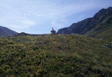
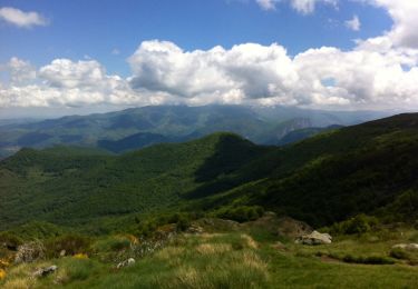
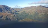
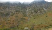
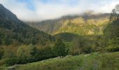
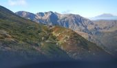
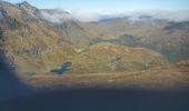
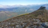
Montée sans problème par le cirque d'Embans en longeant l'étg long et l'étg. bleu jusqu'au col de la Couillate. Beaux panoramas. Partir à gauche sur crête et passer 2 dômes avant d'arriver après un long passage "presque" à plat pour arriver au Pioulou.Entamer la descente sur la gauche, sur une "sente" a peine tracée et pentue pour arriver en contre bas et trouver l'autre sente partant  encore à gauche à travers rodos, bruyères et autres herbes htes et bien mouillées ce jour là = belles glissades -Attention ou vous marchez! Après 3/4h de devers on a enfin retrouvé le sentier "normal" revenant vers le ruisseau Barataux et descendant vers le parking. Conclusion : avec de la neige on ne fera pas la boucle par là !

Elevation profile

Photos

Positioning

Country:
France
Region :
Occitania
Department/Province :
Ariège
Municipality :
Rabat-les-Trois-Seigneurs
Location:
Unknown
Start:(UTM)
376210 ; 4744188 (31T) N.

Trails nearby

Trail Walking Rabat-les-Trois-Seigneurs - Pyrénées-120910 - EtangBleu - Photo
Walking
randodan

Walking

Medium
(1)
Rabat-les-Trois-Seigneurs, Occitania, Ariège, France
11.9 km | 23 km-effort
7h 45min
Yes
Trail Walking Gourbit - 04/06/2014 Rando Etang d'Artax - Photo
Walking
chrisbal

Walking

Difficult
(1)
Gourbit, Occitania, Ariège, France
10.8 km | 24 km-effort
2h 53min
Yes
Trail Walking Rabat-les-Trois-Seigneurs - Cirque D'Embans - Photo
Walking
minakara

Walking

Medium
(2)
Rabat-les-Trois-Seigneurs, Occitania, Ariège, France
8.8 km | 18.4 km-effort
3h 52min
Yes
Trail On foot Gourbit - Étang d'Artax - Photo
On foot
GUIDE+

On foot

Easy
Gourbit, Occitania, Ariège, France
4.3 km | 12.3 km-effort
2h 47min
No
Trail Walking Gourbit - Gourbit- rochers Carlong - Photo
Walking
pidjam

Walking

Medium
Gourbit, Occitania, Ariège, France
11.1 km | 19.7 km-effort
4h 15min
Yes
Trail Walking Gourbit - 22/04/2017 Rando Etang d'Artax - Photo
Walking
chrisbal

Walking

Difficult
(1)
Gourbit, Occitania, Ariège, France
12.2 km | 25 km-effort
5h 4min
Yes
Trail Walking Saurat - balade sauratoise - Photo
Walking
bellouelo46

Walking

Medium
Saurat, Occitania, Ariège, France
11.3 km | 19.4 km-effort
3h 46min
Yes
Trail Walking Rabat-les-Trois-Seigneurs - Le Pic des Trois Seigneurs par l'étang bleu - La Freyte - Photo
Walking
tracegps

Walking

Very difficult
Rabat-les-Trois-Seigneurs, Occitania, Ariège, France
16.8 km | 34 km-effort
7h 0min
Yes
Trail Walking Gourbit - Le Roc de Querquéou (Etang d'Artax - col de Lastrix) - Photo
Walking
tracegps

Walking

Very difficult
(1)
Gourbit, Occitania, Ariège, France
10.3 km | 23 km-effort
5h 19min
Yes


Close
My subscriptions