Trail On foot Taussac - Manhaval la Chapelle - Photo

Manhaval la Chapelle

 rigol05
rigol05

User

© OpenStreetMap contributors
Length
Length
9 km
Max alt
Max alt
737 m
Uphill gradient
Uphill gradient
346 m
Km-Effort
Km-Effort  
13.6 km
Min alt
Min alt
431 m
Downhill gradient
Downhill gradient
345 m
Boucle
Boucle
Yes
Creation date :
2019-10-07 08:16:29.327
Updated on :
2019-10-07 08:16:29.327

(0 Reviews)

On foot
On foot
--
Difficulty : Unknown

Scan this QR Code to open this trail in the SityTrail application

FREE GPS app for hiking

Logo SityTrail SityTrail

IGN / Geographical institutes

Download SityTrail from the App Store Download SityTrail from Google Play

Logo SityTrail SityTrail World

The world is yours!

Download SityTrail from the App Store Download SityTrail from Google Play Download SityTrail on Huawei AppGallery

About

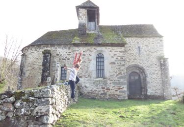
Trail On foot of 9 km to be discovered at Occitania, Aveyron, Taussac. This trail is proposed by rigol05.

Elevation profile

Positioning

Country:
France
Region :
Occitania
Department/Province :
Aveyron
Municipality :
Taussac
Location:
Unknown
Start:(UTM)
467466 ; 4958773 (31T) N.

Trails nearby

Trail Walking Lacroix-Barrez - a effacer - Photo
Walking
avdem

Walking

Easy
Lacroix-Barrez, Occitania, Aveyron, France
1.8 km | 2.3 km-effort
40min
No
Trail Cycle Taussac - Tour des ruisseaux du Goul et de l'Embernat - Photo
Cycle
destras

Cycle

Difficult
Taussac, Occitania, Aveyron, France
47 km | 61 km-effort
3h 1min
Yes
Trail Walking Taussac - le tour du ruisseau d'Embernat - Photo
Walking
destras

Walking

Medium
Taussac, Occitania, Aveyron, France
21 km | 27 km-effort
5h 48min
Yes
Trail Walking Lacroix-Barrez - 12_valon_ginolhac_2024 - Photo
Walking
jab31

Walking

Very difficult
Lacroix-Barrez, Occitania, Aveyron, France
21 km | 34 km-effort
7h 39min
No
Trail Walking Lacroix-Barrez - Vallon, les gorges de la Thruyère - Photo
Walking
jocelyneviel

Walking

Medium
Lacroix-Barrez, Occitania, Aveyron, France
8.3 km | 13.3 km-effort
2h 41min
Yes
Trail Horseback riding Teissières-lès-Bouliès - Boucle teissieres les bouiles - Photo
Horseback riding
AdeBoyer

Horseback riding

Very easy
Teissières-lès-Bouliès, Auvergne-Rhône-Alpes, Cantal, France
11.6 km | 14.9 km-effort
2h 48min
Yes
Trail Quad Murols - Murols(12)/Figeac(46) - Photo
Quad
O.R.

Quad

Very easy
Murols, Occitania, Aveyron, France
91 km | 117 km-effort
3h 43min
No
Trail Other activity Murols - Les Bois de Murols - Photo
Other activity
Lacaze

Other activity

Difficult
Murols, Occitania, Aveyron, France
9.2 km | 15 km-effort
5min
Yes
Trail Walking Lacroix-Barrez - LACROIX-BARREZ _ du magma à la pierre 2) - Photo
Walking
Elbe

Walking

Easy
Lacroix-Barrez, Occitania, Aveyron, France
5.9 km | 7.1 km-effort
1h 30min
Yes


Close
My subscriptions