![](/images/other/stat-length.png)
![Trail Walking Moliets-et-Maâ - Les Etangs de Moliets et de la Prade _ 13,2 km - Photo](https://media.geolcdn.com/t/1900/400/ext.pjpeg?maxdim=2&url=https%3A%2F%2Fstatic1.geolcdn.com%2Fsiteimages%2Fupload%2Ffiles%2F1553511878bg_sport_marche.png)
Les Etangs de Moliets et de la Prade _ 13,2 km
Pousscailleux
User
![Length](/images/other/stat-length.png)
![Max alt](https://static1.geolcdn.com/siteimages/upload/files/1508320355ic_sort_altitude_max_24dp.png)
![Uphill gradient](https://static1.geolcdn.com/siteimages/upload/files/1508320355ic_sort_den_pos_24dp.png)
![Km-Effort](/images/other/stat-length.png)
![Min alt](https://static1.geolcdn.com/siteimages/upload/files/1508320355ic_sort_altitude_min_24dp.png)
![Downhill gradient](https://static1.geolcdn.com/siteimages/upload/files/1508320355ic_sort_den_neg_24dp.png)
![Boucle](https://static1.geolcdn.com/siteimages/upload/files/16400158638029165_repeat_loop_refresh_sync_direction_icon.png)
![Walking](https://static1.geolcdn.com/sitytour/trail-icons/101.png)
3h30
Difficulty : Medium
![Scan this QR Code to open this trail in the SityTrail application](https://capi.geolives.com/qq0zvz2zws4bq2lad0pu/sitytour/trails/222004/qr.png?size=200)
FREE GPS app for hiking
About
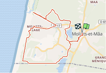
Trail Walking of 13.1 km to be discovered at New Aquitaine, Landes, Moliets-et-Maâ. This trail is proposed by Pousscailleux.
Description
Ce tracé est proposé aux promeneurs sur des panneaux en ville, sur lesquels est écrit :
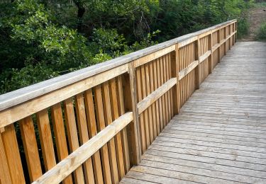
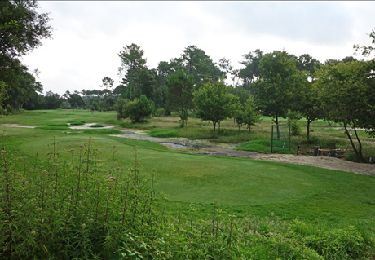
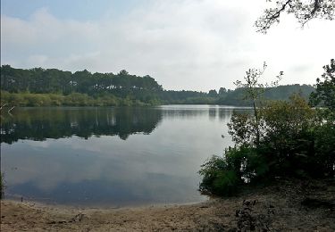
"Circuit sportif offrant des sections de grande qualité et diversifiées.Tout en contraste, il passe des rives de l'étang de Moliets aux sommets de quelques tucs, de la végétation exubérante des zones humides au green parfaitement lisse du golf, des zones pavillonnaires et commerciales aux magnifiques futaies de pins."
Conséquence vraisemblable de travaux forestiers, la "section sportive" comporte des portions dépourvues de sentiers fiables. La boussole est indispensable, le GPS conseillé.
Points of interest
Positioning
Comments
Trails nearby
![Trail Walking Moliets-et-Maâ - balade dans les pins avec vue sur dune - Photo](https://media.geolcdn.com/t/375/260/0218ac8f-b6c0-46e5-b6fe-b779c8db0705.jpg&format=jpg&maxdim=2)
![Walking Walking](https://static1.geolcdn.com/sitytour/trail-icons/101.png)
Walking
![](/images/other/stat-length.png)
![](https://static1.geolcdn.com/siteimages/upload/files/16400158638029165_repeat_loop_refresh_sync_direction_icon.png)
![Trail Walking Moliets-et-Maâ - MOLIETS le courant d huchet 290 7700 - Photo](https://media.geolcdn.com/t/375/260/11eb8d60-2334-433e-941c-ab21d54ad840.jpg&format=jpg&maxdim=2)
![Walking Walking](https://static1.geolcdn.com/sitytour/trail-icons/101.png)
Walking
![](/images/other/stat-length.png)
![](https://static1.geolcdn.com/siteimages/upload/files/16400158638029165_repeat_loop_refresh_sync_direction_icon.png)
![Trail Walking Léon - Etang VSP 10km - Photo](https://media.geolcdn.com/t/375/260/0f991cfe-6bda-4037-a335-2a4be6192310.jpg&format=jpg&maxdim=2)
![Walking Walking](https://static1.geolcdn.com/sitytour/trail-icons/101.png)
Walking
![](/images/other/stat-length.png)
![](https://static1.geolcdn.com/siteimages/upload/files/16400158638029165_repeat_loop_refresh_sync_direction_icon.png)
![Trail Walking Léon - Courant du Huchet - Photo](https://media.geolcdn.com/t/375/260/32dab752-80e3-43c9-adcf-46932eefb47e.jpg&format=jpg&maxdim=2)
![Walking Walking](https://static1.geolcdn.com/sitytour/trail-icons/101.png)
Walking
![](/images/other/stat-length.png)
![](https://static1.geolcdn.com/siteimages/upload/files/16400158638029165_repeat_loop_refresh_sync_direction_icon.png)
![Trail Walking Moliets-et-Maâ - circuit des Cigales camping au courant d'Uchet et retour - Photo](https://media.geolcdn.com/t/375/260/cb479472-290b-4db1-bc86-532d9c3e1638.jpg&format=jpg&maxdim=2)
![Walking Walking](https://static1.geolcdn.com/sitytour/trail-icons/101.png)
Walking
![](/images/other/stat-length.png)
![](https://static1.geolcdn.com/siteimages/upload/files/16400158638029165_repeat_loop_refresh_sync_direction_icon.png)
![Trail Walking Moliets-et-Maâ - Le Courant d' Huchet _ 5,3 km_Trace GPS - Photo](https://media.geolcdn.com/t/375/260/ext.jpg?maxdim=2&url=https%3A%2F%2Fservices.sitytrail.com%2FGeolivesWS%2FDownloadMedia.ashx%3FTrailID%3D221866%26Media%3D358f56fb-4383-43a9-84d6-d433489d3737.jpg)
![Walking Walking](https://static1.geolcdn.com/sitytour/trail-icons/101.png)
Walking
![](/images/other/stat-length.png)
![](https://static1.geolcdn.com/siteimages/upload/files/16400158638029165_repeat_loop_refresh_sync_direction_icon.png)
![Trail Walking Moliets-et-Maâ - La Chapelle Saint Laurent de Maa _ 8,5 km_Trace GPS - Photo](https://media.geolcdn.com/t/375/260/ext.jpg?maxdim=2&url=https%3A%2F%2Fservices.sitytrail.com%2FGeolivesWS%2FDownloadMedia.ashx%3FTrailID%3D206853%26Media%3D3409a967-a099-4afb-939e-ee94bb6de565.jpg)
![Walking Walking](https://static1.geolcdn.com/sitytour/trail-icons/101.png)
Walking
![](/images/other/stat-length.png)
![](https://static1.geolcdn.com/siteimages/upload/files/16400158638029165_repeat_loop_refresh_sync_direction_icon.png)
![Trail Walking Moliets-et-Maâ - Courant Huchet complet - Photo](https://media.geolcdn.com/t/375/260/ext.jpg?maxdim=2&url=https%3A%2F%2Fstatic1.geolcdn.com%2Fsiteimages%2Fupload%2Ffiles%2F1553511878bg_sport_marche.png)
![Walking Walking](https://static1.geolcdn.com/sitytour/trail-icons/101.png)
Walking
![](/images/other/stat-length.png)
![](https://static1.geolcdn.com/siteimages/upload/files/16400158638029165_repeat_loop_refresh_sync_direction_icon.png)
![Trail Walking Vielle-Saint-Girons - Ballade Courant Huchet - Photo](https://media.geolcdn.com/t/375/260/ext.jpg?maxdim=2&url=https%3A%2F%2Fstatic1.geolcdn.com%2Fsiteimages%2Fupload%2Ffiles%2F1553511878bg_sport_marche.png)
![Walking Walking](https://static1.geolcdn.com/sitytour/trail-icons/101.png)
Walking
![](/images/other/stat-length.png)
![](https://static1.geolcdn.com/siteimages/upload/files/16400158638029165_repeat_loop_refresh_sync_direction_icon.png)