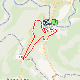
![](/images/other/stat-length.png)
![Trail Walking Cléron - cléron la voie du tacot - Photo](https://media.geolcdn.com/t/1900/400/ext.pjpeg?maxdim=2&url=https%3A%2F%2Fstatic1.geolcdn.com%2Fsiteimages%2Fupload%2Ffiles%2F1553511878bg_sport_marche.png)
cléron la voie du tacot
eltonnermou
User
![Length](/images/other/stat-length.png)
Length
6 km
![Max alt](https://static1.geolcdn.com/siteimages/upload/files/1508320355ic_sort_altitude_max_24dp.png)
Max alt
436 m
![Uphill gradient](https://static1.geolcdn.com/siteimages/upload/files/1508320355ic_sort_den_pos_24dp.png)
Uphill gradient
132 m
![Km-Effort](/images/other/stat-length.png)
Km-Effort
7.7 km
![Min alt](https://static1.geolcdn.com/siteimages/upload/files/1508320355ic_sort_altitude_min_24dp.png)
Min alt
312 m
![Downhill gradient](https://static1.geolcdn.com/siteimages/upload/files/1508320355ic_sort_den_neg_24dp.png)
Downhill gradient
132 m
![Boucle](https://static1.geolcdn.com/siteimages/upload/files/16400158638029165_repeat_loop_refresh_sync_direction_icon.png)
Boucle
Yes
Creation date :
2019-09-30 12:27:37.717
Updated on :
2019-11-18 20:00:31.643
![Walking](https://static1.geolcdn.com/sitytour/trail-icons/101.png)
1h45
Difficulty : Very easy
![Scan this QR Code to open this trail in the SityTrail application](https://capi.geolives.com/qq0zvz2zws4bq2lad0pu/sitytour/trails/2218095/qr.png?size=200)
FREE GPS app for hiking
About
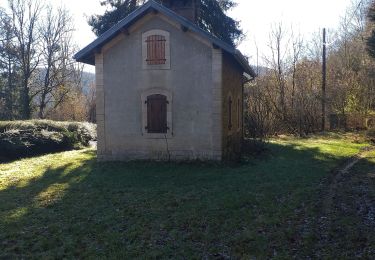
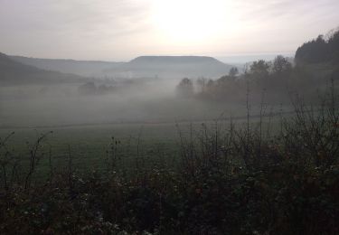
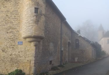
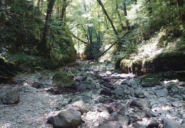
Trail Walking of 6 km to be discovered at Bourgogne-Franche-Comté, Doubs, Cléron. This trail is proposed by eltonnermou.
Description
balade courte 6km, à travers prairie, très belle vue sur le château médiéval. Randonnée en groupe, très facile meme avec enfant en bas âge
Positioning
Country:
France
Region :
Bourgogne-Franche-Comté
Department/Province :
Doubs
Municipality :
Cléron
Location:
Unknown
Start:(Dec)
Start:(UTM)
276726 ; 5219092 (32T) N.
Comments
Trails nearby
![Trail Walking Ornans - Votre-dame du chêne - Photo](https://media.geolcdn.com/t/375/260/ext.jpg?maxdim=2&url=https%3A%2F%2Fmedia.geolcdn.com%2Ff%2Fc7bb9265-b47a-4388-88e0-f95f4287d390.jpg)
![Walking Walking](https://static1.geolcdn.com/sitytour/trail-icons/101.png)
Votre-dame du chêne
Walking
Medium
(1)
Ornans,
Bourgogne-Franche-Comté,
Doubs,
France
![](/images/other/stat-length.png)
14.3 km | 19.7 km-effort
2h 57min
![](https://static1.geolcdn.com/siteimages/upload/files/16400158638029165_repeat_loop_refresh_sync_direction_icon.png)
Yes
![Trail Walking Ornans - ravin du puits noir - Photo](https://media.geolcdn.com/t/375/260/ext.jpg?maxdim=2&url=https%3A%2F%2Fstatic1.geolcdn.com%2Fsiteimages%2Fupload%2Ffiles%2F1553511878bg_sport_marche.png)
![Walking Walking](https://static1.geolcdn.com/sitytour/trail-icons/101.png)
ravin du puits noir
Walking
Easy
(1)
Ornans,
Bourgogne-Franche-Comté,
Doubs,
France
![](/images/other/stat-length.png)
4.9 km | 6.3 km-effort
1h 32min
![](https://static1.geolcdn.com/siteimages/upload/files/16400158638029165_repeat_loop_refresh_sync_direction_icon.png)
Yes
![Trail Walking Amondans - Amondans - Photo](https://media.geolcdn.com/t/375/260/ext.jpg?maxdim=2&url=https%3A%2F%2Fmedia.geolcdn.com%2Ff%2F4d00c8d3-fdc4-49de-aa75-bde7a160856b.jpg)
![Walking Walking](https://static1.geolcdn.com/sitytour/trail-icons/101.png)
Amondans
Walking
Easy
(1)
Amondans,
Bourgogne-Franche-Comté,
Doubs,
France
![](/images/other/stat-length.png)
16 km | 21 km-effort
2h 42min
![](https://static1.geolcdn.com/siteimages/upload/files/16400158638029165_repeat_loop_refresh_sync_direction_icon.png)
Yes
![Trail Walking Chassagne-Saint-Denis - Chassagne st denis - Photo](https://media.geolcdn.com/t/375/260/ext.jpg?maxdim=2&url=https%3A%2F%2Fmedia.geolcdn.com%2Ff%2Fa656547c-7416-4702-9ec6-aeb3d4c9289c.jpg)
![Walking Walking](https://static1.geolcdn.com/sitytour/trail-icons/101.png)
Chassagne st denis
Walking
Easy
Chassagne-Saint-Denis,
Bourgogne-Franche-Comté,
Doubs,
France
![](/images/other/stat-length.png)
12.7 km | 16.6 km-effort
5h 15min
![](https://static1.geolcdn.com/siteimages/upload/files/16400158638029165_repeat_loop_refresh_sync_direction_icon.png)
Yes
![Trail Walking Ornans - bonnevaux le bas - Photo](https://media.geolcdn.com/t/375/260/ext.jpg?maxdim=2&url=https%3A%2F%2Fmedia.geolcdn.com%2Ff%2F5ff62682-efb8-483f-8256-a13a182673fd.jpg)
![Walking Walking](https://static1.geolcdn.com/sitytour/trail-icons/101.png)
bonnevaux le bas
Walking
Easy
Ornans,
Bourgogne-Franche-Comté,
Doubs,
France
![](/images/other/stat-length.png)
11.3 km | 15.3 km-effort
2h 40min
![](https://static1.geolcdn.com/siteimages/upload/files/16400158638029165_repeat_loop_refresh_sync_direction_icon.png)
Yes
![Trail Walking Ornans - la brème-ornans - Photo](https://media.geolcdn.com/t/375/260/ext.jpg?maxdim=2&url=https%3A%2F%2Fmedia.geolcdn.com%2Ff%2F81308a17-509d-403e-8794-e1193f7b651d.jpg)
![Walking Walking](https://static1.geolcdn.com/sitytour/trail-icons/101.png)
la brème-ornans
Walking
Medium
(1)
Ornans,
Bourgogne-Franche-Comté,
Doubs,
France
![](/images/other/stat-length.png)
10 km | 14.7 km-effort
2h 12min
![](https://static1.geolcdn.com/siteimages/upload/files/16400158638029165_repeat_loop_refresh_sync_direction_icon.png)
Yes
![Trail Nordic walking Ornans - 12 septembre 2020 - Photo](https://media.geolcdn.com/t/375/260/ext.jpg?maxdim=2&url=https%3A%2F%2Fstatic1.geolcdn.com%2Fsiteimages%2Fupload%2Ffiles%2F1545311037marcheuse_200dpi.jpg)
![Nordic walking Nordic walking](https://static1.geolcdn.com/sitytour/trail-icons/102.png)
12 septembre 2020
Nordic walking
(1)
Ornans,
Bourgogne-Franche-Comté,
Doubs,
France
![](/images/other/stat-length.png)
13.1 km | 18.1 km-effort
2h 50min
![](https://static1.geolcdn.com/siteimages/upload/files/16400158638029165_repeat_loop_refresh_sync_direction_icon.png)
Yes
![Trail Walking Lizine - Belvédère de Lizine - Photo](https://media.geolcdn.com/t/375/260/ext.jpg?maxdim=2&url=https%3A%2F%2Fservices.sitytrail.com%2FGeolivesWS%2FDownloadMedia.ashx%3FTrailID%3D317685%26Media%3D16980_4.jpg)
![Walking Walking](https://static1.geolcdn.com/sitytour/trail-icons/101.png)
Belvédère de Lizine
Walking
Easy
Lizine,
Bourgogne-Franche-Comté,
Doubs,
France
![](/images/other/stat-length.png)
6.7 km | 8.6 km-effort
2h 0min
![](https://static1.geolcdn.com/siteimages/upload/files/16400158638029165_repeat_loop_refresh_sync_direction_icon.png)
Yes
![Trail Walking Scey-Maisières - Château de Scey en varois et plateau - Photo](https://media.geolcdn.com/t/375/260/ext.jpg?maxdim=2&url=https%3A%2F%2Fmedia.geolcdn.com%2Ff%2Fd2e8a421-790f-4c44-b227-6c3292dccdfe.jpg)
![Walking Walking](https://static1.geolcdn.com/sitytour/trail-icons/101.png)
Château de Scey en varois et plateau
Walking
Medium
Scey-Maisières,
Bourgogne-Franche-Comté,
Doubs,
France
![](/images/other/stat-length.png)
12.7 km | 16.7 km-effort
3h 35min
![](https://static1.geolcdn.com/siteimages/upload/files/16400158638029165_repeat_loop_refresh_sync_direction_icon.png)
No