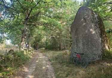
22 km | 32 km-effort
Golinhac
hamar
User
Length
16 km
Max alt
667 m
Uphill gradient
603 m
Km-Effort
23 km
Min alt
312 m
Downhill gradient
267 m
Boucle
No
Creation date :
2019-09-29 06:47:28.0
Updated on :
2019-09-29 13:30:27.885
5h35
Difficulty : Unknown
FREE GPS app for hiking
About
Trail Walking of 16 km to be discovered at Occitania, Aveyron, Estaing. This trail is proposed by hamar.
Positioning
Country:
France
Region :
Occitania
Department/Province :
Aveyron
Municipality :
Estaing
Location:
Unknown
Start:(Dec)
Start:(UTM)
473944 ; 4933526 (31T) N.
Comments
Trails nearby
Estaing - Espeyrac - Chemin de St-Jacques de Compostelle
Walking
Difficult
(1)
Estaing,
Occitania,
Aveyron,
France
23 km | 32 km-effort
4h 15min
No
Rallye Estaing 2013 - 15km
Equestrian
Medium
(1)
Estaing,
Occitania,
Aveyron,
France
17.4 km | 24 km-effort
2h 59min
Yes
St Jacques Etape 9 par GR6
Walking
Very difficult
Sébrazac,
Occitania,
Aveyron,
France
23 km | 31 km-effort
6h 57min
No
A la découverte des trésors - Estaing
Cycle
Difficult
Estaing,
Occitania,
Aveyron,
France
82 km | 101 km-effort
4h 30min
Yes
Estaing - Rallye 2012 - 8km
Equestrian
Medium
(1)
Estaing,
Occitania,
Aveyron,
France
8.4 km | 12.1 km-effort
Unknown
Yes
live Estaing - Golinhac
Walking
Difficult
Estaing,
Occitania,
Aveyron,
France
15.5 km | 22 km-effort
5h 5min
No
gohinlac itinéraire 5 + retour Estaing par gr6
Electric bike
Difficult
Sébrazac,
Occitania,
Aveyron,
France
53 km | 71 km-effort
3h 22min
No
estaing-gonilhac
Walking
Easy
Estaing,
Occitania,
Aveyron,
France
15.2 km | 22 km-effort
3h 32min
No