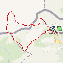
![](/images/other/stat-length.png)
![Trail On foot Setcases - bastiments - Photo](https://media.geolcdn.com/t/1900/400/ext.pjpeg?maxdim=2&url=https%3A%2F%2Fstatic1.geolcdn.com%2Fsiteimages%2Fupload%2Ffiles%2F1545311037marcheuse_200dpi.jpg)
bastiments
MarcheNature
User
![Length](/images/other/stat-length.png)
![Max alt](https://static1.geolcdn.com/siteimages/upload/files/1508320355ic_sort_altitude_max_24dp.png)
![Uphill gradient](https://static1.geolcdn.com/siteimages/upload/files/1508320355ic_sort_den_pos_24dp.png)
![Km-Effort](/images/other/stat-length.png)
![Min alt](https://static1.geolcdn.com/siteimages/upload/files/1508320355ic_sort_altitude_min_24dp.png)
![Downhill gradient](https://static1.geolcdn.com/siteimages/upload/files/1508320355ic_sort_den_neg_24dp.png)
![Boucle](https://static1.geolcdn.com/siteimages/upload/files/16400158638029165_repeat_loop_refresh_sync_direction_icon.png)
![On foot](https://static1.geolcdn.com/sitytour/trail-icons/100.png)
5h00
Difficulty : Very difficult
![Scan this QR Code to open this trail in the SityTrail application](https://capi.geolives.com/qq0zvz2zws4bq2lad0pu/sitytour/trails/2204735/qr.png?size=200)
FREE GPS app for hiking
About
Trail On foot of 10 km to be discovered at Catalonia, Girona, Setcases. This trail is proposed by MarcheNature.
Description
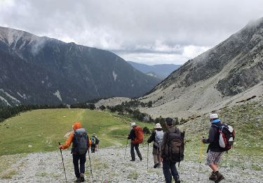
A Setcase continuer jusqu'à la station de Valter 2000 - se gerer à la station.
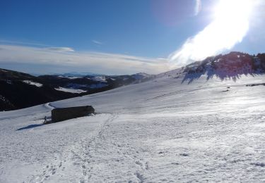
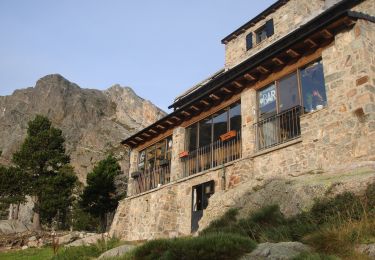
Points d'intérêt : Station de ski Valter 2000.
Montez à gauche de la piste.
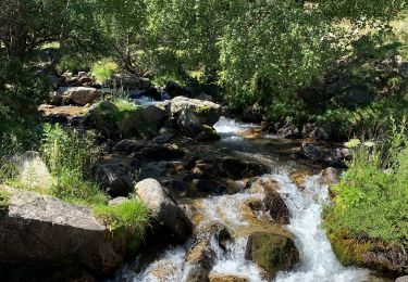
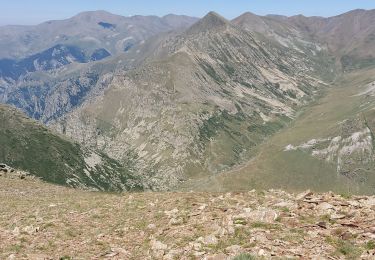
La progression se fait dans le fond de la vallée sous le Gra de Fajol.
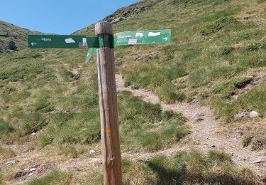
Retrouvez le Gr11.
collada de la Marrana, quittez le GR.
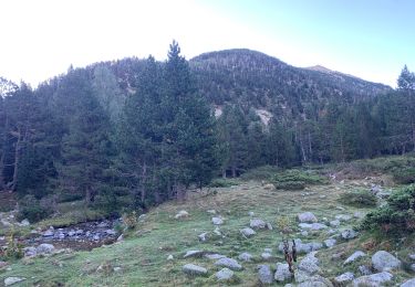
Montez à droite vers le Pic des Bastiments en Catalogne ou du Géant en France.
Croix: suivez la crête à gauche.
Ski en ferraille, descendez la crête caillouteuse.
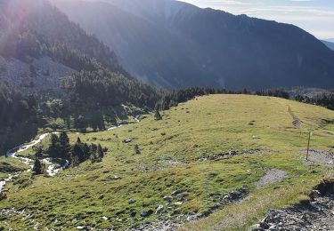
La pente s'adoucit et devient plus herbeuse.
Elle remonte au pic du Prats de Bassibès.
Descente à droite par un chemin glissant
Que l'on peut quitter pour rejoindre directement l'étang de Bassibès.
De l'étang de Mourens,son autre nom, dirigez-vous dans les prairies vers le col du Géant par une légère montée.
Descente par une petite sente
Vers les bâtiments de la station de Ski Valter 2000.
Parking.
Positioning
Comments
Trails nearby
![Trail Walking Fontpédrouse - Carenza à la perche - Photo](https://media.geolcdn.com/t/375/260/e5129642-9fc2-49eb-8e63-ecc481cd1928.jpg&format=jpg&maxdim=2)
![Walking Walking](https://static1.geolcdn.com/sitytour/trail-icons/101.png)
Walking
![](/images/other/stat-length.png)
![](https://static1.geolcdn.com/siteimages/upload/files/16400158638029165_repeat_loop_refresh_sync_direction_icon.png)
![Trail Walking Fontpédrouse - 2022 TRANSPYRÉNÉENNE : refuge du Ras de la Carança - Photo](https://media.geolcdn.com/t/375/260/f5ce2549-8db0-4469-a943-a23fcb97a879.jpg&format=jpg&maxdim=2)
![Walking Walking](https://static1.geolcdn.com/sitytour/trail-icons/101.png)
Walking
![](/images/other/stat-length.png)
![](https://static1.geolcdn.com/siteimages/upload/files/16400158638029165_repeat_loop_refresh_sync_direction_icon.png)
![Trail Walking Setcases - ulldeter - Nuria - Photo](https://media.geolcdn.com/t/375/260/86190e6f-d09d-437c-91bf-dda7a844ca8c.jpg&format=jpg&maxdim=2)
![Walking Walking](https://static1.geolcdn.com/sitytour/trail-icons/101.png)
Walking
![](/images/other/stat-length.png)
![](https://static1.geolcdn.com/siteimages/upload/files/16400158638029165_repeat_loop_refresh_sync_direction_icon.png)
![Trail Walking Queralbs - refugi ulldeter - Photo](https://media.geolcdn.com/t/375/260/59317c28-bcad-41a1-a0f1-b0c2dde995de.jpg&format=jpg&maxdim=2)
![Walking Walking](https://static1.geolcdn.com/sitytour/trail-icons/101.png)
Walking
![](/images/other/stat-length.png)
![](https://static1.geolcdn.com/siteimages/upload/files/16400158638029165_repeat_loop_refresh_sync_direction_icon.png)
![Trail Walking Setcases - refugi ull de ter à Nuria - - Photo](https://media.geolcdn.com/t/375/260/74e07d74-a5dd-447c-afab-41e56373bd3a.jpg&format=jpg&maxdim=2)
![Walking Walking](https://static1.geolcdn.com/sitytour/trail-icons/101.png)
Walking
![](/images/other/stat-length.png)
![](https://static1.geolcdn.com/siteimages/upload/files/16400158638029165_repeat_loop_refresh_sync_direction_icon.png)
![Trail Walking Fontpédrouse - Refuges Ras Carança - Ulldeter via col del Geant - Photo](https://media.geolcdn.com/t/375/260/1db565fb-0284-4d6c-9495-de82535d6b22.jpg&format=jpg&maxdim=2)
![Walking Walking](https://static1.geolcdn.com/sitytour/trail-icons/101.png)
Walking
![](/images/other/stat-length.png)
![](https://static1.geolcdn.com/siteimages/upload/files/16400158638029165_repeat_loop_refresh_sync_direction_icon.png)
![Trail On foot Setcases - Setcases, volta al riu Carboner - Photo](https://media.geolcdn.com/t/375/260/2ce7f44a-9896-41cb-990d-f63440cf508c.jpeg&format=jpg&maxdim=2)
![On foot On foot](https://static1.geolcdn.com/sitytour/trail-icons/100.png)
On foot
![](/images/other/stat-length.png)
![](https://static1.geolcdn.com/siteimages/upload/files/16400158638029165_repeat_loop_refresh_sync_direction_icon.png)
![Walking Walking](https://static1.geolcdn.com/sitytour/trail-icons/101.png)
Walking
![](/images/other/stat-length.png)
![](https://static1.geolcdn.com/siteimages/upload/files/16400158638029165_repeat_loop_refresh_sync_direction_icon.png)
![Trail Walking Fontpédrouse - Carença-Mont-Louis - Photo](https://media.geolcdn.com/t/375/260/ext.jpg?maxdim=2&url=https%3A%2F%2Fstatic1.geolcdn.com%2Fsiteimages%2Fupload%2Ffiles%2F1553511878bg_sport_marche.png)
![Walking Walking](https://static1.geolcdn.com/sitytour/trail-icons/101.png)
Walking
![](/images/other/stat-length.png)
![](https://static1.geolcdn.com/siteimages/upload/files/16400158638029165_repeat_loop_refresh_sync_direction_icon.png)