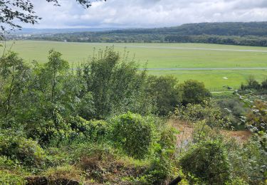
10.1 km | 13.5 km-effort
Mandeure
gigi8825
User
Length
12.2 km
Max alt
576 m
Uphill gradient
333 m
Km-Effort
16.6 km
Min alt
329 m
Downhill gradient
333 m
Boucle
Yes
Creation date :
2019-09-09 22:09:59.059
Updated on :
2019-10-02 21:15:10.363
3h31
Difficulty : Difficult
FREE GPS app for hiking
About
Trail Walking of 12.2 km to be discovered at Bourgogne-Franche-Comté, Doubs, Mandeure. This trail is proposed by gigi8825.
Positioning
Country:
France
Region :
Bourgogne-Franche-Comté
Department/Province :
Doubs
Municipality :
Mandeure
Location:
Unknown
Start:(Dec)
Start:(UTM)
333853 ; 5257443 (32T) N.
Comments
Trails nearby
Seloncourt, les 5 sapins (10 km )
Walking
Medium
(1)
Seloncourt,
Bourgogne-Franche-Comté,
Doubs,
France
3h 3min
Yes
Mandeure, Les Grands Communaux 9.6 Km
Walking
Difficult
(1)
Mandeure,
Bourgogne-Franche-Comté,
Doubs,
France
9.6 km | 13.2 km-effort
2h 59min
Yes
Bourguignon, entre eau et forêt 9.5 Km
Walking
Medium
(1)
Bourguignon,
Bourgogne-Franche-Comté,
Doubs,
France
9.5 km | 11.9 km-effort
2h 2min
Yes
2019.09.06.Roches
Walking
Very easy
Roches-lès-Blamont,
Bourgogne-Franche-Comté,
Doubs,
France
11.4 km | 16.5 km-effort
3h 12min
Yes
2019.09.05.Roches
Walking
Very easy
Roches-lès-Blamont,
Bourgogne-Franche-Comté,
Doubs,
France
10.8 km | 14.7 km-effort
2h 38min
Yes
de voujeaucourt à Dambelin, puis pont de roide
Other activity
Very easy
Voujeaucourt,
Bourgogne-Franche-Comté,
Doubs,
France
57 km | 77 km-effort
4h 46min
Yes
randonnée du lion 2024
Nordic walking
Very easy
Courcelles-lès-Montbéliard,
Bourgogne-Franche-Comté,
Doubs,
France
18.1 km | 22 km-effort
4h 3min
No
GTJ #1
Bicycle tourism
Very difficult
Arbouans,
Bourgogne-Franche-Comté,
Doubs,
France
108 km | 142 km-effort
10h 18min
No
source Charles
Walking
Easy
Mandeure,
Bourgogne-Franche-Comté,
Doubs,
France
5 km | 6.4 km-effort
1h 35min
No