![](/images/other/stat-length.png)
![Trail Walking Mons - RB-Ha-13 - Raccourci - Sur les terres du prince de Ligne - Photo](https://media.geolcdn.com/t/1900/400/ext.pjpeg?maxdim=2&url=https%3A%2F%2Fservices.sitytrail.com%2FGeolivesWS%2FDownloadMedia.ashx%3FTrailID%3D219513%26Media%3Dee6cd659-80c2-435e-9976-43cb94344f6e.jpg)
RB-Ha-13 - Raccourci - Sur les terres du prince de Ligne
GR Rando
Randonnez sur et autour des GR ® wallons (Sentiers de Grande Randonnée). PRO
![Length](/images/other/stat-length.png)
![Max alt](https://static1.geolcdn.com/siteimages/upload/files/1508320355ic_sort_altitude_max_24dp.png)
![Uphill gradient](https://static1.geolcdn.com/siteimages/upload/files/1508320355ic_sort_den_pos_24dp.png)
![Km-Effort](/images/other/stat-length.png)
![Min alt](https://static1.geolcdn.com/siteimages/upload/files/1508320355ic_sort_altitude_min_24dp.png)
![Downhill gradient](https://static1.geolcdn.com/siteimages/upload/files/1508320355ic_sort_den_neg_24dp.png)
![Boucle](https://static1.geolcdn.com/siteimages/upload/files/16400158638029165_repeat_loop_refresh_sync_direction_icon.png)
![Walking](https://static1.geolcdn.com/sitytour/trail-icons/101.png)
4h32
Difficulty : Very difficult
![Scan this QR Code to open this trail in the SityTrail application](https://capi.geolives.com/qq0zvz2zws4bq2lad0pu/sitytour/trails/219513/qr.png?size=200)
FREE GPS app for hiking
About
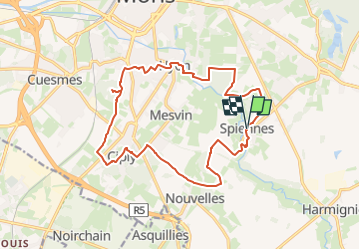
Trail Walking of 16.2 km to be discovered at Wallonia, Hainaut, Mons. This trail is proposed by GR Rando.
Description
Beloeil – Les Écacheries – Grandglise – Stambruges - Beloeil
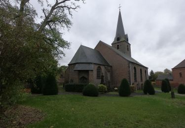
Cet itinéraire promène longuement le randonneur sur les terres ancestrales du prince de Ligne. En effet, cette famille aristocratique est implantée à Beloeil depuis le 14e siècle.
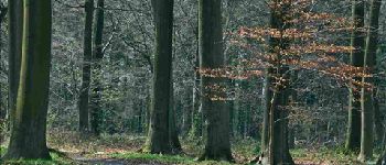
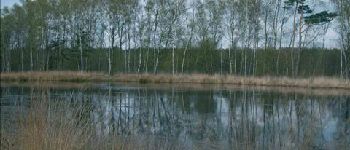
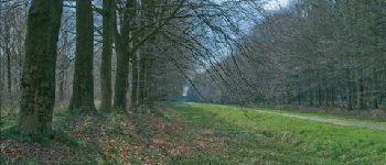
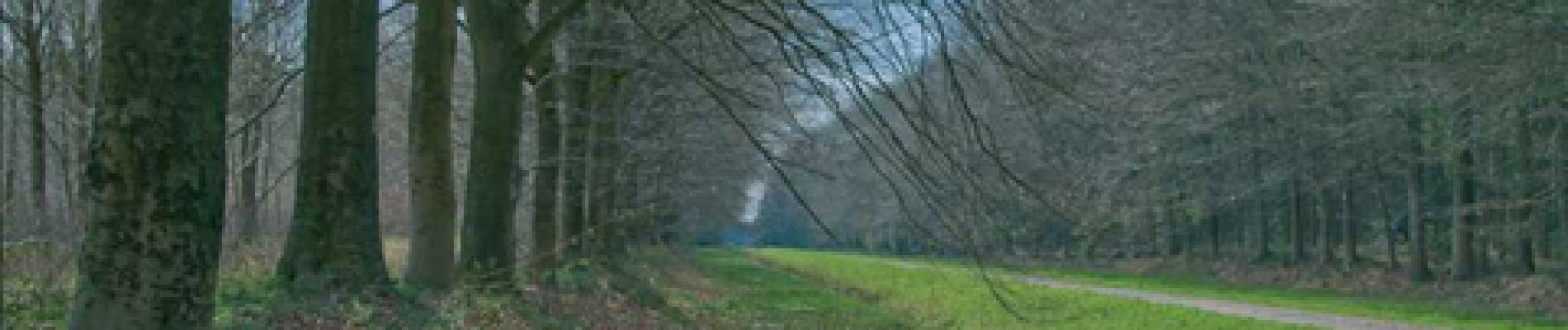
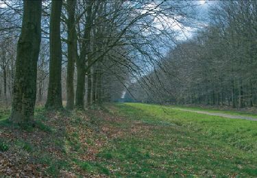
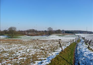
Ce coin du Hainaut peut aussi se prévaloir de vastes forêts, agréablement aménagées pour accueillir les promeneurs pédestres et cyclistes. Au coeur de ces étendues forestières, le site de la Mer de Sable étonnera plus d’un randonneur. Enfin, les rives du canal Blaton – Ath, empruntées par le RAVeL 4, offrent un cheminement bien paisible…
Cartographie et documentation:
Carte IGN au 1 : 20 000 45/1-2 « Beloeil – Tertre ».
Topo-guide des GR 123/121 « Tour du Hainaut occidental ».
Où se désaltérer et se restaurer :
Le randonneur trouvera, bien sûr, cafés et restaurants à Beloeil, à proximité du château, donc près de l’esplanade de stationnement. En cours de balade, cafés et restaurants à la Mer de Sable et le long de la N50, traversée peu après ce site.
Positioning
Comments
Trails nearby
![Trail Walking Mons - RB-Ha-13 - Sur les terres du prince de Ligne - Photo](https://media.geolcdn.com/t/375/260/ext.jpg?maxdim=2&url=https%3A%2F%2Fservices.sitytrail.com%2FGeolivesWS%2FDownloadMedia.ashx%3FTrailID%3D179607%26Media%3Dee6cd659-80c2-435e-9976-43cb94344f6e.jpg)
![Walking Walking](https://static1.geolcdn.com/sitytour/trail-icons/101.png)
Walking
![](/images/other/stat-length.png)
![](https://static1.geolcdn.com/siteimages/upload/files/16400158638029165_repeat_loop_refresh_sync_direction_icon.png)
![Trail Walking Mons - Nuit du scoutisme - Mons - Photo](https://media.geolcdn.com/t/375/260/87b716aa-c8cf-4b43-af3b-2f8493539c6a.jpg&format=jpg&maxdim=2)
![Walking Walking](https://static1.geolcdn.com/sitytour/trail-icons/101.png)
Walking
![](/images/other/stat-length.png)
![](https://static1.geolcdn.com/siteimages/upload/files/16400158638029165_repeat_loop_refresh_sync_direction_icon.png)
![Trail Walking Mons - RB-Ha-13 - Spiennes - Via allongement - 2024-04-24 - Photo](https://media.geolcdn.com/t/375/260/ext.jpg?maxdim=2&url=https%3A%2F%2Fstatic1.geolcdn.com%2Fsiteimages%2Fupload%2Ffiles%2F1553511878bg_sport_marche.png)
![Walking Walking](https://static1.geolcdn.com/sitytour/trail-icons/101.png)
Walking
![](/images/other/stat-length.png)
![](https://static1.geolcdn.com/siteimages/upload/files/16400158638029165_repeat_loop_refresh_sync_direction_icon.png)
![Trail Walking Mons - Balade dans le bois d'Havré - Photo](https://media.geolcdn.com/t/375/260/ext.jpg?maxdim=2&url=https%3A%2F%2Fservices.sitytrail.com%2FGeolivesWS%2FDownloadMedia.ashx%3FTrailID%3D100535%26Media%3D87419146-43c8-4ee2-bd27-497925302c85.JPG)
![Walking Walking](https://static1.geolcdn.com/sitytour/trail-icons/101.png)
Walking
![](/images/other/stat-length.png)
![](https://static1.geolcdn.com/siteimages/upload/files/16400158638029165_repeat_loop_refresh_sync_direction_icon.png)
![Trail Walking Mons - petit tour à mons - Photo](https://media.geolcdn.com/t/375/260/d7cbcfa9-b19e-435e-ba25-f17ef2758d9e.jpg&format=jpg&maxdim=2)
![Walking Walking](https://static1.geolcdn.com/sitytour/trail-icons/101.png)
Walking
![](/images/other/stat-length.png)
![](https://static1.geolcdn.com/siteimages/upload/files/16400158638029165_repeat_loop_refresh_sync_direction_icon.png)
![Walking Walking](https://static1.geolcdn.com/sitytour/trail-icons/101.png)
Walking
![](/images/other/stat-length.png)
![](https://static1.geolcdn.com/siteimages/upload/files/16400158638029165_repeat_loop_refresh_sync_direction_icon.png)
![Trail Walking Mons - marche 5-06 montpanisel - Photo](https://media.geolcdn.com/t/375/260/ext.jpg?maxdim=2&url=https%3A%2F%2Fstatic1.geolcdn.com%2Fsiteimages%2Fupload%2Ffiles%2F1553511878bg_sport_marche.png)
![Walking Walking](https://static1.geolcdn.com/sitytour/trail-icons/101.png)
Walking
![](/images/other/stat-length.png)
![](https://static1.geolcdn.com/siteimages/upload/files/16400158638029165_repeat_loop_refresh_sync_direction_icon.png)
![Trail Mountain bike Mons - transboraine 34km - Photo](https://media.geolcdn.com/t/375/260/ext.jpg?maxdim=2&url=https%3A%2F%2Fstatic1.geolcdn.com%2Fsiteimages%2Fupload%2Ffiles%2F1524743154velo.jpg)
![Mountain bike Mountain bike](https://static1.geolcdn.com/sitytour/trail-icons/202.png)
Mountain bike
![](/images/other/stat-length.png)
![](https://static1.geolcdn.com/siteimages/upload/files/16400158638029165_repeat_loop_refresh_sync_direction_icon.png)
![Trail Walking Mons - Havré (Mons) - Photo](https://media.geolcdn.com/t/375/260/446e2f05-1b0f-43e6-beed-8d30f19d900f.jpg&format=jpg&maxdim=2)
![Walking Walking](https://static1.geolcdn.com/sitytour/trail-icons/101.png)
Walking
![](/images/other/stat-length.png)
![](https://static1.geolcdn.com/siteimages/upload/files/16400158638029165_repeat_loop_refresh_sync_direction_icon.png)