Trail Walking Saint-Raymond - Trail Planner Map - Photo

Trail Planner Map

 Alizée.pee
Alizée.pee

User GUIDE

© OpenStreetMap contributors
Length
Length
14.5 km
Max alt
Max alt
690 m
Uphill gradient
Uphill gradient
632 m
Km-Effort
Km-Effort  
23 km
Min alt
Min alt
224 m
Downhill gradient
Downhill gradient
633 m
Boucle
Boucle
Yes
Creation date :
2019-09-06 10:11:08.876
Updated on :
2019-09-06 10:11:47.84

(0 Reviews)

Walking
Walking
4h44
Difficulty : Medium

Scan this QR Code to open this trail in the SityTrail application

FREE GPS app for hiking

Logo SityTrail SityTrail

IGN / Geographical institutes

Download SityTrail from the App Store Download SityTrail from Google Play

Logo SityTrail SityTrail World

The world is yours!

Download SityTrail from the App Store Download SityTrail from Google Play Download SityTrail on Huawei AppGallery

About

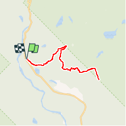
Trail Walking of 14.5 km to be discovered at Quebec, Portneuf, Saint-Raymond. This trail is proposed by Alizée.pee.

Description

Le sentier présente des escaliers en roches, une véritable œuvre d’art qui vous mène jusqu’au sommet. Le sentier semble ensuite un peu plus apprivoisé. Ce n’est pas la randonnée la plus difficile et elle offre des vues splendides.

Elevation profile

Positioning

Country:
Canada
Region :
Quebec
Department/Province :
Portneuf
Municipality :
Saint-Raymond
Location:
Unknown
Start:(UTM)
280632 ; 5217424 (19T) N.

Trails nearby


Close
My subscriptions