


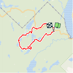

10.7 km | 15.4 km-effort


User GUIDE


FREE GPS app for hiking
 SityTrail
IGN / Geographical institutes
SityTrail World
The world is yours!
Trail Walking of 13.1 km to be discovered at Quebec, Unknown, Shawinigan. This trail is proposed by Alizée.pee.
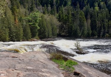
Randonnée avec un sentier génial. La rando passe par plusieurs parcs et offre de magnifiques vues de ceux-ci. Attention, la région est connue pour la présence d’ours. Il y a une grande variété dans cette randonnée au niveau des terrains. Fantastique, je la conseille réellement.
Walking

Walking
Walking
Walking
Walking

Canoe - kayak
Walking