Trail Mountain bike Le Plan-de-la-Tour - le plan de la tour Grimaud - Photo
 jjduvar
jjduvar

User

© OpenStreetMap contributors
Length
Length
42 km
Max alt
Max alt
385 m
Uphill gradient
Uphill gradient
886 m
Km-Effort
Km-Effort  
54 km
Min alt
Min alt
0 m
Downhill gradient
Downhill gradient
886 m
Boucle
Boucle
Yes
Creation date :
2019-09-04 07:14:44.685
Updated on :
2019-09-04 14:26:53.393

(0 Reviews)

Mountain bike
Mountain bike
6h04
Difficulty : Difficult

Scan this QR Code to open this trail in the SityTrail application

FREE GPS app for hiking

Logo SityTrail SityTrail

IGN / Geographical institutes

Download SityTrail from the App Store Download SityTrail from Google Play

Logo SityTrail SityTrail World

The world is yours!

Download SityTrail from the App Store Download SityTrail from Google Play Download SityTrail on Huawei AppGallery

About

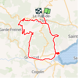
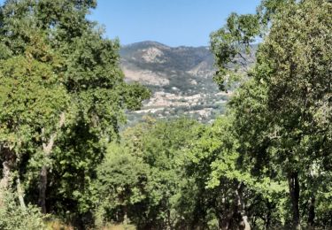
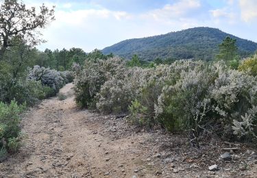
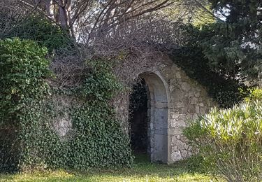
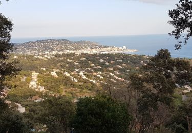
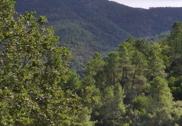
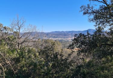
Trail Mountain bike of 42 km to be discovered at Provence-Alpes-Côte d'Azur, Var, Le Plan-de-la-Tour. This trail is proposed by jjduvar.

Description

Magali Eric Sylvain Hervé Pierrot luc

Elevation profile

Positioning

Country:
France
Region :
Provence-Alpes-Côte d'Azur
Department/Province :
Var
Municipality :
Le Plan-de-la-Tour
Location:
Unknown
Start:(UTM)
301304 ; 4801297 (32T) N.

Trails nearby

Trail Walking Le Plan-de-la-Tour - Plan de la Tour - Piste de colle Dure - Col de Vignon - Photo
Walking
LtZIP

Walking

Medium
Le Plan-de-la-Tour, Provence-Alpes-Côte d'Azur, Var, France
18.2 km | 25 km-effort
4h 16min
Yes
Trail Walking Sainte-Maxime - Chapelle St Donat - Marri Vallat - Le Revest - Col de Grateloup - Photo
Walking
LtZIP

Walking

Easy
Sainte-Maxime, Provence-Alpes-Côte d'Azur, Var, France
19 km | 27 km-effort
4h 35min
Yes
Trail Walking Le Plan-de-la-Tour - Le Plan de la Tour - Photo
Walking
Chantheys

Walking

Medium
(1)
Le Plan-de-la-Tour, Provence-Alpes-Côte d'Azur, Var, France
7.7 km | 10.6 km-effort
2h 16min
Yes
Trail Walking Sainte-Maxime - Les Suils GR 51 départ de saint donat - Photo
Walking
jean-marie.parachini

Walking

Medium
Sainte-Maxime, Provence-Alpes-Côte d'Azur, Var, France
4.2 km | 6.6 km-effort
1h 41min
Yes
Trail Walking Le Plan-de-la-Tour - PLAN DE LA TOUR - AUTOUR DE SAN PEÏRE ET SAINT SEBASTIEN - Photo
Walking
jean-marie.parachini

Walking

Easy
Le Plan-de-la-Tour, Provence-Alpes-Côte d'Azur, Var, France
14.2 km | 18.8 km-effort
5h 4min
Yes
Trail Walking Grimaud - HAUTEURS DE BEAUVALLON - Photo
Walking
jean-marie.parachini

Walking

Easy
Grimaud, Provence-Alpes-Côte d'Azur, Var, France
6.1 km | 9.8 km-effort
2h 57min
Yes
Trail Walking La Garde-Freinet - Boucle la Mourre/ Cabrettes - Photo
Walking
LBarel

Walking

Easy
(1)
La Garde-Freinet, Provence-Alpes-Côte d'Azur, Var, France
9.8 km | 13.6 km-effort
2h 56min
Yes
Trail Walking Le Plan-de-la-Tour - plan de la tour - Reverdi  les vernades - Photo
Walking
jean-marie.parachini

Walking

Medium
Le Plan-de-la-Tour, Provence-Alpes-Côte d'Azur, Var, France
8 km | 10.8 km-effort
2h 55min
Yes
Trail Walking Sainte-Maxime - Vers Peigros - Photo
Walking
jean-marie.parachini

Walking

Easy
Sainte-Maxime, Provence-Alpes-Côte d'Azur, Var, France
6.8 km | 9.3 km-effort
2h 43min
Yes


Close
My subscriptions