Trail Walking Bouillon - La Randonnée des échelles - Rochehaut - Photo

La Randonnée des échelles - Rochehaut

 Desrumaux
Desrumaux

User GUIDE

© OpenStreetMap contributors
Length
Length
5.4 km
Max alt
Max alt
384 m
Uphill gradient
Uphill gradient
203 m
Km-Effort
Km-Effort  
8.1 km
Min alt
Min alt
207 m
Downhill gradient
Downhill gradient
202 m
Boucle
Boucle
Yes
Creation date :
2019-09-01 11:02:03.285
Updated on :
2021-10-08 15:06:20.826

(1 Reviews)

Walking
Walking
3h22
Difficulty : Difficult

Scan this QR Code to open this trail in the SityTrail application

FREE GPS app for hiking

Logo SityTrail SityTrail

IGN / Geographical institutes

Download SityTrail from the App Store Download SityTrail from Google Play

Logo SityTrail SityTrail World

The world is yours!

Download SityTrail from the App Store Download SityTrail from Google Play Download SityTrail on Huawei AppGallery

About

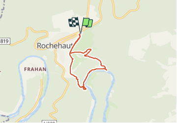
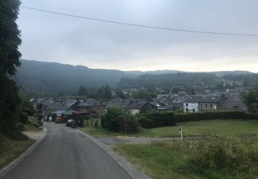
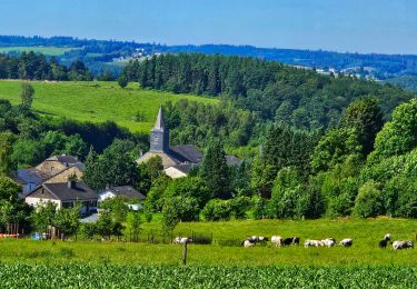
Trail Walking of 5.4 km to be discovered at Wallonia, Luxembourg, Bouillon. This trail is proposed by Desrumaux.

Description

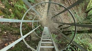
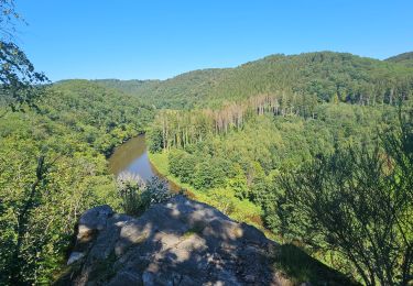
Comme son nom l’indique, cette balade au parcours escarpé ponctuée d’échelles qui vous aiderons à franchir les passages les plus raides est classée difficile en raison du franchissement de certains obstacles naturelles, elle est donc déconseillée aux personnes sujettes au vertige.
La sécurité est assurée par la mise en place de mains courante, passerelles, anneaux circulaires entourant les échelles, à faire par temps sec.
Le départ se fait à l’église de Rochehaut ou à la ferme de Christine et Marc Boreux, balisage rectangle rouge numéroté 43.

Elevation profile

Photos

Positioning

Country:
Belgium
Region :
Wallonia
Department/Province :
Luxembourg
Municipality :
Bouillon
Location:
Unknown
Start:(UTM)
644948 ; 5523135 (31U) N.

Comments

Please log in to post a review or rate the element
 

Trails nearby

Trail Walking Bouillon - RB-Lu-12 - Premier contact avec la Semois au Tombeau du Géant - Photo
Walking
PRO

Walking

Very difficult
(6)
Bouillon, Wallonia, Luxembourg, Belgium
19.1 km | 27 km-effort
6h 7min
Yes
Trail Walking Vresse-sur-Semois - Rb-Na-32-Racc_Sur-les-rampes-escarpées-de-la-vallée-de-la-Semois - Photo
Walking
PRO

Walking

Very difficult
(2)
Vresse-sur-Semois, Wallonia, Namur, Belgium
14.7 km | 23 km-effort
5h 14min
Yes
Trail Walking Vresse-sur-Semois - Rb-Na-32_Sur les rampes escarpées de la vallée de la Semois - Photo
Walking
PRO

Walking

Very difficult
(2)
Vresse-sur-Semois, Wallonia, Namur, Belgium
19.8 km | 31 km-effort
7h 5min
Yes
Trail Walking Bouillon - De Poupehan à Frahan par le sentier des crêtes - Photo
Walking
GUIDE
Desrumaux

Walking

Medium
(2)
Bouillon, Wallonia, Luxembourg, Belgium
8.8 km | 12.5 km-effort
3h 0min
Yes
Trail Walking Bouillon - Poupehan_Rochehaut_Frahan_Poupzhan - Photo
Walking
Dom62

Walking

Medium
(4)
Bouillon, Wallonia, Luxembourg, Belgium
12.8 km | 18.7 km-effort
5h 7min
Yes
Trail Walking Bouillon - rochehaut 180620 - Photo
Walking
guyernage25

Walking

Difficult
(1)
Bouillon, Wallonia, Luxembourg, Belgium
20 km | 31 km-effort
5h 1min
Yes
Trail Walking Vresse-sur-Semois - Alle - Mouzaive - Photo
Walking
mavbelgium

Walking

Medium
(1)
Vresse-sur-Semois, Wallonia, Namur, Belgium
5.6 km | 8.1 km-effort
1h 45min
Yes
Trail Walking Bouillon - Balade à Ucimont - Photo
Walking
GUIDE
Desrumaux

Walking

Difficult
Bouillon, Wallonia, Luxembourg, Belgium
10.3 km | 14.2 km-effort
3h 13min
Yes
Trail Walking Bouillon - Le Sentier des Points de Vues - Bouillon - Photo
Walking
GUIDE
Desrumaux

Walking

Difficult
Bouillon, Wallonia, Luxembourg, Belgium
8.5 km | 12.2 km-effort
2h 47min
Yes


Close
My subscriptions