![](/images/other/stat-length.png)
![Trail Walking Sagnes-et-Goudoulet - De la Tour à eaux à la table d’interprétation - Photo](https://media.geolcdn.com/t/1900/400/ext.pjpeg?maxdim=2&url=https%3A%2F%2Fstatic1.geolcdn.com%2Fsiteimages%2Fupload%2Ffiles%2F1553511878bg_sport_marche.png)
De la Tour à eaux à la table d’interprétation
sandrineh
User
![Length](/images/other/stat-length.png)
Length
4.9 km
![Max alt](https://static1.geolcdn.com/siteimages/upload/files/1508320355ic_sort_altitude_max_24dp.png)
Max alt
1424 m
![Uphill gradient](https://static1.geolcdn.com/siteimages/upload/files/1508320355ic_sort_den_pos_24dp.png)
Uphill gradient
106 m
![Km-Effort](/images/other/stat-length.png)
Km-Effort
6.3 km
![Min alt](https://static1.geolcdn.com/siteimages/upload/files/1508320355ic_sort_altitude_min_24dp.png)
Min alt
1337 m
![Downhill gradient](https://static1.geolcdn.com/siteimages/upload/files/1508320355ic_sort_den_neg_24dp.png)
Downhill gradient
116 m
![Boucle](https://static1.geolcdn.com/siteimages/upload/files/16400158638029165_repeat_loop_refresh_sync_direction_icon.png)
Boucle
Yes
Creation date :
2019-08-31 14:34:40.0
Updated on :
2019-08-31 16:55:20.439
![Walking](https://static1.geolcdn.com/sitytour/trail-icons/101.png)
2h19
Difficulty : Easy
![Scan this QR Code to open this trail in the SityTrail application](https://capi.geolives.com/qq0zvz2zws4bq2lad0pu/sitytour/trails/2187780/qr.png?size=200)
FREE GPS app for hiking
About
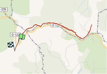
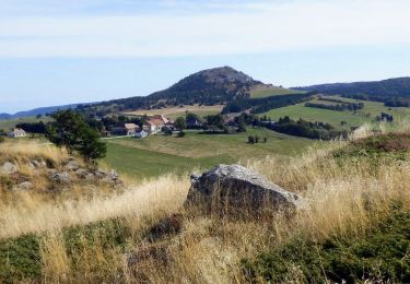
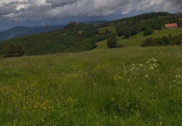
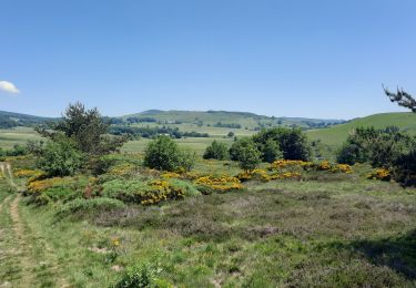
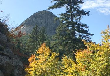
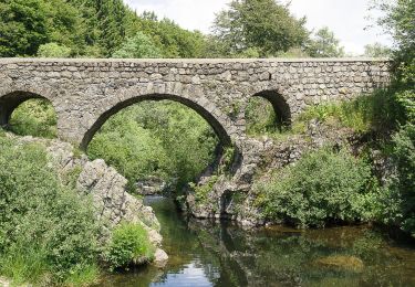
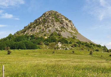
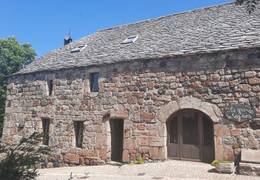
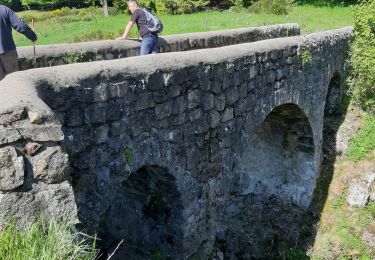
Trail Walking of 4.9 km to be discovered at Auvergne-Rhône-Alpes, Ardèche, Sagnes-et-Goudoulet. This trail is proposed by sandrineh.
Description
Un A/R plutôt facile en partant depuis le parking de la tour à eaux. Prévoir quand même des chaussures qui tiennent bien. Le chemin traverse parfois des roches/cailloux ou de la tourbe.
Positioning
Country:
France
Region :
Auvergne-Rhône-Alpes
Department/Province :
Ardèche
Municipality :
Sagnes-et-Goudoulet
Location:
Unknown
Start:(Dec)
Start:(UTM)
598408 ; 4962998 (31T) N.
Comments
Trails nearby
![Trail Walking Péreyres - Pereyres Lachamp 16km - Photo](https://media.geolcdn.com/t/375/260/cd059db4-0e57-4cdd-b0a7-57f5a9d765a9.jpg&format=jpg&maxdim=2)
![Walking Walking](https://static1.geolcdn.com/sitytour/trail-icons/101.png)
Pereyres Lachamp 16km
Walking
Medium
Péreyres,
Auvergne-Rhône-Alpes,
Ardèche,
France
![](/images/other/stat-length.png)
16.1 km | 24 km-effort
5h 32min
![](https://static1.geolcdn.com/siteimages/upload/files/16400158638029165_repeat_loop_refresh_sync_direction_icon.png)
Yes
![Trail Walking Lachamp-Raphaël - 07 lachamp Raphaël orga 10.06.23 - Photo](https://media.geolcdn.com/t/375/260/07456a0b-3bda-48f2-bd40-fb46d8070303.jpg&format=jpg&maxdim=2)
![Walking Walking](https://static1.geolcdn.com/sitytour/trail-icons/101.png)
07 lachamp Raphaël orga 10.06.23
Walking
Medium
Lachamp-Raphaël,
Auvergne-Rhône-Alpes,
Ardèche,
France
![](/images/other/stat-length.png)
18 km | 27 km-effort
5h 39min
![](https://static1.geolcdn.com/siteimages/upload/files/16400158638029165_repeat_loop_refresh_sync_direction_icon.png)
No
![Trail Walking Sagnes-et-Goudoulet - Les Coux-Sagnes-Tour à Eau 14km - Photo](https://media.geolcdn.com/t/375/260/7bfff9d7-91a3-4852-a6bf-dd6f46240ce8.jpg&format=jpg&maxdim=2)
![Walking Walking](https://static1.geolcdn.com/sitytour/trail-icons/101.png)
Les Coux-Sagnes-Tour à Eau 14km
Walking
Medium
Sagnes-et-Goudoulet,
Auvergne-Rhône-Alpes,
Ardèche,
France
![](/images/other/stat-length.png)
14.1 km | 19.4 km-effort
5h 42min
![](https://static1.geolcdn.com/siteimages/upload/files/16400158638029165_repeat_loop_refresh_sync_direction_icon.png)
Yes
![Walking Walking](https://static1.geolcdn.com/sitytour/trail-icons/101.png)
SityTrail - 435359 - gerbier-de-jonc-x-le-pradal
Walking
Very difficult
Sainte-Eulalie,
Auvergne-Rhône-Alpes,
Ardèche,
France
![](/images/other/stat-length.png)
13.9 km | 21 km-effort
4h 43min
![](https://static1.geolcdn.com/siteimages/upload/files/16400158638029165_repeat_loop_refresh_sync_direction_icon.png)
Yes
![Trail Walking Saint-Andéol-de-Fourchades - Boucle de la ferme de Bourdalier à Sagnes-et-Gourdoulet - Photo](https://media.geolcdn.com/t/375/260/31c1868a-b2a8-47e4-b863-8b44b5da618e.jpg&format=jpg&maxdim=2)
![Walking Walking](https://static1.geolcdn.com/sitytour/trail-icons/101.png)
Boucle de la ferme de Bourdalier à Sagnes-et-Gourdoulet
Walking
Medium
Saint-Andéol-de-Fourchades,
Auvergne-Rhône-Alpes,
Ardèche,
France
![](/images/other/stat-length.png)
11.7 km | 15.8 km-effort
3h 35min
![](https://static1.geolcdn.com/siteimages/upload/files/16400158638029165_repeat_loop_refresh_sync_direction_icon.png)
Yes
![Trail Walking Saint-Martial - 2023-01-26_11h38m36_Gerbier Sentier botanique 14km.gpx.xml - Photo](https://media.geolcdn.com/t/375/260/908a31be-ec11-4c97-9939-f22f3cd5b90e.jpg&format=jpg&maxdim=2)
![Walking Walking](https://static1.geolcdn.com/sitytour/trail-icons/101.png)
2023-01-26_11h38m36_Gerbier Sentier botanique 14km.gpx.xml
Walking
Difficult
Saint-Martial,
Auvergne-Rhône-Alpes,
Ardèche,
France
![](/images/other/stat-length.png)
13.8 km | 21 km-effort
4h 46min
![](https://static1.geolcdn.com/siteimages/upload/files/16400158638029165_repeat_loop_refresh_sync_direction_icon.png)
Yes
![Trail Walking Sagnes-et-Goudoulet - Les Coux - Sagne et Goudoulet - La Tour à Eau 14km - Photo](https://media.geolcdn.com/t/375/260/e50b9160-d833-4b37-8588-2eb7f9e44f6b.jpg&format=jpg&maxdim=2)
![Walking Walking](https://static1.geolcdn.com/sitytour/trail-icons/101.png)
Les Coux - Sagne et Goudoulet - La Tour à Eau 14km
Walking
Difficult
Sagnes-et-Goudoulet,
Auvergne-Rhône-Alpes,
Ardèche,
France
![](/images/other/stat-length.png)
14.2 km | 19.6 km-effort
5h 36min
![](https://static1.geolcdn.com/siteimages/upload/files/16400158638029165_repeat_loop_refresh_sync_direction_icon.png)
Yes
![Trail Walking Lachamp-Raphaël - Lachamp-Raphaël : les sucs - Photo](https://media.geolcdn.com/t/375/260/efd94835-0c85-498e-997c-3f10de9c1e49.jpg&format=jpg&maxdim=2)
![Walking Walking](https://static1.geolcdn.com/sitytour/trail-icons/101.png)
Lachamp-Raphaël : les sucs
Walking
Medium
Lachamp-Raphaël,
Auvergne-Rhône-Alpes,
Ardèche,
France
![](/images/other/stat-length.png)
23 km | 31 km-effort
5h 18min
![](https://static1.geolcdn.com/siteimages/upload/files/16400158638029165_repeat_loop_refresh_sync_direction_icon.png)
Yes
![Trail Walking Sainte-Eulalie - balade Gerbier de joncs - Photo](https://media.geolcdn.com/t/375/260/ext.jpg?maxdim=2&url=https%3A%2F%2Fstatic1.geolcdn.com%2Fsiteimages%2Fupload%2Ffiles%2F1553511878bg_sport_marche.png)
![Walking Walking](https://static1.geolcdn.com/sitytour/trail-icons/101.png)
balade Gerbier de joncs
Walking
Easy
(1)
Sainte-Eulalie,
Auvergne-Rhône-Alpes,
Ardèche,
France
![](/images/other/stat-length.png)
8.1 km | 10 km-effort
2h 8min
![](https://static1.geolcdn.com/siteimages/upload/files/16400158638029165_repeat_loop_refresh_sync_direction_icon.png)
Yes