![](/images/other/stat-length.png)
![Trail Walking Orp-Jauche - RB-BW-01 - Raccourci 1- L'Extrême-Orient du Brabant wallon - Photo](https://media.geolcdn.com/t/1900/400/ext.pjpeg?maxdim=2&url=https%3A%2F%2Fservices.sitytrail.com%2FGeolivesWS%2FDownloadMedia.ashx%3FTrailID%3D218532%26Media%3D2b25bbe0-0fd5-407f-bf14-f349bb03461d.jpg)
RB-BW-01 - Raccourci 1- L'Extrême-Orient du Brabant wallon
GR Rando
Randonnez sur et autour des GR ® wallons (Sentiers de Grande Randonnée). PRO
![Length](/images/other/stat-length.png)
![Max alt](https://static1.geolcdn.com/siteimages/upload/files/1508320355ic_sort_altitude_max_24dp.png)
![Uphill gradient](https://static1.geolcdn.com/siteimages/upload/files/1508320355ic_sort_den_pos_24dp.png)
![Km-Effort](/images/other/stat-length.png)
![Min alt](https://static1.geolcdn.com/siteimages/upload/files/1508320355ic_sort_altitude_min_24dp.png)
![Downhill gradient](https://static1.geolcdn.com/siteimages/upload/files/1508320355ic_sort_den_neg_24dp.png)
![Boucle](https://static1.geolcdn.com/siteimages/upload/files/16400158638029165_repeat_loop_refresh_sync_direction_icon.png)
![Walking](https://static1.geolcdn.com/sitytour/trail-icons/101.png)
5h46
Difficulty : Medium
![Scan this QR Code to open this trail in the SityTrail application](https://capi.geolives.com/qq0zvz2zws4bq2lad0pu/sitytour/trails/218532/qr.png?size=200)
FREE GPS app for hiking
About
Trail Walking of 20 km to be discovered at Wallonia, Walloon Brabant, Orp-Jauche. This trail is proposed by GR Rando.
Description
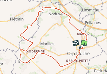
Orp-le-Grand – Noduwez – Nodrenge – Orp-le-Petit – Orp-le-Grand
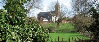
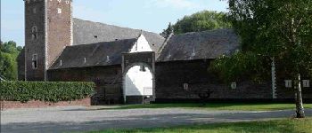
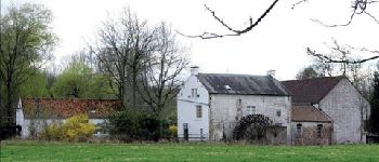
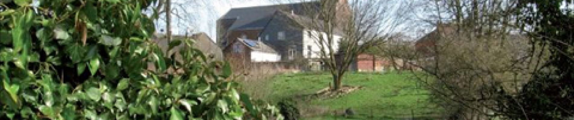
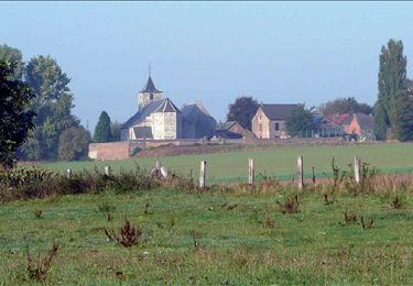
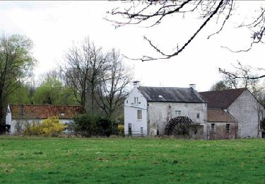
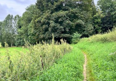
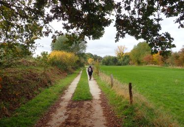
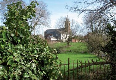
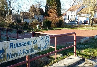
Si la Hesbaye vous inspire des paysages plats, assez peu variés, cette excursion vous amènera sans doute à revoir quelque peu votre jugement car le paysage vous surprendra par sa diversité. Vous savourerez le charme des rives de la Petite Gette et de ses discrets affluents, vous rencontrerez quelques églises remarquables et de nombreuses fermes aux porches monumentaux.
Cartographie et documentation
Cartes IGN au 1:20 000, 40/3-4 « Jodoigne – Jauche » et 41/1-2 « Hannut – Montenaken ».
Topo-guide du GR 579 « Bruxelles – Liège ».
Carte de la commune d’Orp-Jauche.
Carte de promenades de la Hesbaye brabançonne au 1:30 000, reprenant les 34 promenades des six communes de l’est du Brabant wallon. Cette carte est accompagnée d’un carnet descriptif.
Brochure décrivant les quatre promenades pédestres balisées à Orp-Jauche.
Où se désaltérer et se restaurer
À Orp-le-Grand, non loin de l’église, le café « Le Lyrique », et, un peu plus loin, près
de l’ancienne gare, le café « Le Ravel ».
En été, à la buvette de l’étang de pêche.
À Orp-le-Grand, le « Snack gourmand », non loin du café Lyrique.
Autres restaurants à Jauche, à Hélécine, à Jodoigne, à Hannut…
Points of interest
Positioning
Comments
Trails nearby
![Trail Walking Orp-Jauche - RB-BW-02 - raccourci 2 - La solitude des grands espaces - Photo](https://media.geolcdn.com/t/375/260/ext.jpg?maxdim=2&url=https%3A%2F%2Fservices.sitytrail.com%2FGeolivesWS%2FDownloadMedia.ashx%3FTrailID%3D218648%26Media%3Dc9e8c77a-c3f0-47a1-8c90-911d33267101.jpg)
![Walking Walking](https://static1.geolcdn.com/sitytour/trail-icons/101.png)
Walking
![](/images/other/stat-length.png)
![](https://static1.geolcdn.com/siteimages/upload/files/16400158638029165_repeat_loop_refresh_sync_direction_icon.png)
![Trail Walking Orp-Jauche - RB-BW-02 - raccourci 1 - La solitude des grands espaces - Photo](https://media.geolcdn.com/t/375/260/ext.jpg?maxdim=2&url=https%3A%2F%2Fservices.sitytrail.com%2FGeolivesWS%2FDownloadMedia.ashx%3FTrailID%3D218641%26Media%3Dc9e8c77a-c3f0-47a1-8c90-911d33267101.jpg)
![Walking Walking](https://static1.geolcdn.com/sitytour/trail-icons/101.png)
Walking
![](/images/other/stat-length.png)
![](https://static1.geolcdn.com/siteimages/upload/files/16400158638029165_repeat_loop_refresh_sync_direction_icon.png)
![Trail Walking Orp-Jauche - RB-BW-02 - La solitude des grands espaces - Photo](https://media.geolcdn.com/t/375/260/ext.jpg?maxdim=2&url=https%3A%2F%2Fservices.sitytrail.com%2FGeolivesWS%2FDownloadMedia.ashx%3FTrailID%3D179577%26Media%3Dc9e8c77a-c3f0-47a1-8c90-911d33267101.jpg)
![Walking Walking](https://static1.geolcdn.com/sitytour/trail-icons/101.png)
Walking
![](/images/other/stat-length.png)
![](https://static1.geolcdn.com/siteimages/upload/files/16400158638029165_repeat_loop_refresh_sync_direction_icon.png)
![Trail Walking Orp-Jauche - RB-Bw-01 - Orp-le-Grand via la variante - Photo](https://media.geolcdn.com/t/375/260/ext.jpg?maxdim=2&url=https%3A%2F%2Fservices.sitytrail.com%2FGeolivesWS%2FDownloadMedia.ashx%3FTrailID%3D179575%26Media%3D1fb01559-2292-4faf-8acf-655ff0b406da.jpg)
![Walking Walking](https://static1.geolcdn.com/sitytour/trail-icons/101.png)
Walking
![](/images/other/stat-length.png)
![](https://static1.geolcdn.com/siteimages/upload/files/16400158638029165_repeat_loop_refresh_sync_direction_icon.png)
![Trail Walking Hannut - La Balade des Deux Vallées - Photo](https://media.geolcdn.com/t/375/260/bf859057-7cb9-4d70-a913-bf32ef5ee4d0.jpeg&format=jpg&maxdim=2)
![Walking Walking](https://static1.geolcdn.com/sitytour/trail-icons/101.png)
Walking
![](/images/other/stat-length.png)
![](https://static1.geolcdn.com/siteimages/upload/files/16400158638029165_repeat_loop_refresh_sync_direction_icon.png)
![Walking Walking](https://static1.geolcdn.com/sitytour/trail-icons/101.png)
Walking
![](/images/other/stat-length.png)
![](https://static1.geolcdn.com/siteimages/upload/files/16400158638029165_repeat_loop_refresh_sync_direction_icon.png)
![Trail Walking Orp-Jauche - RB-BW-01 - Raccourci 2- L'Extrême-Orient du Brabant wallon - Photo](https://media.geolcdn.com/t/375/260/ext.jpg?maxdim=2&url=https%3A%2F%2Fservices.sitytrail.com%2FGeolivesWS%2FDownloadMedia.ashx%3FTrailID%3D218537%26Media%3D2b25bbe0-0fd5-407f-bf14-f349bb03461d.jpg)
![Walking Walking](https://static1.geolcdn.com/sitytour/trail-icons/101.png)
Walking
![](/images/other/stat-length.png)
![](https://static1.geolcdn.com/siteimages/upload/files/16400158638029165_repeat_loop_refresh_sync_direction_icon.png)
![Trail Walking Orp-Jauche - Orp le Grand Nathalie Demain 29 11 2016 - Photo](https://media.geolcdn.com/t/375/260/ext.jpg?maxdim=2&url=https%3A%2F%2Fservices.sitytrail.com%2FGeolivesWS%2FDownloadMedia.ashx%3FTrailID%3D666139%26Media%3Dfix__20161129124748.jpg)
![Walking Walking](https://static1.geolcdn.com/sitytour/trail-icons/101.png)
Walking
![](/images/other/stat-length.png)
![](https://static1.geolcdn.com/siteimages/upload/files/16400158638029165_repeat_loop_refresh_sync_direction_icon.png)
![Trail On foot Jodoigne - Promenade de la chapelle d'Herbais - Photo](https://media.geolcdn.com/t/375/260/9aa9d8fc-8d5f-4ab8-a073-3c93152fc20d.jpeg&format=jpg&maxdim=2)
![On foot On foot](https://static1.geolcdn.com/sitytour/trail-icons/100.png)
On foot
![](/images/other/stat-length.png)
![](https://static1.geolcdn.com/siteimages/upload/files/16400158638029165_repeat_loop_refresh_sync_direction_icon.png)
mooi 7/10