![](/images/other/stat-length.png)
![Trail Arques - SityTrail - Les Berques - Arques - Photo](https://media.geolcdn.com/t/1900/400/ext.pjpeg?maxdim=2&url=https%3A%2F%2Fsecurestorage.geolives.com%2Fsitytour%2Ftrail-bg%2Fdefault.jpg)
SityTrail - Les Berques - Arques
mouma_77
User
![Length](/images/other/stat-length.png)
![Max alt](https://static1.geolcdn.com/siteimages/upload/files/1508320355ic_sort_altitude_max_24dp.png)
![Uphill gradient](https://static1.geolcdn.com/siteimages/upload/files/1508320355ic_sort_den_pos_24dp.png)
![Km-Effort](/images/other/stat-length.png)
![Min alt](https://static1.geolcdn.com/siteimages/upload/files/1508320355ic_sort_altitude_min_24dp.png)
![Downhill gradient](https://static1.geolcdn.com/siteimages/upload/files/1508320355ic_sort_den_neg_24dp.png)
![Boucle](https://static1.geolcdn.com/siteimages/upload/files/16400158638029165_repeat_loop_refresh_sync_direction_icon.png)
![Scan this QR Code to open this trail in the SityTrail application](https://capi.geolives.com/qq0zvz2zws4bq2lad0pu/sitytour/trails/2184292/qr.png?size=200)
FREE GPS app for hiking
About
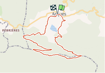
Trail of 11.4 km to be discovered at Occitania, Aude, Arques. This trail is proposed by mouma_77.
Description
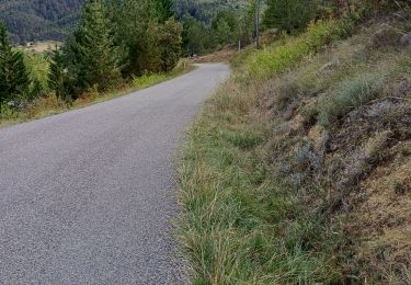
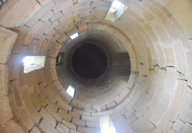
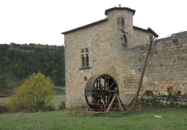
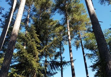
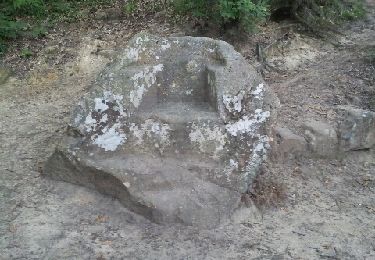
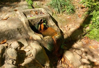
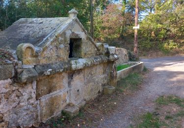
Circuit proposé par le Pays de Couiza. Départ de l'église d'Arques. Cet itinéraire offre un panorama somptueux depuis les deux sommets principaux de la forêt du Rialsesse d’où l’on aperçoit le lac d’Arques. Cette forêt des Corbières Occidentales est domaniale et s’étend sur 8 communes. Les différents étages de la végétation s’échelonnent du chêne pubescent aux résineux : pins noirs, pins laricio, pins sylvestres et à l’étage supérieur, les sapins, cèdres et hêtres. Vues exceptionnelles sur Arques, la vallée et les collines qui l’entourent avec au sud, le Pech de Bugarach et à l’ouest, la chaîne des Pyrénées orientales et ariégeoises. Retrouvez cette randonnée sur le site du Pays de Couiza.
Positioning
Comments
Trails nearby
![Trail Cycle Arques - CCS FFC Aude en Pyrénées - Circuit n°11 - Arques - Photo](https://media.geolcdn.com/t/375/260/ext.jpg?maxdim=2&url=https%3A%2F%2Fservices.sitytrail.com%2FGeolivesWS%2FDownloadMedia.ashx%3FTrailID%3D111470%26Media%3D7353_1.jpg)
![Cycle Cycle](https://static1.geolcdn.com/sitytour/trail-icons/200.png)
Cycle
![](/images/other/stat-length.png)
![](https://static1.geolcdn.com/siteimages/upload/files/16400158638029165_repeat_loop_refresh_sync_direction_icon.png)
![Trail Walking Serres - Serres Cardou - Photo](https://media.geolcdn.com/t/375/260/3dcdcfad-e675-4328-969d-93b02c6e2d21.jpg&format=jpg&maxdim=2)
![Walking Walking](https://static1.geolcdn.com/sitytour/trail-icons/101.png)
![Trail On foot Arques - La Frau - Photo](https://media.geolcdn.com/t/375/260/dd7678c6-a794-444d-a52c-e2d60c9d9291.jpeg&format=jpg&maxdim=2)
![On foot On foot](https://static1.geolcdn.com/sitytour/trail-icons/100.png)
![Trail On foot Arques - Les Berques - Photo](https://media.geolcdn.com/t/375/260/84344748-6b6d-47a0-bbe7-d97839fec542.jpeg&format=jpg&maxdim=2)
![On foot On foot](https://static1.geolcdn.com/sitytour/trail-icons/100.png)
![Trail Walking Arques - Arques 29 09 3019 - Photo](https://media.geolcdn.com/t/375/260/d8261a14-6ebe-438a-a45c-071567d1fc57.jpg&format=jpg&maxdim=2)
![Walking Walking](https://static1.geolcdn.com/sitytour/trail-icons/101.png)
Walking
![](/images/other/stat-length.png)
![](https://static1.geolcdn.com/siteimages/upload/files/16400158638029165_repeat_loop_refresh_sync_direction_icon.png)
![Trail Walking Rennes-les-Bains - Sources Rennes les bains - Photo](https://media.geolcdn.com/t/375/260/ext.jpg?maxdim=2&url=https%3A%2F%2Fservices.sitytrail.com%2FGeolivesWS%2FDownloadMedia.ashx%3FTrailID%3D139042%26Media%3D20120625205934.jpeg)
![Walking Walking](https://static1.geolcdn.com/sitytour/trail-icons/101.png)
Walking
![](/images/other/stat-length.png)
![](https://static1.geolcdn.com/siteimages/upload/files/16400158638029165_repeat_loop_refresh_sync_direction_icon.png)
![Trail Walking Rennes-les-Bains - Rennes-les-Bains-le fauteuil du diable - Photo](https://media.geolcdn.com/t/375/260/00addcaa-31da-40b2-8ced-3828d5d82226.jpg&format=jpg&maxdim=2)
![Walking Walking](https://static1.geolcdn.com/sitytour/trail-icons/101.png)
Walking
![](/images/other/stat-length.png)
![](https://static1.geolcdn.com/siteimages/upload/files/16400158638029165_repeat_loop_refresh_sync_direction_icon.png)
![Trail Walking Rennes-les-Bains - Rennes-les-Bains le pech Cardou - Photo](https://media.geolcdn.com/t/375/260/15aaa3e2-afa0-4a81-ba73-18c11f064f8c.jpg&format=jpg&maxdim=2)
![Walking Walking](https://static1.geolcdn.com/sitytour/trail-icons/101.png)
Walking
![](/images/other/stat-length.png)
![](https://static1.geolcdn.com/siteimages/upload/files/16400158638029165_repeat_loop_refresh_sync_direction_icon.png)
![Trail Walking Serres - gogo1965 - Photo](https://media.geolcdn.com/t/375/260/2c2ad03e-8680-4903-b90a-a34f9c6cb5bc.jpg&format=jpg&maxdim=2)
![Walking Walking](https://static1.geolcdn.com/sitytour/trail-icons/101.png)