![](/images/other/stat-length.png)
![Trail Walking Brewster Creek - Wikiloc - Cory pass - Photo](https://media.geolcdn.com/t/1900/400/ext.pjpeg?maxdim=2&url=https%3A%2F%2Fstatic1.geolcdn.com%2Fsiteimages%2Fupload%2Ffiles%2F1553511878bg_sport_marche.png)
Wikiloc - Cory pass
Alizée.pee
User GUIDE
![Length](/images/other/stat-length.png)
Length
13.6 km
![Max alt](https://static1.geolcdn.com/siteimages/upload/files/1508320355ic_sort_altitude_max_24dp.png)
Max alt
2361 m
![Uphill gradient](https://static1.geolcdn.com/siteimages/upload/files/1508320355ic_sort_den_pos_24dp.png)
Uphill gradient
1057 m
![Km-Effort](/images/other/stat-length.png)
Km-Effort
28 km
![Min alt](https://static1.geolcdn.com/siteimages/upload/files/1508320355ic_sort_altitude_min_24dp.png)
Min alt
1389 m
![Downhill gradient](https://static1.geolcdn.com/siteimages/upload/files/1508320355ic_sort_den_neg_24dp.png)
Downhill gradient
1061 m
![Boucle](https://static1.geolcdn.com/siteimages/upload/files/16400158638029165_repeat_loop_refresh_sync_direction_icon.png)
Boucle
Yes
Creation date :
2019-08-26 11:37:49.317
Updated on :
2019-08-26 11:43:01.497
![Walking](https://static1.geolcdn.com/sitytour/trail-icons/101.png)
5h29
Difficulty : Very difficult
![Scan this QR Code to open this trail in the SityTrail application](https://capi.geolives.com/qq0zvz2zws4bq2lad0pu/sitytour/trails/2183497/qr.png?size=200)
FREE GPS app for hiking
About
Trail Walking of 13.6 km to be discovered at Alberta, Improvement District No. 9. This trail is proposed by Alizée.pee.
Description
Randonnée sympa avec des vues magnifiques. Elle demande beaucoup d'efforts et de cardio mais ça en vaut la peine. Les vues sont déja splendides dès le début de la rando !
Positioning
Country:
Canada
Region :
Alberta
Department/Province :
Improvement District No. 9
Municipality :
Brewster Creek
Location:
Unknown
Start:(Dec)
Start:(UTM)
593668 ; 5669682 (11U) N.
Comments
Trails nearby
![Trail Walking - Wikiloc - Johnston Canyon and ink pots - Photo](https://media.geolcdn.com/t/375/260/ext.jpg?maxdim=2&url=https%3A%2F%2Fstatic1.geolcdn.com%2Fsiteimages%2Fupload%2Ffiles%2F1553511878bg_sport_marche.png)
![Walking Walking](https://static1.geolcdn.com/sitytour/trail-icons/101.png)
Wikiloc - Johnston Canyon and ink pots
Walking
Difficult
,
Alberta,
Improvement District No. 9,
Canada
![](/images/other/stat-length.png)
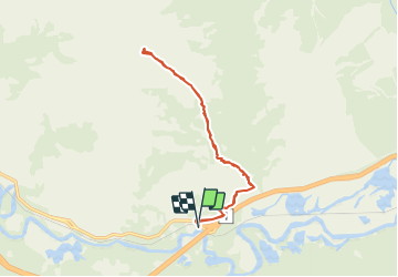
13.4 km | 20 km-effort
4h 10min
![](https://static1.geolcdn.com/siteimages/upload/files/16400158638029165_repeat_loop_refresh_sync_direction_icon.png)
Yes
![Trail Walking - Wikiloc - Sulphur Mountain trail - Photo](https://media.geolcdn.com/t/375/260/ext.jpg?maxdim=2&url=https%3A%2F%2Fstatic1.geolcdn.com%2Fsiteimages%2Fupload%2Ffiles%2F1553511878bg_sport_marche.png)
![Walking Walking](https://static1.geolcdn.com/sitytour/trail-icons/101.png)
Wikiloc - Sulphur Mountain trail
Walking
Very difficult
,
Alberta,
Improvement District No. 9,
Canada
![](/images/other/stat-length.png)
18.9 km | 31 km-effort
6h 26min
![](https://static1.geolcdn.com/siteimages/upload/files/16400158638029165_repeat_loop_refresh_sync_direction_icon.png)
Yes
![Trail Walking - Wikiloc - Lake Minnewanka - Stewart canyon - Photo](https://media.geolcdn.com/t/375/260/ext.jpg?maxdim=2&url=https%3A%2F%2Fstatic1.geolcdn.com%2Fsiteimages%2Fupload%2Ffiles%2F1553511878bg_sport_marche.png)
![Walking Walking](https://static1.geolcdn.com/sitytour/trail-icons/101.png)
Wikiloc - Lake Minnewanka - Stewart canyon
Walking
Medium
,
Alberta,
Improvement District No. 9,
Canada
![](/images/other/stat-length.png)
6.4 km | 8 km-effort
1h 43min
![](https://static1.geolcdn.com/siteimages/upload/files/16400158638029165_repeat_loop_refresh_sync_direction_icon.png)
Yes
![Trail Other activity - Castle-Mountain - Photo](https://media.geolcdn.com/t/375/260/ext.jpg?maxdim=2&url=https%3A%2F%2Fstatic1.geolcdn.com%2Fsiteimages%2Fupload%2Ffiles%2F1545311037marcheuse_200dpi.jpg)
![Other activity Other activity](https://static1.geolcdn.com/sitytour/trail-icons/900.png)
Castle-Mountain
Other activity
Very easy
,
Alberta,
Improvement District No. 9,
Canada
![](/images/other/stat-length.png)
8.3 km | 16.3 km-effort
Unknown
![](https://static1.geolcdn.com/siteimages/upload/files/16400158638029165_repeat_loop_refresh_sync_direction_icon.png)
No
![Trail Other activity - mahnam - Photo](https://media.geolcdn.com/t/375/260/ext.jpg?maxdim=2&url=https%3A%2F%2Fstatic1.geolcdn.com%2Fsiteimages%2Fupload%2Ffiles%2F1545311037marcheuse_200dpi.jpg)
![Other activity Other activity](https://static1.geolcdn.com/sitytour/trail-icons/900.png)