Trail Walking Coquitlam - Wikiloc - Coquitlam, BC, Minnekhada Regional Park - Photo

Wikiloc - Coquitlam, BC, Minnekhada Regional Park

 Alizée.pee
Alizée.pee

User GUIDE

© OpenStreetMap contributors
Length
Length
7.4 km
Max alt
Max alt
179 m
Uphill gradient
Uphill gradient
266 m
Km-Effort
Km-Effort  
11 km
Min alt
Min alt
14 m
Downhill gradient
Downhill gradient
270 m
Boucle
Boucle
Yes
Creation date :
2019-08-26 10:22:52.642
Updated on :
2019-08-26 10:27:47.149

(0 Reviews)

Walking
Walking
2h17
Difficulty : Medium

Scan this QR Code to open this trail in the SityTrail application

FREE GPS app for hiking

Logo SityTrail SityTrail

IGN / Geographical institutes

Download SityTrail from the App Store Download SityTrail from Google Play

Logo SityTrail SityTrail World

The world is yours!

Download SityTrail from the App Store Download SityTrail from Google Play Download SityTrail on Huawei AppGallery

About

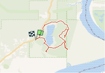
Trail Walking of 7.4 km to be discovered at British Columbia, Unknown, Coquitlam. This trail is proposed by Alizée.pee.

Description

Randonnée très jolie passant par un petit lac. Il y a des avertissements à la présence d'ours noirs, ainsi que de pumas. Néanmoins, les vues et la végétation sont splendides.

Elevation profile

Positioning

Country:
Canada
Region :
British Columbia
Department/Province :
Unknown
Municipality :
Coquitlam
Location:
Unknown
Start:(UTM)
521279 ; 5460855 (10U) N.

Trails nearby

Trail Walking Maple Ridge - Wikiloc - Golden Ears Provincial Park - Photo
Walking
GUIDE
Alizée.pee

Walking

Very difficult
Maple Ridge, British Columbia, Unknown, Canada
22 km | 41 km-effort
8h 12min
Yes
Trail Walking District of North Vancouver - Wikiloc - Mount Seymour Trail - Photo
Walking
GUIDE
Alizée.pee

Walking

Difficult
District of North Vancouver, British Columbia, Unknown, Canada
8 km | 15.1 km-effort
3h 1min
Yes
Trail Walking Anmore - Wikiloc - Buntzen Lake, Port Moody, BC - hike around lake - Photo
Walking
GUIDE
Alizée.pee

Walking

Difficult
Anmore, British Columbia, Unknown, Canada
9.7 km | 13.5 km-effort
2h 51min
No
Trail Walking Maple Ridge - Wikiloc - Golden Ears Provincial Park, East Canyon Trail - Photo
Walking
GUIDE
Alizée.pee

Walking

Difficult
Maple Ridge, British Columbia, Unknown, Canada
10.1 km | 13.8 km-effort
2h 55min
Yes


Close
My subscriptions