![](/images/other/stat-length.png)
![Trail Walking Notre-Dame-des-Bois - Wikiloc - Cantons-de-l’Est - Parc national du Mont-Mégantic - Sentier du Mont-Saint-Joseph - Rando-Québec - Photo](https://media.geolcdn.com/t/1900/400/ext.pjpeg?maxdim=2&url=https%3A%2F%2Fstatic1.geolcdn.com%2Fsiteimages%2Fupload%2Ffiles%2F1553511878bg_sport_marche.png)
Wikiloc - Cantons-de-l’Est - Parc national du Mont-Mégantic - Sentier du Mont-Saint-Joseph - Rando-Québec
Alizée.pee
User GUIDE
![Length](/images/other/stat-length.png)
Length
6.6 km
![Max alt](https://static1.geolcdn.com/siteimages/upload/files/1508320355ic_sort_altitude_max_24dp.png)
Max alt
1070 m
![Uphill gradient](https://static1.geolcdn.com/siteimages/upload/files/1508320355ic_sort_den_pos_24dp.png)
Uphill gradient
474 m
![Km-Effort](/images/other/stat-length.png)
Km-Effort
12.9 km
![Min alt](https://static1.geolcdn.com/siteimages/upload/files/1508320355ic_sort_altitude_min_24dp.png)
Min alt
591 m
![Downhill gradient](https://static1.geolcdn.com/siteimages/upload/files/1508320355ic_sort_den_neg_24dp.png)
Downhill gradient
473 m
![Boucle](https://static1.geolcdn.com/siteimages/upload/files/16400158638029165_repeat_loop_refresh_sync_direction_icon.png)
Boucle
Yes
Creation date :
2019-08-22 11:25:57.305
Updated on :
2019-08-22 11:28:49.341
![Walking](https://static1.geolcdn.com/sitytour/trail-icons/101.png)
2h34
Difficulty : Medium
![Scan this QR Code to open this trail in the SityTrail application](https://capi.geolives.com/qq0zvz2zws4bq2lad0pu/sitytour/trails/2179092/qr.png?size=200)
FREE GPS app for hiking
About
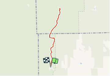
Trail Walking of 6.6 km to be discovered at Quebec, Le Granit, Notre-Dame-des-Bois. This trail is proposed by Alizée.pee.
Description
Randonnée très intéressante. Passage par une petite chapelle construite en 1935 de l'Oratoire du Mont Saint-Joseph. très joli ! Malgré la difficulté et les dénivelés, la randonnée est très agréable.
Positioning
Country:
Canada
Region :
Quebec
Department/Province :
Le Granit
Municipality :
Notre-Dame-des-Bois
Location:
Unknown
Start:(Dec)
Start:(UTM)
333766 ; 5032270 (19T) N.
Comments
Trails nearby
![Trail Walking Notre-Dame-des-Bois - 2014-07-06 16:25:48 - Photo](https://media.geolcdn.com/t/375/260/ext.jpg?maxdim=2&url=https%3A%2F%2Fstatic1.geolcdn.com%2Fsiteimages%2Fupload%2Ffiles%2F1553511878bg_sport_marche.png)
![Walking Walking](https://static1.geolcdn.com/sitytour/trail-icons/101.png)
2014-07-06 16:25:48
Walking
Very difficult
Notre-Dame-des-Bois,
Quebec,
Le Granit,
Canada
![](/images/other/stat-length.png)
16.5 km | 27 km-effort
7h 0min
![](https://static1.geolcdn.com/siteimages/upload/files/16400158638029165_repeat_loop_refresh_sync_direction_icon.png)
Yes
![Trail Walking Notre-Dame-des-Bois - Wikiloc - mont Saint-Joseph - Photo](https://media.geolcdn.com/t/375/260/ext.jpg?maxdim=2&url=https%3A%2F%2Fstatic1.geolcdn.com%2Fsiteimages%2Fupload%2Ffiles%2F1553511878bg_sport_marche.png)
![Walking Walking](https://static1.geolcdn.com/sitytour/trail-icons/101.png)
Wikiloc - mont Saint-Joseph
Walking
Difficult
Notre-Dame-des-Bois,
Quebec,
Le Granit,
Canada
![](/images/other/stat-length.png)
9.7 km | 16.3 km-effort
3h 19min
![](https://static1.geolcdn.com/siteimages/upload/files/16400158638029165_repeat_loop_refresh_sync_direction_icon.png)
Yes
![Trail Trail Notre-Dame-des-Bois - mont saint Joseph - Photo](https://media.geolcdn.com/t/375/260/ext.jpg?maxdim=2&url=https%3A%2F%2Fstatic1.geolcdn.com%2Fsiteimages%2Fupload%2Ffiles%2F1524743154running.jpg)
![Trail Trail](https://static1.geolcdn.com/sitytour/trail-icons/104.png)
mont saint Joseph
Trail
Difficult
Notre-Dame-des-Bois,
Quebec,
Le Granit,
Canada
![](/images/other/stat-length.png)
7.3 km | 13.4 km-effort
3h 23min
![](https://static1.geolcdn.com/siteimages/upload/files/16400158638029165_repeat_loop_refresh_sync_direction_icon.png)
Yes