Trail Walking Estérençuby - Mont Urkulu en boucle  - Photo
 pacha56
pacha56

User

© OpenStreetMap contributors
Length
Length
10.2 km
Max alt
Max alt
1413 m
Uphill gradient
Uphill gradient
510 m
Km-Effort
Km-Effort  
17 km
Min alt
Min alt
974 m
Downhill gradient
Downhill gradient
509 m
Boucle
Boucle
Yes
Creation date :
2019-08-15 09:33:56.923
Updated on :
2019-08-15 17:13:30.632

(0 Reviews)

Walking
Walking
5h15
Difficulty : Easy

Scan this QR Code to open this trail in the SityTrail application

FREE GPS app for hiking

Logo SityTrail SityTrail

IGN / Geographical institutes

Download SityTrail from the App Store Download SityTrail from Google Play

Logo SityTrail SityTrail World

The world is yours!

Download SityTrail from the App Store Download SityTrail from Google Play Download SityTrail on Huawei AppGallery

About

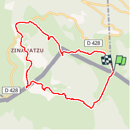
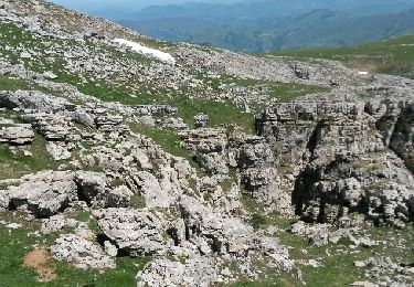
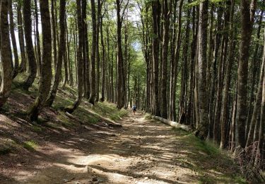
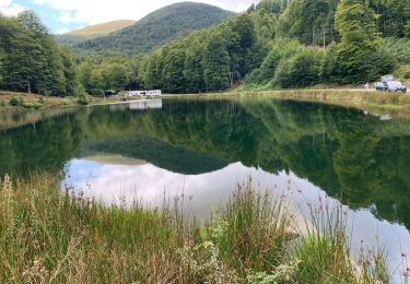
Trail Walking of 10.2 km to be discovered at New Aquitaine, Pyrénées-Atlantiques, Estérençuby. This trail is proposed by pacha56.

Description

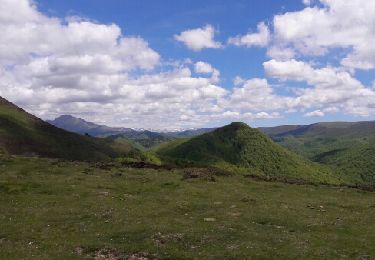
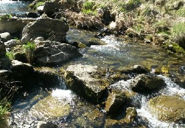
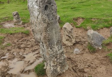
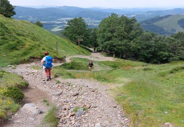
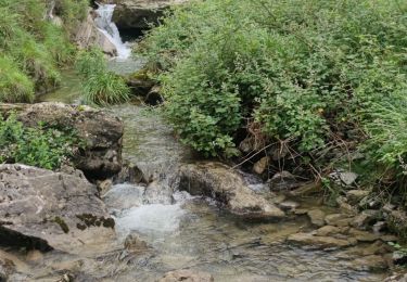
Montée vers le sommet où une tour-trophée a été érigée en 28 av. J.-C. par le proconsul Marcus Valerius Messalla Corvinus pour commémorer sa victoire sur les Tarbelles (peuple aquitain proto-basque) dans les Pyrénées et marquer la limite sud des nouveaux territoires conquis. Beaux paysages.. cromlechs au départ

Elevation profile

Positioning

Country:
France
Region :
New Aquitaine
Department/Province :
Pyrénées-Atlantiques
Municipality :
Estérençuby
Location:
Unknown
Start:(UTM)
645652 ; 4767867 (30T) N.

Trails nearby

Trail Walking Estérençuby - URCULU 2015 05 12 effectuée - Photo
Walking
DECHAMPD

Walking

Medium
(2)
Estérençuby, New Aquitaine, Pyrénées-Atlantiques, France
12.3 km | 19.6 km-effort
3h 46min
Yes
Trail Walking Estérençuby - GROTTE D'HARPEA - Photo
Walking
PVERTICAL

Walking

Medium
(1)
Estérençuby, New Aquitaine, Pyrénées-Atlantiques, France
12.1 km | 23 km-effort
4h 49min
Yes
Trail Walking Saint-Michel - compostelle - camino Frances J2 : de Orisson à Espinal - Photo
Walking
webmammuth

Walking

Medium
Saint-Michel, New Aquitaine, Pyrénées-Atlantiques, France
20 km | 28 km-effort
7h 30min
No
Trail Walking Estérençuby - GR 10 7ème étape : gîte de Kaskoleta - com d’Okabe - chalet Iraty - Photo
Walking
LEGUE

Walking

Difficult
Estérençuby, New Aquitaine, Pyrénées-Atlantiques, France
23 km | 41 km-effort
6h 27min
No
Trail Walking Estérençuby - Harpéa  - Photo
Walking
mickmimiver

Walking

Medium
Estérençuby, New Aquitaine, Pyrénées-Atlantiques, France
15.9 km | 29 km-effort
5h 52min
Yes
Trail Walking Estérençuby - source de la Nive et grotte Harpéa. - Photo
Walking
DECHAMPD

Walking

Very difficult
Estérençuby, New Aquitaine, Pyrénées-Atlantiques, France
12 km | 21 km-effort
4h 43min
Yes
Trail Walking Orbaizeta - Pyrénées 3 - Photo
Walking
guyzinz

Walking

Difficult
Orbaizeta, Navarre, Unknown, Spain
10.2 km | 16.8 km-effort
4h 58min
Yes
Trail Walking Arnéguy - 2023 01 ronceveaux - Photo
Walking
bernard.music

Walking

Difficult
Arnéguy, New Aquitaine, Pyrénées-Atlantiques, France
12.6 km | 18.6 km-effort
4h 21min
No
Trail Walking Estérençuby - Rando Nive Hapea - Photo
Walking
Fab-Oz

Walking

Medium
Estérençuby, New Aquitaine, Pyrénées-Atlantiques, France
12.2 km | 21 km-effort
3h 38min
Yes


Close
My subscriptions