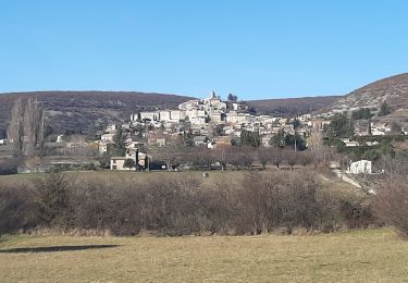
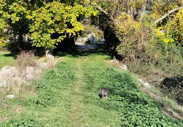
Trail Walking Banon - Le Largue 2 - Photo
 dsurin
dsurin

User

© OpenStreetMap contributors
Length
Length
8.2 km
Max alt
Max alt
874 m
Uphill gradient
Uphill gradient
224 m
Km-Effort
Km-Effort  
11.2 km
Min alt
Min alt
660 m
Downhill gradient
Downhill gradient
225 m
Boucle
Boucle
Yes
Creation date :
2019-08-14 13:15:44.0
Updated on :
2019-08-14 15:33:10.625

(1 Reviews)

Walking
Walking
2h14
Difficulty : Difficult

Scan this QR Code to open this trail in the SityTrail application

FREE GPS app for hiking

Logo SityTrail SityTrail

IGN / Geographical institutes

Download SityTrail from the App Store Download SityTrail from Google Play

Logo SityTrail SityTrail World

The world is yours!

Download SityTrail from the App Store Download SityTrail from Google Play Download SityTrail on Huawei AppGallery

About

Trail Walking of 8.2 km to be discovered at Provence-Alpes-Côte d'Azur, Alpes-de-Haute-Provence, Banon. This trail is proposed by dsurin.

Elevation profile

Photos

Positioning

Country:
France
Region :
Provence-Alpes-Côte d'Azur
Department/Province :
Alpes-de-Haute-Provence
Municipality :
Banon
Location:
Unknown
Start:(UTM)
714721 ; 4878028 (31T) N.

Comments

Please log in to post a review or rate the element


Belle rando. Attention pas de balisage et de multiples chemins qui se croisent. Belle vue sur le village de Banon


Trails nearby

Trail Walking Lardiers - lardiers.le jas du grand chêne  - Photo
Walking
Roger

Walking

Medium
Lardiers, Provence-Alpes-Côte d'Azur, Alpes-de-Haute-Provence, France
9.1 km | 13.6 km-effort
3h 30min
Yes
Trail Walking Ongles - Le r0 h - Photo
Walking
Roger

Walking

Medium
Ongles, Provence-Alpes-Côte d'Azur, Alpes-de-Haute-Provence, France
10 km | 13.3 km-effort
4h 27min
Yes
Trail Walking Ongles - Le rocher d ongles. lardiers par le collet de champon  - Photo
Walking
Roger

Walking

Medium
Ongles, Provence-Alpes-Côte d'Azur, Alpes-de-Haute-Provence, France
7.8 km | 10.3 km-effort
2h 36min
Yes
Trail Walking Banon - Le plan du largue. la chapelle  Saint Michel  - Photo
Walking
Roger

Walking

Medium
Banon, Provence-Alpes-Côte d'Azur, Alpes-de-Haute-Provence, France
15.8 km | 21 km-effort
5h 4min
Yes
Trail Walking Banon - BANON Les Chastellas . Aven de Courtin . Hameau  ruiné  des Plaines n - Photo
Walking
GUIDE
RobinMicheline

Walking

Easy
Banon, Provence-Alpes-Côte d'Azur, Alpes-de-Haute-Provence, France
12.4 km | 17.3 km-effort
3h 33min
Yes
Trail Walking Ongles - ONGLES Sentier de Seignes Lardiers Ongles o n  - Photo
Walking
GUIDE
RobinMicheline

Walking

Medium
Ongles, Provence-Alpes-Côte d'Azur, Alpes-de-Haute-Provence, France
17.6 km | 22 km-effort
4h 6min
Yes
Trail Walking Vachères - Le revest des brousses .val Marie  - Photo
Walking
Roger

Walking

Easy
Vachères, Provence-Alpes-Côte d'Azur, Alpes-de-Haute-Provence, France
7.1 km | 9 km-effort
2h 46min
Yes
Trail Walking Ongles - ONGLES  CASTELARD DE LARDIER7 - Photo
Walking
Claude Caméléon

Walking

Medium
Ongles, Provence-Alpes-Côte d'Azur, Alpes-de-Haute-Provence, France
15.1 km | 21 km-effort
7h 10min
Yes
Trail Walking Limans - Limans les pigeonniers - Photo
Walking
PITOUSSAINT

Walking

Easy
Limans, Provence-Alpes-Côte d'Azur, Alpes-de-Haute-Provence, France
8.2 km | 12.3 km-effort
5h 15min
Yes


Close
My subscriptions