13.2 km | 14.5 km-effort
Crouy-Blaincourt
Djaie60
User
Length
9.5 km
Max alt
126 m
Uphill gradient
156 m
Km-Effort
11.6 km
Min alt
44 m
Downhill gradient
156 m
Boucle
Yes
Creation date :
2019-08-12 17:21:38.238
Updated on :
2019-08-12 17:22:29.753
2h31
Difficulty : Medium
FREE GPS app for hiking
About
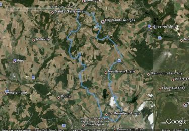
Trail Walking of 9.5 km to be discovered at Hauts-de-France, Oise, Crouy-en-Thelle. This trail is proposed by Djaie60.
Positioning
Country:
France
Region :
Hauts-de-France
Department/Province :
Oise
Municipality :
Crouy-en-Thelle
Location:
Unknown
Start:(Dec)
Start:(UTM)
450545 ; 5451423 (31U) N.
Comments
Trails nearby
randonnée abbaye de Royaumont
Walking
Difficult
(1)
Boran-sur-Oise,
Hauts-de-France,
Oise,
France
3h 8min
Yes
La Vallée de Noé - Neuilly-en-Thelle
Walking
Difficult
(1)
Neuilly-en-Thelle,
Hauts-de-France,
Oise,
France
13.5 km | 16.1 km-effort
3h 30min
Yes
La Vallée de Noé - Neuilly en Thelle
Walking
Medium
(1)
Neuilly-en-Thelle,
Hauts-de-France,
Oise,
France
13.5 km | 16.1 km-effort
3h 30min
Yes
randonnée de precy au bois st Michel
Walking
Medium
Précy-sur-Oise,
Hauts-de-France,
Oise,
France
11.6 km | 14.2 km-effort
2h 47min
Yes
les maisons troglodytes
Walking
Medium
Précy-sur-Oise,
Hauts-de-France,
Oise,
France
11.6 km | 13.2 km-effort
2h 33min
Yes
Mesnil 20190914
Walking
Very easy
Le Mesnil-en-Thelle,
Hauts-de-France,
Oise,
France
14.7 km | 16.3 km-effort
2h 46min
No
Mesnilloise 2012
Mountain bike
Difficult
Le Mesnil-en-Thelle,
Hauts-de-France,
Oise,
France
53 km | 62 km-effort
3h 0min
Yes
La Mesniloise 2009
Mountain bike
Difficult
Le Mesnil-en-Thelle,
Hauts-de-France,
Oise,
France
44 km | 53 km-effort
2h 30min
Yes
Mesnil en Thelle, Morangles, Fresnoy en Thelle et retour.(parcours de la rand...
On foot
Easy
Le Mesnil-en-Thelle,
Hauts-de-France,
Oise,
France
14.5 km | 16 km-effort
3h 38min
Yes
très sympa, j'ai adoré la 2e partie avec le passage en forêt.