


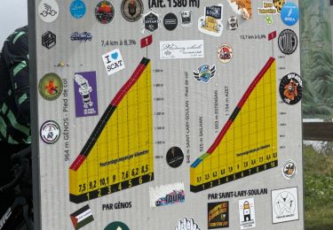
9.9 km | 18.4 km-effort


User


FREE GPS app for hiking
 SityTrail
IGN / Geographical institutes
SityTrail World
The world is yours!
Trail Walking of 11.4 km to be discovered at Occitania, Hautespyrenees, Cazaux-Fréchet-Anéran-Camors. This trail is proposed by Alokteff.
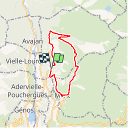
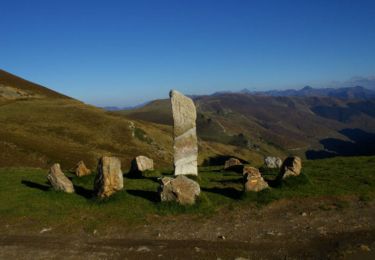
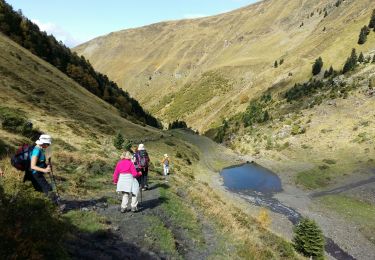
circuit en boucle de 12 km avec 650 m de dénivelée positive. Beaux points de vue sur la vallée du Louron. Passage par des petits villages typiques.

Walking

Walking
Walking

Walking

Walking
Walking

Snowshoes
Walking
Walking