Trail Walking Saint-Mesmin - boucle de l'étang et de la forge - Photo

boucle de l'étang et de la forge

 sebcar
sebcar

User

© OpenStreetMap contributors
Length
Length
12.7 km
Max alt
Max alt
350 m
Uphill gradient
Uphill gradient
278 m
Km-Effort
Km-Effort  
16.4 km
Min alt
Min alt
253 m
Downhill gradient
Downhill gradient
278 m
Boucle
Boucle
Yes
Creation date :
2019-08-07 14:05:00.269
Updated on :
2019-08-24 13:03:41.557

(0 Reviews)

Walking
Walking
3h08
Difficulty : Very easy

Scan this QR Code to open this trail in the SityTrail application

FREE GPS app for hiking

Logo SityTrail SityTrail

IGN / Geographical institutes

Download SityTrail from the App Store Download SityTrail from Google Play

Logo SityTrail SityTrail World

The world is yours!

Download SityTrail from the App Store Download SityTrail from Google Play Download SityTrail on Huawei AppGallery

About

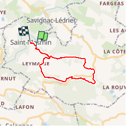
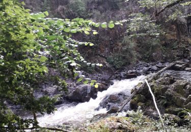
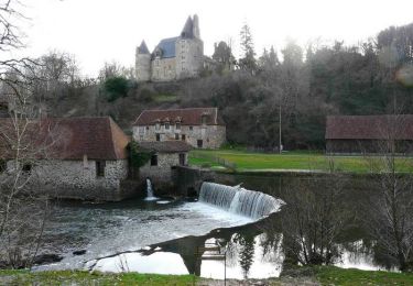
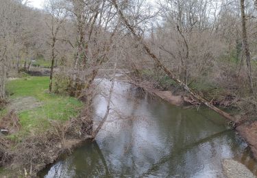
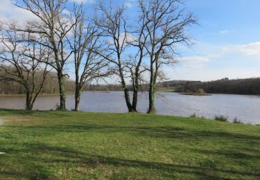
Trail Walking of 12.7 km to be discovered at New Aquitaine, Dordogne, Saint-Mesmin. This trail is proposed by sebcar.

Description

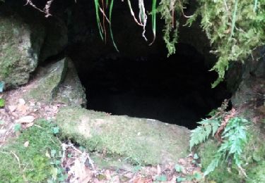
Chemin à la limite du Périgord noir. Balisage correct.

Elevation profile

Positioning

Country:
France
Region :
New Aquitaine
Department/Province :
Dordogne
Municipality :
Saint-Mesmin
Location:
Unknown
Start:(UTM)
359430 ; 5023695 (31T) N.

Trails nearby

Trail Walking Saint-Mesmin - DORDOGNE / SAINT MESMIN: L' AUVEZERE - Photo
Walking
djeepee74

Walking

Easy
Saint-Mesmin, New Aquitaine, Dordogne, France
3.2 km | 5.3 km-effort
1h 12min
Yes
Trail On foot Saint-Mesmin - Boucle du Gabourat - Photo
On foot
GUIDE+

On foot

Easy
(1)
Saint-Mesmin, New Aquitaine, Dordogne, France
6.3 km | 9.5 km-effort
2h 9min
Yes
Trail Walking Saint-Mesmin - St Mesmin - Photo
Walking
NICOLEROBERT

Walking

Difficult
(1)
Saint-Mesmin, New Aquitaine, Dordogne, France
12.8 km | 16.8 km-effort
4h 9min
Yes
Trail Mountain bike Savignac-Lédrier - Sentier Les Bruyères du Puy des Ages à Savignac-Lédrier - Photo
Mountain bike
tracegps

Mountain bike

Easy
Savignac-Lédrier, New Aquitaine, Dordogne, France
9.6 km | 12.3 km-effort
1h 15min
Yes
Trail Walking Savignac-Lédrier - Sentier Les Bruyères du Puy des Ages à Savignac-Lédrier - Photo
Walking
tracegps

Walking

Medium
(1)
Savignac-Lédrier, New Aquitaine, Dordogne, France
9.6 km | 12.3 km-effort
2h 25min
Yes
Trail Walking Génis - Rand'Auvezere - Photo
Walking
NICOLEROBERT

Walking

Difficult
Génis, New Aquitaine, Dordogne, France
11.4 km | 15.9 km-effort
3h 8min
Yes
Trail Walking Anlhiac - dudule - Photo
Walking
bidnick

Walking

Very easy
Anlhiac, New Aquitaine, Dordogne, France
5.7 km | 7.4 km-effort
1h 5min
No
Trail Walking Salagnac - boucle saint martin - Photo
Walking
fab0202

Walking

Easy
Salagnac, New Aquitaine, Dordogne, France
12.2 km | 14.9 km-effort
3h 38min
Yes
Trail Walking Salagnac - Salagnac- Boucle de Saint-Martin - Photo
Walking
houbart

Walking

Medium
Salagnac, New Aquitaine, Dordogne, France
8.6 km | 11 km-effort
2h 24min
Yes


Close
My subscriptions