![](/images/other/stat-length.png)
![Trail Walking Valorbiquet - St Cyr du Ronceray - Fervaques - Cheffreville - Photo](https://media.geolcdn.com/t/1900/400/b2a30246-deda-4617-80f3-3ad642a52eb6.jpg&format=pjpeg&maxdim=2)
St Cyr du Ronceray - Fervaques - Cheffreville
Eve - Line
User
![Length](/images/other/stat-length.png)
Length
21 km
![Max alt](https://static1.geolcdn.com/siteimages/upload/files/1508320355ic_sort_altitude_max_24dp.png)
Max alt
186 m
![Uphill gradient](https://static1.geolcdn.com/siteimages/upload/files/1508320355ic_sort_den_pos_24dp.png)
Uphill gradient
287 m
![Km-Effort](/images/other/stat-length.png)
Km-Effort
25 km
![Min alt](https://static1.geolcdn.com/siteimages/upload/files/1508320355ic_sort_altitude_min_24dp.png)
Min alt
82 m
![Downhill gradient](https://static1.geolcdn.com/siteimages/upload/files/1508320355ic_sort_den_neg_24dp.png)
Downhill gradient
288 m
![Boucle](https://static1.geolcdn.com/siteimages/upload/files/16400158638029165_repeat_loop_refresh_sync_direction_icon.png)
Boucle
Yes
Creation date :
2019-08-05 05:13:27.302
Updated on :
2019-08-05 09:35:15.659
![Walking](https://static1.geolcdn.com/sitytour/trail-icons/101.png)
4h20
Difficulty : Medium
![Scan this QR Code to open this trail in the SityTrail application](https://capi.geolives.com/qq0zvz2zws4bq2lad0pu/sitytour/trails/2160672/qr.png?size=200)
FREE GPS app for hiking
About
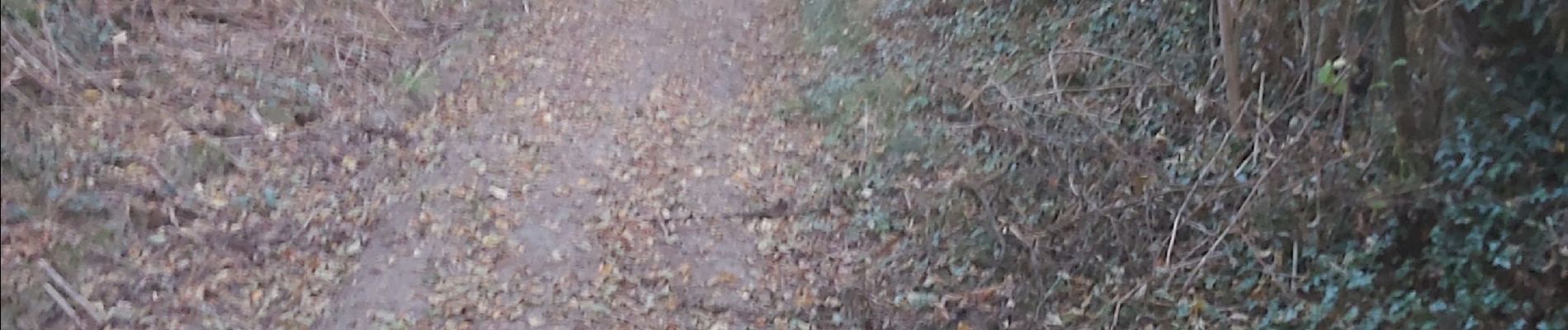
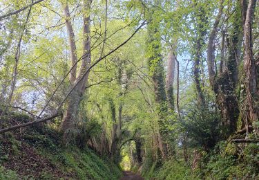
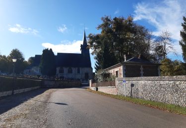
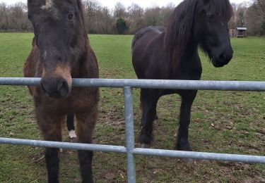
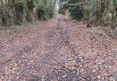
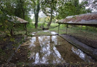
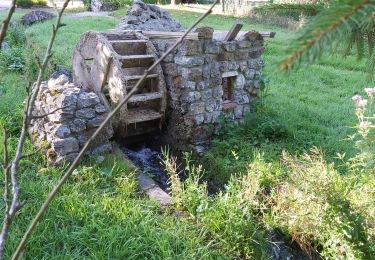
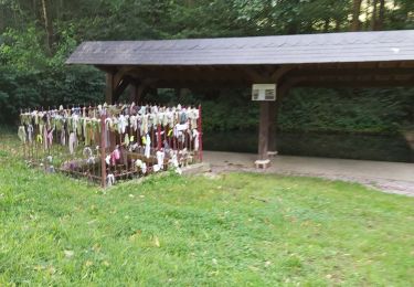
Trail Walking of 21 km to be discovered at Normandy, Calvados, Valorbiquet. This trail is proposed by Eve - Line.
Description
Départ Place des Canadiens St Cyr du Ronceray. Vous pouvez partir du parking de l'église de Cheffreville, suivre le balisage de randonnée bleu pour une boucle de 8 km environ. Bonne ballade.
Positioning
Country:
France
Region :
Normandy
Department/Province :
Calvados
Municipality :
Valorbiquet
Location:
Saint-Cyr-du-Ronceray
Start:(Dec)
Start:(UTM)
302497 ; 5436974 (31U) N.
Comments
Trails nearby
![Trail Walking Livarot-Pays-d'Auge - De Fervaques à Cheffreville-Tonnencourt - Photo](https://media.geolcdn.com/t/375/260/ext.jpg?maxdim=2&url=https%3A%2F%2Fservices.sitytrail.com%2FGeolivesWS%2FDownloadMedia.ashx%3FTrailID%3D317398%26Media%3D16619_6.jpg)
![Walking Walking](https://static1.geolcdn.com/sitytour/trail-icons/101.png)
De Fervaques à Cheffreville-Tonnencourt
Walking
Difficult
(1)
Livarot-Pays-d'Auge,
Normandy,
Calvados,
France
![](/images/other/stat-length.png)
13.6 km | 16.7 km-effort
3h 10min
![](https://static1.geolcdn.com/siteimages/upload/files/16400158638029165_repeat_loop_refresh_sync_direction_icon.png)
Yes
![Trail Walking Valorbiquet - St Cyr du Ronceray/Pretreville - Photo](https://media.geolcdn.com/t/375/260/0fab71f0-97b5-47db-8b23-7205198b2cdb.jpg&format=jpg&maxdim=2)
![Walking Walking](https://static1.geolcdn.com/sitytour/trail-icons/101.png)
St Cyr du Ronceray/Pretreville
Walking
Medium
Valorbiquet,
Normandy,
Calvados,
France
![](/images/other/stat-length.png)
15.2 km | 18 km-effort
3h 16min
![](https://static1.geolcdn.com/siteimages/upload/files/16400158638029165_repeat_loop_refresh_sync_direction_icon.png)
Yes
![Trail Walking Saint-Martin-de-Bienfaite-la-Cressonnière - saint Martin de bienfaite la cressonnière - Photo](https://media.geolcdn.com/t/375/260/dc2e5291-effa-4a8a-9672-fcdf7b22cd6e.jpg&format=jpg&maxdim=2)
![Walking Walking](https://static1.geolcdn.com/sitytour/trail-icons/101.png)
saint Martin de bienfaite la cressonnière
Walking
Medium
Saint-Martin-de-Bienfaite-la-Cressonnière,
Normandy,
Calvados,
France
![](/images/other/stat-length.png)
9.6 km | 12.2 km-effort
2h 52min
![](https://static1.geolcdn.com/siteimages/upload/files/16400158638029165_repeat_loop_refresh_sync_direction_icon.png)
Yes
![Trail Walking Valorbiquet - St Cyr du Ronceray - Photo](https://media.geolcdn.com/t/375/260/8c813de1-aef1-486a-973a-2ec950c5b0f1.jpg&format=jpg&maxdim=2)
![Walking Walking](https://static1.geolcdn.com/sitytour/trail-icons/101.png)
St Cyr du Ronceray
Walking
Medium
Valorbiquet,
Normandy,
Calvados,
France
![](/images/other/stat-length.png)
15.2 km | 19.5 km-effort
3h 53min
![](https://static1.geolcdn.com/siteimages/upload/files/16400158638029165_repeat_loop_refresh_sync_direction_icon.png)
Yes
![Trail Walking Livarot-Pays-d'Auge - Fervaques - Photo](https://media.geolcdn.com/t/375/260/b94b2acf-3064-4221-a39a-84ea585f6cce.jpg&format=jpg&maxdim=2)
![Walking Walking](https://static1.geolcdn.com/sitytour/trail-icons/101.png)
Fervaques
Walking
Medium
(1)
Livarot-Pays-d'Auge,
Normandy,
Calvados,
France
![](/images/other/stat-length.png)
13.1 km | 16.1 km-effort
2h 43min
![](https://static1.geolcdn.com/siteimages/upload/files/16400158638029165_repeat_loop_refresh_sync_direction_icon.png)
Yes
![Trail Walking Valorbiquet - St Cyr du Ronceray-Tordouet-St Martin de Bienfaite-Cernay - Photo](https://media.geolcdn.com/t/375/260/503a0cb7-5433-4f6c-a6ee-d3786b5228fc.jpg&format=jpg&maxdim=2)
![Walking Walking](https://static1.geolcdn.com/sitytour/trail-icons/101.png)
St Cyr du Ronceray-Tordouet-St Martin de Bienfaite-Cernay
Walking
Medium
Valorbiquet,
Normandy,
Calvados,
France
![](/images/other/stat-length.png)
17.9 km | 22 km-effort
3h 57min
![](https://static1.geolcdn.com/siteimages/upload/files/16400158638029165_repeat_loop_refresh_sync_direction_icon.png)
Yes
![Trail Walking Valorbiquet - St Cyr du Ronceray - Photo](https://media.geolcdn.com/t/375/260/05bb0fe6-a66f-4cad-8014-1d41b3e61cec.jpg&format=jpg&maxdim=2)
![Walking Walking](https://static1.geolcdn.com/sitytour/trail-icons/101.png)
St Cyr du Ronceray
Walking
Medium
Valorbiquet,
Normandy,
Calvados,
France
![](/images/other/stat-length.png)
16 km | 18.7 km-effort
3h 5min
![](https://static1.geolcdn.com/siteimages/upload/files/16400158638029165_repeat_loop_refresh_sync_direction_icon.png)
Yes
![Trail Walking Valorbiquet - st Cyr du Ronceray - Photo](https://media.geolcdn.com/t/375/260/ac57d32e-b68f-4283-8245-e86b4fa8e5cc.jpg&format=jpg&maxdim=2)
![Walking Walking](https://static1.geolcdn.com/sitytour/trail-icons/101.png)
st Cyr du Ronceray
Walking
Very easy
Valorbiquet,
Normandy,
Calvados,
France
![](/images/other/stat-length.png)
14.2 km | 16.2 km-effort
3h 2min
![](https://static1.geolcdn.com/siteimages/upload/files/16400158638029165_repeat_loop_refresh_sync_direction_icon.png)
Yes
![Trail Walking Livarot-Pays-d'Auge - La Croupte - Photo](https://media.geolcdn.com/t/375/260/0d44cd34-3305-4d81-8959-36dd7671e177.jpg&format=jpg&maxdim=2)
![Walking Walking](https://static1.geolcdn.com/sitytour/trail-icons/101.png)
La Croupte
Walking
Medium
Livarot-Pays-d'Auge,
Normandy,
Calvados,
France
![](/images/other/stat-length.png)
18.4 km | 21 km-effort
2h 52min
![](https://static1.geolcdn.com/siteimages/upload/files/16400158638029165_repeat_loop_refresh_sync_direction_icon.png)
No