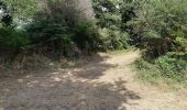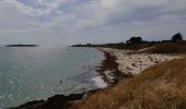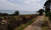

Kerascoët- Plage de Tahiti-Raguenez

walrou63
User

Length
3.8 km

Max alt
39 m

Uphill gradient
37 m

Km-Effort
4.3 km

Min alt
5 m

Downhill gradient
36 m
Boucle
Yes
Creation date :
2019-08-01 14:04:13.967
Updated on :
2021-06-13 10:21:43.899
2h34
Difficulty : Very easy

FREE GPS app for hiking
About
Trail Walking of 3.8 km to be discovered at Brittany, Finistère, Névez. This trail is proposed by walrou63.
Description
Petite marche au départ du camping des Chaumieres et retour par la chapelle de Tremorvezen et halte à l'Île Verte pour prier de rafraîchissantes bières bretonnes.
Positioning
Country:
France
Region :
Brittany
Department/Province :
Finistère
Municipality :
Névez
Location:
Unknown
Start:(Dec)
Start:(UTM)
441976 ; 5294034 (30T) N.
Comments
Trails nearby

Samedi 4 novembre 2012


Walking
Very easy
(1)
Névez,
Brittany,
Finistère,
France

6.6 km | 7.2 km-effort
1h 16min
Yes

Randonnee de Trévignon - Trégunc


Walking
Easy
(2)
Trégunc,
Brittany,
Finistère,
France

6.7 km | 7.3 km-effort
1h 45min
Yes

Saint Philibert-Trévignon plage


Walking
Medium
Trégunc,
Brittany,
Finistère,
France

7.1 km | 7.7 km-effort
1h 55min
Yes
MOËLAN sur MER


Walking
Medium
Moëlan-sur-Mer,
Brittany,
Finistère,
France

22 km | 26 km-effort
5h 15min
Yes
Port Menech 16 juin 19


Walking
Medium
Névez,
Brittany,
Finistère,
France

17.6 km | 20 km-effort
6h 40min
Yes

Rospico, Trémorvézen, Kercvaillet, Plage Tahiti et retour par bord de mer


Walking
Very easy
(1)
Névez,
Brittany,
Finistère,
France

7 km | 7.8 km-effort
2h 0min
Yes
Raguenez - Kercanic - Kerascoet


Walking
Difficult
Névez,
Brittany,
Finistère,
France

13.2 km | 14.9 km-effort
3h 30min
Yes


 SityTrail


