![](/images/other/stat-length.png)
![Trail Walking Aulon - L''Arbizon - Aulon - Photo](https://media.geolcdn.com/t/1900/400/ext.pjpeg?maxdim=2&url=https%3A%2F%2Fservices.sitytrail.com%2FGeolivesWS%2FDownloadMedia.ashx%3FTrailID%3D215294%26Media%3D15811_6.jpg)
L''Arbizon - Aulon
tracegps
User
![Length](/images/other/stat-length.png)
![Max alt](https://static1.geolcdn.com/siteimages/upload/files/1508320355ic_sort_altitude_max_24dp.png)
![Uphill gradient](https://static1.geolcdn.com/siteimages/upload/files/1508320355ic_sort_den_pos_24dp.png)
![Km-Effort](/images/other/stat-length.png)
![Min alt](https://static1.geolcdn.com/siteimages/upload/files/1508320355ic_sort_altitude_min_24dp.png)
![Downhill gradient](https://static1.geolcdn.com/siteimages/upload/files/1508320355ic_sort_den_neg_24dp.png)
![Boucle](https://static1.geolcdn.com/siteimages/upload/files/16400158638029165_repeat_loop_refresh_sync_direction_icon.png)
![Walking](https://static1.geolcdn.com/sitytour/trail-icons/101.png)
7h00
Difficulty : Very difficult
![Scan this QR Code to open this trail in the SityTrail application](https://capi.geolives.com/qq0zvz2zws4bq2lad0pu/sitytour/trails/215294/qr.png?size=200)
FREE GPS app for hiking
About
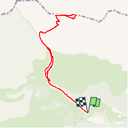
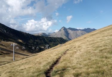
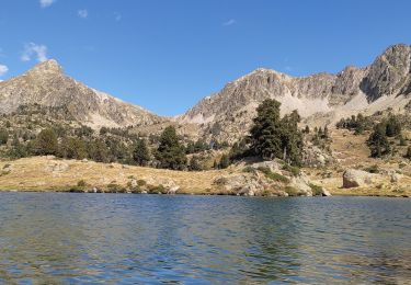
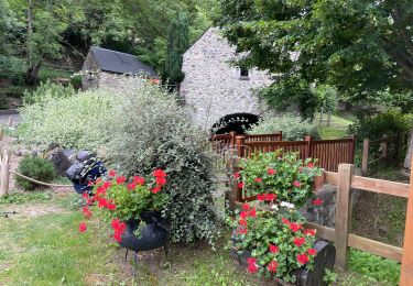
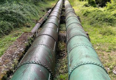
Trail Walking of 10.1 km to be discovered at Occitania, Hautespyrenees, Aulon. This trail is proposed by tracegps.
Description
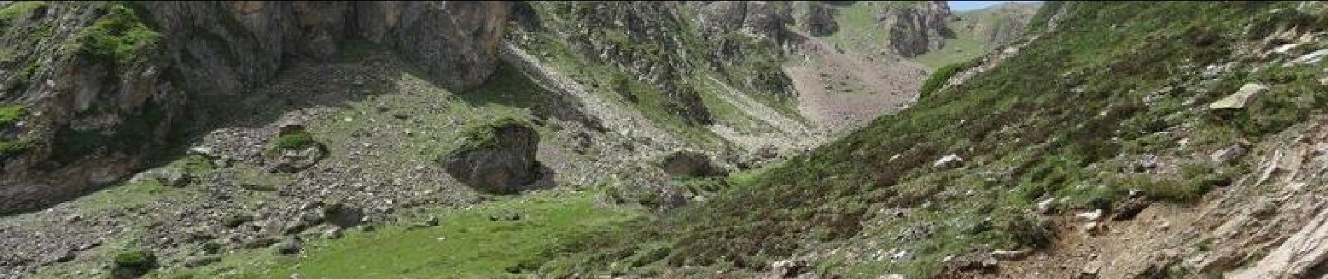
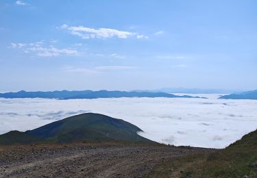
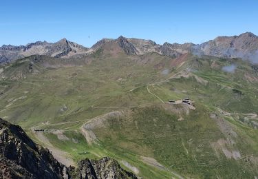
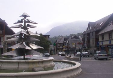
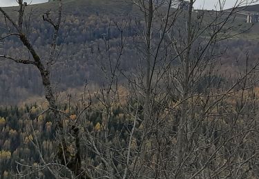
Départ des granges de Lurgues au-dessus d'Aulon en Vallée d'Aure. Le sentier à suivre n'est pas balisé mais de nombreux cairns le jalonnent. Deux cheminées à passer où pour la première il faut s'aider des mains. Après, un immense pierrier conduit à la brèche d'Aurey. De là suivre en contrebas la crête pour aboutir au sommet à 2831 m. Immense panorama à 360°.
Positioning
Comments
Trails nearby
![Trail Walking Saint-Lary-Soulan - 2011-08-03 15h51m06 - Photo](https://media.geolcdn.com/t/375/260/ext.jpg?maxdim=2&url=https%3A%2F%2Fservices.sitytrail.com%2FGeolivesWS%2FDownloadMedia.ashx%3FTrailID%3D70666%26Media%3D20110803154635.jpeg)
![Walking Walking](https://static1.geolcdn.com/sitytour/trail-icons/101.png)
Walking
![](/images/other/stat-length.png)
![](https://static1.geolcdn.com/siteimages/upload/files/16400158638029165_repeat_loop_refresh_sync_direction_icon.png)
![Trail Walking Saint-Lary-Soulan - refuge de bastan et lacs - Photo](https://media.geolcdn.com/t/375/260/39cee356-b9bc-4599-b9dd-36b8ef943f1a.jpg&format=jpg&maxdim=2)
![Walking Walking](https://static1.geolcdn.com/sitytour/trail-icons/101.png)
Walking
![](/images/other/stat-length.png)
![](https://static1.geolcdn.com/siteimages/upload/files/16400158638029165_repeat_loop_refresh_sync_direction_icon.png)
![Trail Walking Saint-Lary-Soulan - Pène-Male par les crêtes de Heche-Barrade - Photo](https://media.geolcdn.com/t/375/260/de632eea-ef64-4a92-92e4-bd24316e8942.jpg&format=jpg&maxdim=2)
![Walking Walking](https://static1.geolcdn.com/sitytour/trail-icons/101.png)
Walking
![](/images/other/stat-length.png)
![](https://static1.geolcdn.com/siteimages/upload/files/16400158638029165_repeat_loop_refresh_sync_direction_icon.png)
![Trail Walking Saint-Lary-Soulan - 2023-09-11 Col du Portet - Lac de l'Oule - Refuge de Bastan - Photo](https://media.geolcdn.com/t/375/260/063df153-8983-4dce-b8b6-891d73f87363.jpg&format=jpg&maxdim=2)
![Walking Walking](https://static1.geolcdn.com/sitytour/trail-icons/101.png)
Walking
![](/images/other/stat-length.png)
![](https://static1.geolcdn.com/siteimages/upload/files/16400158638029165_repeat_loop_refresh_sync_direction_icon.png)
![Trail Walking Saint-Lary-Soulan - Col Portet➡️ lac Bastan - Photo](https://media.geolcdn.com/t/375/260/8dd696dc-0c4b-408a-989a-cb4edb7898d5.jpg&format=jpg&maxdim=2)
![Walking Walking](https://static1.geolcdn.com/sitytour/trail-icons/101.png)
Walking
![](/images/other/stat-length.png)
![](https://static1.geolcdn.com/siteimages/upload/files/16400158638029165_repeat_loop_refresh_sync_direction_icon.png)
![Trail Walking Saint-Lary-Soulan - AZET : Pla d’Ourtigué en boucle - Photo](https://media.geolcdn.com/t/375/260/61d95884-b483-4a11-b2a1-350e3c3e812e.jpg&format=jpg&maxdim=2)
![Walking Walking](https://static1.geolcdn.com/sitytour/trail-icons/101.png)
Walking
![](/images/other/stat-length.png)
![](https://static1.geolcdn.com/siteimages/upload/files/16400158638029165_repeat_loop_refresh_sync_direction_icon.png)
![Trail Walking Saint-Lary-Soulan - Vieille Aure-Trachère - Photo](https://media.geolcdn.com/t/375/260/939f9075-2a66-47f6-ada4-2a25ac95fa43.jpg&format=jpg&maxdim=2)
![Walking Walking](https://static1.geolcdn.com/sitytour/trail-icons/101.png)
Walking
![](/images/other/stat-length.png)
![](https://static1.geolcdn.com/siteimages/upload/files/16400158638029165_repeat_loop_refresh_sync_direction_icon.png)
![Trail On foot Saint-Lary-Soulan - Boucle de Caneilles - Photo](https://media.geolcdn.com/t/375/260/0b78c8a6-531b-4e32-888c-f6bec383597c.jpeg&format=jpg&maxdim=2)
![On foot On foot](https://static1.geolcdn.com/sitytour/trail-icons/100.png)
On foot
![](/images/other/stat-length.png)
![](https://static1.geolcdn.com/siteimages/upload/files/16400158638029165_repeat_loop_refresh_sync_direction_icon.png)
![Trail Walking Saint-Lary-Soulan - Soulan - les granges de Lias - Soulan - Photo](https://media.geolcdn.com/t/375/260/3bbe5244-bcfa-48ac-8df8-d0cf387d682b.jpg&format=jpg&maxdim=2)
![Walking Walking](https://static1.geolcdn.com/sitytour/trail-icons/101.png)
Walking
![](/images/other/stat-length.png)
![](https://static1.geolcdn.com/siteimages/upload/files/16400158638029165_repeat_loop_refresh_sync_direction_icon.png)