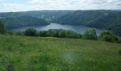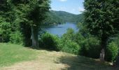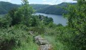

Balade à la presqu''ile de Laussac - Thérondels

tracegps
User

Length
17.1 km

Max alt
954 m

Uphill gradient
506 m

Km-Effort
24 km

Min alt
640 m

Downhill gradient
506 m
Boucle
Yes
Creation date :
2014-12-10 00:00:00.0
Updated on :
2014-12-10 00:00:00.0
6h00
Difficulty : Difficult

FREE GPS app for hiking
About
Trail Walking of 17.1 km to be discovered at Occitania, Aveyron, Thérondels. This trail is proposed by tracegps.
Description
Balade aveyronnaise depuis le village de Thérondels à la limite du Cantal. Un itinéraire varié au soleil et ombragé. Pique-nique à la presqu'ile de Laussac au bord de la retenue du barrage de Sarrans.
Positioning
Country:
France
Region :
Occitania
Department/Province :
Aveyron
Municipality :
Thérondels
Location:
Unknown
Start:(Dec)
Start:(UTM)
480901 ; 4971429 (31T) N.
Comments
Trails nearby

Thérondels,Nigresserre


Walking
Easy
(1)
Thérondels,
Occitania,
Aveyron,
France

12.7 km | 14.8 km-effort
3h 14min
No

puy de Bane


Walking
Difficult
Lacapelle-Barrès,
Auvergne-Rhône-Alpes,
Cantal,
France

19.2 km | 26 km-effort
4h 3min
Yes

Therondels


Walking
Medium
Thérondels,
Occitania,
Aveyron,
France

15.9 km | 22 km-effort
3h 14min
Yes

Therondels à Pierrefort


Other activity
Medium
Thérondels,
Occitania,
Aveyron,
France

12.3 km | 17.6 km-effort
4h 21min
No

tersons 13b


Walking
Very easy
Paulhenc,
Auvergne-Rhône-Alpes,
Cantal,
France

11.4 km | 13.7 km-effort
3h 9min
No

THÉRONDELS _ et le paysan créa la prairie 2)


Walking
Very easy
(1)
Thérondels,
Occitania,
Aveyron,
France

4.1 km | 4.8 km-effort
1h 30min
Yes

la garde-estradié


Walking
Easy
Paulhenc,
Auvergne-Rhône-Alpes,
Cantal,
France

2.8 km | 3.6 km-effort
59min
No

Sentier imaginaire court Therondels


Walking
Easy
Thérondels,
Occitania,
Aveyron,
France

3.6 km | 3.9 km-effort
1h 11min
Yes

Vines les berges du lac de Sarrans


Walking
Difficult
(1)
Cantoin,
Occitania,
Aveyron,
France

11.2 km | 16.4 km-effort
3h 43min
Yes


 SityTrail


Jolie rando. Mise en jambes au départ, longue montée progressive à la fin. Pique nique ou restauration sur place à la presqu’île et baignade possible.