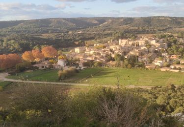
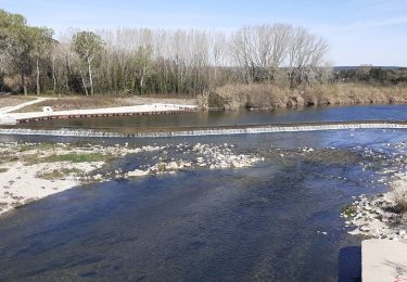
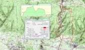
Trail Walking Saint-Hilaire-d'Ozilhan - Forêt de Vallongue - Saint Hilaire d''Ozilhan - Photo

Forêt de Vallongue - Saint Hilaire d''Ozilhan

 tracegps
tracegps

User

© OpenStreetMap contributors
Length
Length
11.8 km
Max alt
Max alt
200 m
Uphill gradient
Uphill gradient
223 m
Km-Effort
Km-Effort  
14.7 km
Min alt
Min alt
58 m
Downhill gradient
Downhill gradient
223 m
Boucle
Boucle
Yes
Creation date :
2014-12-10 00:00:00.0
Updated on :
2014-12-10 00:00:00.0

(0 Reviews)

Walking
Walking
3h30
Difficulty : Medium

Scan this QR Code to open this trail in the SityTrail application

FREE GPS app for hiking

Logo SityTrail SityTrail

IGN / Geographical institutes

Download SityTrail from the App Store Download SityTrail from Google Play

Logo SityTrail SityTrail World

The world is yours!

Download SityTrail from the App Store Download SityTrail from Google Play Download SityTrail on Huawei AppGallery

About

Trail Walking of 11.8 km to be discovered at Occitania, Gard, Saint-Hilaire-d'Ozilhan. This trail is proposed by tracegps.

Description

Balade cueillette des asperges sauvages (à la bonne saison). Du parking remonter plein nord et suivre la combe de Vaziller. Sur le plateau de Lacau, faire le tour de la carrière et rejoindre l'entrée du village de Valliguières (visite possible), traverser la RD 6086 au niveau du cimetière et monter à gauche. Le chemin longe entre la forêt et la crête (points de vue) et devient sentier au dessus de la combe de Vallongue avant de redescendre à la route D192 (attention trace très peu marquée). Traverser la RD 6086 et retourner à St Hilaire. Bonne rando et bonne cueillette !

Elevation profile

Photos

Positioning

Country:
France
Region :
Occitania
Department/Province :
Gard
Municipality :
Saint-Hilaire-d'Ozilhan
Location:
Unknown
Start:(UTM)
627460 ; 4870194 (31T) N.

Trails nearby

Trail Walking Vers-Pont-du-Gard - Rando pont du Gard - Photo
Walking
SabetMick

Walking

Easy
(1)
Vers-Pont-du-Gard, Occitania, Gard, France
6.8 km | 8.6 km-effort
2h 49min
No
Trail Walking Valliguières - Valliguières - St Pierre - Solidarité - Photo
Walking
rando30129

Walking

Medium
(1)
Valliguières, Occitania, Gard, France
5.6 km | 7 km-effort
1h 35min
Yes
Trail Walking Valliguières - Valliguières - Etang - St Pierre - Photo
Walking
rando30129

Walking

Medium
(1)
Valliguières, Occitania, Gard, France
7.3 km | 8.8 km-effort
2h 14min
Yes
Trail Walking Saint-Hilaire-d'Ozilhan - SAINT-HILAIRE-D OZILHAN - FORET DE VALLONGUE - 11.7Km - 03h20 - Dénivelé 250 m - Photo
Walking
dansmabulle

Walking

Medium
(1)
Saint-Hilaire-d'Ozilhan, Occitania, Gard, France
11.8 km | 14.7 km-effort
3h 14min
Yes
Trail Walking Remoulins - remoulins by night - Photo
Walking
GUIDE
stef789

Walking

Easy
Remoulins, Occitania, Gard, France
4.6 km | 5.2 km-effort
1h 35min
No
Trail Walking Remoulins -  Remoulins aqueducs - Photo
Walking
Manoune

Walking

Easy
Remoulins, Occitania, Gard, France
9.2 km | 11.3 km-effort
3h 10min
Yes
Trail Walking Remoulins - REMOULINS Léproserie de Castillon du Gard - Photo
Walking
Manoune

Walking

Medium
Remoulins, Occitania, Gard, France
12.1 km | 13.5 km-effort
3h 12min
No
Trail Walking Remoulins - Le pont du Gard, Vers, les carrières  - Photo
Walking
daniel34

Walking

Medium
Remoulins, Occitania, Gard, France
21 km | 24 km-effort
5h 16min
Yes
Trail Walking Saint-Hilaire-d'Ozilhan - St Hilaire d
Walking
Manoune

Walking

Easy
Saint-Hilaire-d'Ozilhan, Occitania, Gard, France
15.2 km | 18.3 km-effort
5h 23min
Yes


Close
My subscriptions