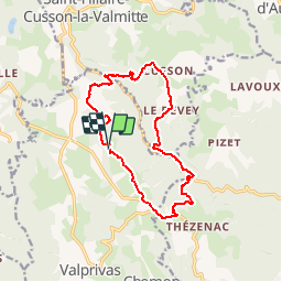
![](/images/other/stat-length.png)
![Trail Mountain bike Valprivas - L''Aigue Blanche - Chanteloube - Photo](https://media.geolcdn.com/t/1900/400/ext.pjpeg?maxdim=2&url=https%3A%2F%2Fservices.sitytrail.com%2FGeolivesWS%2FDownloadMedia.ashx%3FTrailID%3D215260%26Media%3D15454_6.jpg)
L''Aigue Blanche - Chanteloube
tracegps
User
![Length](/images/other/stat-length.png)
![Max alt](https://static1.geolcdn.com/siteimages/upload/files/1508320355ic_sort_altitude_max_24dp.png)
![Uphill gradient](https://static1.geolcdn.com/siteimages/upload/files/1508320355ic_sort_den_pos_24dp.png)
![Km-Effort](/images/other/stat-length.png)
![Min alt](https://static1.geolcdn.com/siteimages/upload/files/1508320355ic_sort_altitude_min_24dp.png)
![Downhill gradient](https://static1.geolcdn.com/siteimages/upload/files/1508320355ic_sort_den_neg_24dp.png)
![Boucle](https://static1.geolcdn.com/siteimages/upload/files/16400158638029165_repeat_loop_refresh_sync_direction_icon.png)
![Mountain bike](https://static1.geolcdn.com/sitytour/trail-icons/202.png)
1h30
Difficulty : Difficult
![Scan this QR Code to open this trail in the SityTrail application](https://capi.geolives.com/qq0zvz2zws4bq2lad0pu/sitytour/trails/215260/qr.png?size=200)
FREE GPS app for hiking
About
Trail Mountain bike of 13.9 km to be discovered at Auvergne-Rhône-Alpes, Haute-Loire, Valprivas. This trail is proposed by tracegps.
Description
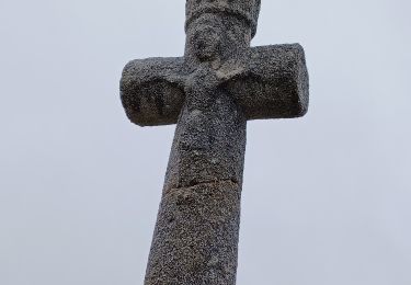
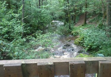
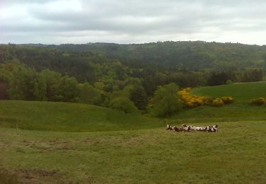
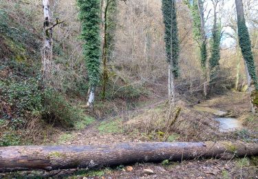
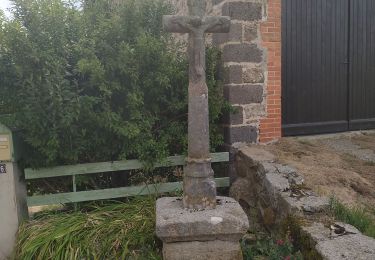
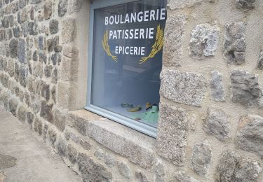
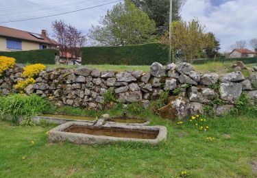
Balade sur les versants du ruisseau L'Aigue Blanche en amont de Bas-en Basset. Descente sur la vallée au départ de Chanteloube par exemple, traversée de la route Bas- St Hilaire- Cusson la Valmite que les cyclistes connaissent bien, remontée dans la Loire, rive gauche sur Le Devey... Les portes de Cusson. Retour en amont de la vallée par Valtaillet. Un bon dénivelé sur les flancs du plateau...
Positioning
Comments
Trails nearby
![Trail Walking Bas-en-Basset - Le Tour du Malorum - Bas-en-Basset - Photo](https://media.geolcdn.com/t/375/260/ext.jpg?maxdim=2&url=https%3A%2F%2Fservices.sitytrail.com%2FGeolivesWS%2FDownloadMedia.ashx%3FTrailID%3D111776%26Media%3D8275_5.jpg)
![Walking Walking](https://static1.geolcdn.com/sitytour/trail-icons/101.png)
Walking
![](/images/other/stat-length.png)
![](https://static1.geolcdn.com/siteimages/upload/files/16400158638029165_repeat_loop_refresh_sync_direction_icon.png)
![Trail Walking Saint-Hilaire-Cusson-la-Valmitte - Saint Hilaire -Cusson la Valmitte - Photo](https://media.geolcdn.com/t/375/260/39ea7fe6-538d-4ae9-b0c3-668600121859.jpg&format=jpg&maxdim=2)
![Walking Walking](https://static1.geolcdn.com/sitytour/trail-icons/101.png)
Walking
![](/images/other/stat-length.png)
![](https://static1.geolcdn.com/siteimages/upload/files/16400158638029165_repeat_loop_refresh_sync_direction_icon.png)
![Trail Walking Merle-Leignec - Luriecq](https://media.geolcdn.com/t/375/260/7214e3e6-0564-4e7d-ab01-7a9f3de1f225.jpg&format=jpg&maxdim=2)
![Walking Walking](https://static1.geolcdn.com/sitytour/trail-icons/101.png)
Walking
![](/images/other/stat-length.png)
![](https://static1.geolcdn.com/siteimages/upload/files/16400158638029165_repeat_loop_refresh_sync_direction_icon.png)
![Trail Walking Boisset - saut du bezan - Photo](https://media.geolcdn.com/t/375/260/ext.jpg?maxdim=2&url=https%3A%2F%2Fservices.sitytrail.com%2FGeolivesWS%2FDownloadMedia.ashx%3FTrailID%3D332676%26Media%3Dfix__20140809171303.jpg)
![Walking Walking](https://static1.geolcdn.com/sitytour/trail-icons/101.png)
Walking
![](/images/other/stat-length.png)
![](https://static1.geolcdn.com/siteimages/upload/files/16400158638029165_repeat_loop_refresh_sync_direction_icon.png)
![Trail Walking Valprivas - L''Aigue Blanche - Chanteloube - Photo](https://media.geolcdn.com/t/375/260/ext.jpg?maxdim=2&url=https%3A%2F%2Fservices.sitytrail.com%2FGeolivesWS%2FDownloadMedia.ashx%3FTrailID%3D215259%26Media%3D15454_6.jpg)
![Walking Walking](https://static1.geolcdn.com/sitytour/trail-icons/101.png)
Walking
![](/images/other/stat-length.png)
![](https://static1.geolcdn.com/siteimages/upload/files/16400158638029165_repeat_loop_refresh_sync_direction_icon.png)
![Trail Walking Bas-en-Basset - Morand tour du proprio - Photo](https://media.geolcdn.com/t/375/260/54dcb866-750c-4485-a205-aa951ef6eb0f.jpg&format=jpg&maxdim=2)
![Walking Walking](https://static1.geolcdn.com/sitytour/trail-icons/101.png)
Walking
![](/images/other/stat-length.png)
![](https://static1.geolcdn.com/siteimages/upload/files/16400158638029165_repeat_loop_refresh_sync_direction_icon.png)
![Trail Walking Apinac - moulin et chapelles - Photo](https://media.geolcdn.com/t/375/260/02594510-8219-4ca7-b4b4-5901da37d7ee.jpg&format=jpg&maxdim=2)
![Walking Walking](https://static1.geolcdn.com/sitytour/trail-icons/101.png)
Walking
![](/images/other/stat-length.png)
![](https://static1.geolcdn.com/siteimages/upload/files/16400158638029165_repeat_loop_refresh_sync_direction_icon.png)
![Trail Walking Rozier-Côtes-d'Aurec - le font des dames - Photo](https://media.geolcdn.com/t/375/260/a0822d9b-ee00-4633-b65c-62627b78e2fa.jpg&format=jpg&maxdim=2)
![Walking Walking](https://static1.geolcdn.com/sitytour/trail-icons/101.png)
Walking
![](/images/other/stat-length.png)
![](https://static1.geolcdn.com/siteimages/upload/files/16400158638029165_repeat_loop_refresh_sync_direction_icon.png)
![Trail Walking Merle-Leignec - le chemin delà poix - Photo](https://media.geolcdn.com/t/375/260/5eb5fa71-e59a-4c94-9c41-393c4ad0e28d.jpg&format=jpg&maxdim=2)
![Walking Walking](https://static1.geolcdn.com/sitytour/trail-icons/101.png)
Walking
![](/images/other/stat-length.png)
![](https://static1.geolcdn.com/siteimages/upload/files/16400158638029165_repeat_loop_refresh_sync_direction_icon.png)