


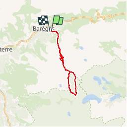

16.2 km | 31 km-effort


User

FREE GPS app for hiking
 SityTrail
IGN / Geographical institutes
SityTrail World
The world is yours!
Trail Walking of 24 km to be discovered at Occitania, Hautespyrenees, Barèges. This trail is proposed by algecko.
Départ du parking Camp Rollot (1557m). Montée : Refuge de la Glère, Lac de l'Oueil-Nègre, Lac det Mail, Lac Estelat Supérieur, Col de Coume Estrète, Turon de Néouvielle (3036m). Descente : glacier de Maniportet, Lac Bleu, Lac Verts, Lac det Mail, Refuge de la Gière, Camp Rollot.
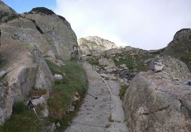
Montée dans un pierrier et un chaos entre le Lac Estelat Supérieur et le Col de Coume Estrète très difficile.
Walking

Walking

Walking

Walking

Horseback riding
Walking

Walking
Walking
Walking