![](/images/other/stat-length.png)
![Trail Mountain bike Grandrif - 8ème Rando VTT des Crêtes du Forez (2013-VTT-70km) - Col des Pradeaux - Photo](https://media.geolcdn.com/t/1900/400/ext.pjpeg?maxdim=2&url=https%3A%2F%2Fservices.sitytrail.com%2FGeolivesWS%2FDownloadMedia.ashx%3FTrailID%3D215203%26Media%3D15808_6.jpg)
8ème Rando VTT des Crêtes du Forez (2013-VTT-70km) - Col des Pradeaux
tracegps
User
![Length](/images/other/stat-length.png)
![Max alt](https://static1.geolcdn.com/siteimages/upload/files/1508320355ic_sort_altitude_max_24dp.png)
![Uphill gradient](https://static1.geolcdn.com/siteimages/upload/files/1508320355ic_sort_den_pos_24dp.png)
![Km-Effort](/images/other/stat-length.png)
![Min alt](https://static1.geolcdn.com/siteimages/upload/files/1508320355ic_sort_altitude_min_24dp.png)
![Downhill gradient](https://static1.geolcdn.com/siteimages/upload/files/1508320355ic_sort_den_neg_24dp.png)
![Boucle](https://static1.geolcdn.com/siteimages/upload/files/16400158638029165_repeat_loop_refresh_sync_direction_icon.png)
![Mountain bike](https://static1.geolcdn.com/sitytour/trail-icons/202.png)
5h30
Difficulty : Very difficult
![Scan this QR Code to open this trail in the SityTrail application](https://capi.geolives.com/qq0zvz2zws4bq2lad0pu/sitytour/trails/215203/qr.png?size=200)
FREE GPS app for hiking
About
Trail Mountain bike of 72 km to be discovered at Auvergne-Rhône-Alpes, Puy-de-Dôme, Grandrif. This trail is proposed by tracegps.
Description
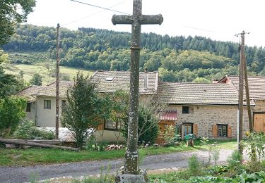
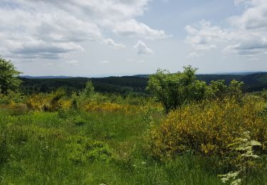
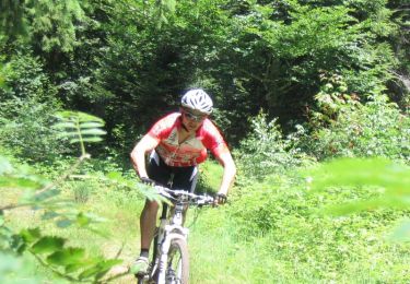
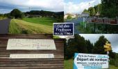
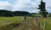
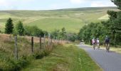
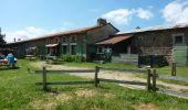
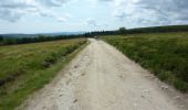
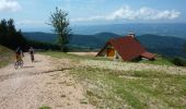
Parking et départ du Col des Pradeaux (alti. 1196 m) sur la RD 996 entre Ambert et Saint-Anthème. Cette randonnée VTT est organisée par le Centre VTT du Pays d’Ambert, elle se déroule chaque 1er dimanche du mois d’août et cette 8ème édition a eu lieu le dimanche 04 août 2013. Cerise sur le gâteau… le soleil et la douceur étaient de la partie. 3 circuits VTT sont proposés (25, 50 et 72 km) 2 circuits pédestres (8 et 16 km) 1 circuits de marche nordique, avec bâtons (5 km). Les circuits sont assez aériens car ils cheminent sur les Hautes Chaumes du Forez, à une altitude comprise entre 1000 et 1400m. Ce circuit VTT, d’un peu plus de 70 km, se révèle très agréable et sans grande difficulté majeure. Il y a ponctuellement des petits passages techniques dans la caillasse mais jamais longs et aussi de bonnes portions roulantes sur de belles pistes qui ressemblent à des boulevards. Passage à la fameuse Auberge de Garnier et sa cuisine de terroir (voir aussi le circuit 15707). Nombreux passages en sous bois avec quelques belles monotraces (single-track). Les paysages sont absolument magnifiques. Garder l’appareil photo à portée de main. Sur les Hautes Chaumes, le circuit traverse de nombreux enclos d’estives dont il faut ouvrir des barrières tubulaires et des clôtures électriques. Bien veiller à les refermer avant de quitter les lieux afin d’éviter toute fuite de bétail. Circuit interdit quand il y a de la neige ou par temps de brouillard. Se renseigner sur les conditions météo avant de monter et prévoir une veste imperméable. Topoguides : Centre VTT du Pays d’Ambert, 15 circuits balisés (O.T d’Ambert) ; Balades en Pays d’Ambert et Livradois Porte d’Auvergne, 20 circuits (O.T d’Ambert) ; Vallée de l’Ance, circuits VTT : 13 circuits (espace VTT N° 24) (O.T de Saint-Anthème) ; Vallée de l’Ance, circuits Pédestres : 15 circuits 1 micro rando 1 bonus (O.T de Saint-Anthème).
Positioning
Comments
Trails nearby
![Trail On foot Grandrif - Sur la piste du chevreuil - Photo](https://media.geolcdn.com/t/375/260/778ee72e-3c3e-495a-8b77-9630f1db8753.jpeg&format=jpg&maxdim=2)
![On foot On foot](https://static1.geolcdn.com/sitytour/trail-icons/100.png)
On foot
![](/images/other/stat-length.png)
![](https://static1.geolcdn.com/siteimages/upload/files/16400158638029165_repeat_loop_refresh_sync_direction_icon.png)
![Trail On foot Saint-Martin-des-Olmes - Saint Martin Des Olmes - Photo](https://media.geolcdn.com/t/375/260/d3ac1e27-dc6e-4107-a049-0101832b4da9.jpeg&format=jpg&maxdim=2)
![On foot On foot](https://static1.geolcdn.com/sitytour/trail-icons/100.png)
On foot
![](/images/other/stat-length.png)
![](https://static1.geolcdn.com/siteimages/upload/files/16400158638029165_repeat_loop_refresh_sync_direction_icon.png)
![Trail On foot Ambert - Le sentier des Papetiers - Photo](https://media.geolcdn.com/t/375/260/735d8ac0-abfc-41f4-ba8e-fdfa4ce6cee9.jpeg&format=jpg&maxdim=2)
![On foot On foot](https://static1.geolcdn.com/sitytour/trail-icons/100.png)
On foot
![](/images/other/stat-length.png)
![](https://static1.geolcdn.com/siteimages/upload/files/16400158638029165_repeat_loop_refresh_sync_direction_icon.png)
![Trail Walking Saint-Romain - Chaulmes - Photo](https://media.geolcdn.com/t/375/260/9044889e-28bf-406b-8a2b-9017a5ea2443.jpg&format=jpg&maxdim=2)
![Walking Walking](https://static1.geolcdn.com/sitytour/trail-icons/101.png)
Walking
![](/images/other/stat-length.png)
![](https://static1.geolcdn.com/siteimages/upload/files/16400158638029165_repeat_loop_refresh_sync_direction_icon.png)
![Trail Walking Saint-Anthème - boucle des Pradeaux - Photo](https://media.geolcdn.com/t/375/260/ext.jpg?maxdim=2&url=https%3A%2F%2Fservices.sitytrail.com%2FGeolivesWS%2FDownloadMedia.ashx%3FTrailID%3D983955%26Media%3Dfix__20180610133330.jpg)
![Walking Walking](https://static1.geolcdn.com/sitytour/trail-icons/101.png)
Walking
![](/images/other/stat-length.png)
![](https://static1.geolcdn.com/siteimages/upload/files/16400158638029165_repeat_loop_refresh_sync_direction_icon.png)
![Trail Walking Saint-Romain - gite le puy montpeloux 2017 - Photo](https://media.geolcdn.com/t/375/260/ext.jpg?maxdim=2&url=https%3A%2F%2Fstatic1.geolcdn.com%2Fsiteimages%2Fupload%2Ffiles%2F1553511878bg_sport_marche.png)
![Walking Walking](https://static1.geolcdn.com/sitytour/trail-icons/101.png)
Walking
![](/images/other/stat-length.png)
![](https://static1.geolcdn.com/siteimages/upload/files/16400158638029165_repeat_loop_refresh_sync_direction_icon.png)
![Trail Mountain bike Grandrif - Randonnée VTT des Crêtes du Forez 2011 - Photo](https://media.geolcdn.com/t/375/260/ext.jpg?maxdim=2&url=https%3A%2F%2Fservices.sitytrail.com%2FGeolivesWS%2FDownloadMedia.ashx%3FTrailID%3D106982%26Media%3D11751_4.jpg)
![Mountain bike Mountain bike](https://static1.geolcdn.com/sitytour/trail-icons/202.png)
Mountain bike
![](/images/other/stat-length.png)
![](https://static1.geolcdn.com/siteimages/upload/files/16400158638029165_repeat_loop_refresh_sync_direction_icon.png)
![Trail Walking Grandrif - Boucle des Pradeaux - Photo](https://media.geolcdn.com/t/375/260/92909e8c-9d38-4f31-b803-37d313042e55.jpg&format=jpg&maxdim=2)
![Walking Walking](https://static1.geolcdn.com/sitytour/trail-icons/101.png)
Walking
![](/images/other/stat-length.png)
![](https://static1.geolcdn.com/siteimages/upload/files/16400158638029165_repeat_loop_refresh_sync_direction_icon.png)
![Trail On foot Saint-Romain - Le bonheur est dans le bois - Photo](https://media.geolcdn.com/t/375/260/ext.jpg?maxdim=2&url=https%3A%2F%2Fstatic1.geolcdn.com%2Fsiteimages%2Fupload%2Ffiles%2F1545311037marcheuse_200dpi.jpg)
![On foot On foot](https://static1.geolcdn.com/sitytour/trail-icons/100.png)
On foot
![](/images/other/stat-length.png)
![](https://static1.geolcdn.com/siteimages/upload/files/16400158638029165_repeat_loop_refresh_sync_direction_icon.png)