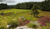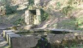

Cranou - Hanvec

tracegps
User

Length
26 km

Max alt
320 m

Uphill gradient
451 m

Km-Effort
32 km

Min alt
56 m

Downhill gradient
451 m
Boucle
Yes
Creation date :
2014-12-10 00:00:00.0
Updated on :
2014-12-10 00:00:00.0
8h00
Difficulty : Difficult

FREE GPS app for hiking
About
Trail Walking of 26 km to be discovered at Brittany, Finistère, Hanvec. This trail is proposed by tracegps.
Description
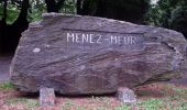
Randonnée Cranou Monts D'Arrée Topo guide FFR "Parc Régional d'Armorique" Longue rando de 26 Km passant par la forêt du Cranou, le Menez Meur, les crêtes....
Positioning
Country:
France
Region :
Brittany
Department/Province :
Finistère
Municipality :
Hanvec
Location:
Unknown
Start:(Dec)
Start:(UTM)
414023 ; 5353317 (30U) N.
Comments
Trails nearby
GR34 Le Faou -- Rangoulic


Walking
Very difficult
Le Faou,
Brittany,
Finistère,
France

18.3 km | 25 km-effort
5h 38min
No
Troiad ar Vadalen


On foot
Easy
Hanvec,
Brittany,
Finistère,
France

9 km | 11.3 km-effort
2h 33min
No
Visite express du centre historique de Le Faou


Walking
Very easy
Le Faou,
Brittany,
Finistère,
France

2.3 km | 2.5 km-effort
33min
Yes

GRP_Crozon_CB_01_Le-Faou_Argol_20200919


Walking
Medium
Le Faou,
Brittany,
Finistère,
France

15.9 km | 21 km-effort
4h 31min
No
La randonnée du Faou


Walking
Medium
Le Faou,
Brittany,
Finistère,
France

9.4 km | 11.6 km-effort
3h 37min
Yes

GR_37_FC_14_Le-Faou_Argol_20200919


Walking
Medium
Le Faou,
Brittany,
Finistère,
France

15.9 km | 21 km-effort
4h 31min
No
2020-09-01_19h30m58_Piste_2020-08-30 174242


Walking
Medium
Le Faou,
Brittany,
Finistère,
France

22 km | 28 km-effort
5h 25min
Yes
Le Faou - 2.1km 15m 40mn - 2019 09 12


Walking
Very easy
Le Faou,
Brittany,
Finistère,
France

2.1 km | 2.3 km-effort
40min
Yes
SAINT ELOI / LE TREHOU


Walking
Medium
Saint-Eloy,
Brittany,
Finistère,
France

22 km | 27 km-effort
5h 18min
Yes


 SityTrail


