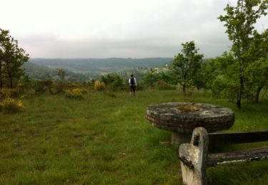
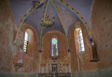
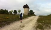
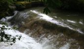
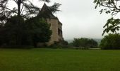
Trail Walking Lendou-en-Quercy - Circuit de Lolmie - Photo

Circuit de Lolmie

 tracegps
tracegps

User

© OpenStreetMap contributors
Length
Length
6.1 km
Max alt
Max alt
261 m
Uphill gradient
Uphill gradient
140 m
Km-Effort
Km-Effort  
8 km
Min alt
Min alt
134 m
Downhill gradient
Downhill gradient
136 m
Boucle
Boucle
Yes
Creation date :
2014-12-10 00:00:00.0
Updated on :
2014-12-10 00:00:00.0

(0 Reviews)

Walking
Walking
2h00
Difficulty : Medium

Scan this QR Code to open this trail in the SityTrail application

FREE GPS app for hiking

Logo SityTrail SityTrail

IGN / Geographical institutes

Download SityTrail from the App Store Download SityTrail from Google Play

Logo SityTrail SityTrail World

The world is yours!

Download SityTrail from the App Store Download SityTrail from Google Play Download SityTrail on Huawei AppGallery

About

Trail Walking of 6.1 km to be discovered at Occitania, Lot, Lendou-en-Quercy. This trail is proposed by tracegps.

Description

Cette balade entre la vallée du Lendou et le plateau, offre un contraste intéressant entre les points de vue sur la polyculture pratiquée par les agriculteurs dont celle du melon du Quercy, et la végétation méditerranéenne de ce coin de Quercy Blanc. La riche vallée du Lendou fait le lien entre Saint-Laurent et Lolmie, deux villages construits à mi-pente et réunis, il y a plus de 150 ans, en une seule commune. Attention le départ de cette randonnée est donné à l'église de Lolmie et non celle de Saint Laurent. Dos à la porte de l'église, descendre en longeant le cimetière, balisage PR jaune.

Elevation profile

Photos

Positioning

Country:
France
Region :
Occitania
Department/Province :
Lot
Municipality :
Lendou-en-Quercy
Location:
Saint-Laurent-Lolmie
Start:(UTM)
358917 ; 4905188 (31T) N.

Trails nearby

Trail Mountain bike Lendou-en-Quercy - Circuit de Lolmie - Photo
Mountain bike
tracegps

Mountain bike

Medium
Lendou-en-Quercy, Occitania, Lot, France
6.1 km | 8 km-effort
45min
Yes
Trail Walking Montlauzun - Montlauzun - St Martin - Chemin de Compostelle - Photo
Walking
tracegps

Walking

Very difficult
Montlauzun, Occitania, Lot, France
23 km | 31 km-effort
9h 49min
No
Trail Walking Montlauzun - Montlauzun - Photo
Walking
Glurps

Walking

Medium
Montlauzun, Occitania, Lot, France
16.6 km | 22 km-effort
4h 18min
Yes
Trail Horseback riding Lendou-en-Quercy - montcuq - Photo
Horseback riding
jces

Horseback riding

Medium
Lendou-en-Quercy, Occitania, Lot, France
18.8 km | 23 km-effort
2h 55min
Yes
Trail Horseback riding Lendou-en-Quercy - marcillac - Photo
Horseback riding
jces

Horseback riding

Medium
Lendou-en-Quercy, Occitania, Lot, France
25 km | 31 km-effort
3h 52min
Yes
Trail Walking Sainte-Juliette - sainte juliette  - Photo
Walking
Oupia82

Walking

Very easy
Sainte-Juliette, Occitania, Tarn-et-Garonne, France
9.8 km | 13.1 km-effort
2h 56min
Yes
Trail Walking Montcuq-en-Quercy-Blanc - 6. Etappe; 3. Reise Kirchgemeinde Egg - Photo
Walking
hallauer

Walking

Very easy
Montcuq-en-Quercy-Blanc, Occitania, Lot, France
19.3 km | 26 km-effort
5h 30min
No
Trail Horseback riding Lendou-en-Quercy - Etape 1 - Saint-Cyprien/Le Boulve - Photo
Horseback riding
elsarose

Horseback riding

Difficult
Lendou-en-Quercy, Occitania, Lot, France
26 km | 34 km-effort
4h 11min
No
Trail Equestrian Lendou-en-Quercy - J2 MARCILLAC FLAUGNAC 33k - Photo
Equestrian
randolibre

Equestrian

Very easy
Lendou-en-Quercy, Occitania, Lot, France
33 km | 43 km-effort
5h 20min
No


Close
My subscriptions