![](/images/other/stat-length.png)
![Trail Mountain bike La Bresse - Le Tour de La Bresse en VTT - Photo](https://media.geolcdn.com/t/1900/400/ext.pjpeg?maxdim=2&url=https%3A%2F%2Fservices.sitytrail.com%2FGeolivesWS%2FDownloadMedia.ashx%3FTrailID%3D214836%26Media%3D15354_3.jpg)
Le Tour de La Bresse en VTT
tracegps
User
![Length](/images/other/stat-length.png)
Length
49 km
![Max alt](https://static1.geolcdn.com/siteimages/upload/files/1508320355ic_sort_altitude_max_24dp.png)
Max alt
1256 m
![Uphill gradient](https://static1.geolcdn.com/siteimages/upload/files/1508320355ic_sort_den_pos_24dp.png)
Uphill gradient
1785 m
![Km-Effort](/images/other/stat-length.png)
Km-Effort
72 km
![Min alt](https://static1.geolcdn.com/siteimages/upload/files/1508320355ic_sort_altitude_min_24dp.png)
Min alt
704 m
![Downhill gradient](https://static1.geolcdn.com/siteimages/upload/files/1508320355ic_sort_den_neg_24dp.png)
Downhill gradient
1787 m
![Boucle](https://static1.geolcdn.com/siteimages/upload/files/16400158638029165_repeat_loop_refresh_sync_direction_icon.png)
Boucle
Yes
Creation date :
2014-12-10 00:00:00.0
Updated on :
2014-12-10 00:00:00.0
![Mountain bike](https://static1.geolcdn.com/sitytour/trail-icons/202.png)
5h00
Difficulty : Very difficult
![Scan this QR Code to open this trail in the SityTrail application](https://capi.geolives.com/qq0zvz2zws4bq2lad0pu/sitytour/trails/214836/qr.png?size=200)
FREE GPS app for hiking
About
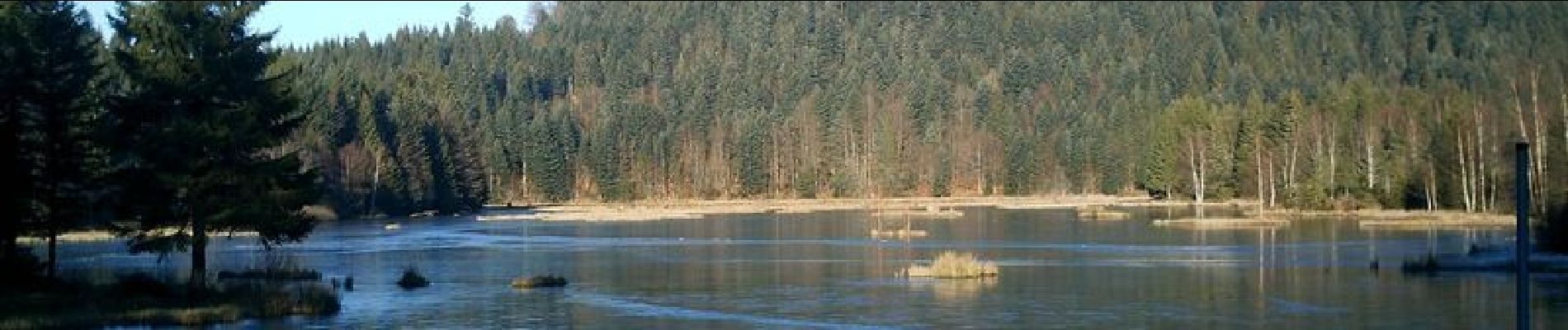
Trail Mountain bike of 49 km to be discovered at Grand Est, Vosges, La Bresse. This trail is proposed by tracegps.
Description
Découvrez les charmes de La Bresse en VTT grâce à ce tracé établi par des professionnels. Départ du Domaine du Haut des Bluches , centre Cyclo Sport qui vous propose également des possibilités d'hébergement. Dénivelé positif: 1620m. Altitude minimum:707m. Altitude maxi 1255m.
Positioning
Country:
France
Region :
Grand Est
Department/Province :
Vosges
Municipality :
La Bresse
Location:
Unknown
Start:(Dec)
Start:(UTM)
344612 ; 5318413 (32U) N.
Comments
Trails nearby
![Trail Walking La Bresse - 2023-04-16 Marche Abri Lac de Blanchemer vers Lac de Lispach - Photo](https://media.geolcdn.com/t/375/260/20b642e6-a3a8-4790-bc8e-b2ad298c0408.jpg&format=jpg&maxdim=2)
![Walking Walking](https://static1.geolcdn.com/sitytour/trail-icons/101.png)
2023-04-16 Marche Abri Lac de Blanchemer vers Lac de Lispach
Walking
Very difficult
(1)
La Bresse,
Grand Est,
Vosges,
France
![](/images/other/stat-length.png)
23 km | 36 km-effort
8h 4min
![](https://static1.geolcdn.com/siteimages/upload/files/16400158638029165_repeat_loop_refresh_sync_direction_icon.png)
No
![Trail Walking La Bresse - 2023-04-15 Marche Abri Collet de Etang vers Abri Lac de Blanchemer - Photo](https://media.geolcdn.com/t/375/260/f5705708-8e73-435e-a1e8-28d1d0c03215.jpg&format=jpg&maxdim=2)
![Walking Walking](https://static1.geolcdn.com/sitytour/trail-icons/101.png)
2023-04-15 Marche Abri Collet de Etang vers Abri Lac de Blanchemer
Walking
Medium
(1)
La Bresse,
Grand Est,
Vosges,
France
![](/images/other/stat-length.png)
22 km | 35 km-effort
7h 51min
![](https://static1.geolcdn.com/siteimages/upload/files/16400158638029165_repeat_loop_refresh_sync_direction_icon.png)
No
![Trail Walking Wildenstein - 2022-02-20 Marche Kruth Grand Ventron - Photo](https://media.geolcdn.com/t/375/260/74324e84-ba09-479c-87ba-50417488039d.jpg&format=jpg&maxdim=2)
![Walking Walking](https://static1.geolcdn.com/sitytour/trail-icons/101.png)
2022-02-20 Marche Kruth Grand Ventron
Walking
Very difficult
(1)
Wildenstein,
Grand Est,
Haut-Rhin,
France
![](/images/other/stat-length.png)
16.8 km | 27 km-effort
4h 52min
![](https://static1.geolcdn.com/siteimages/upload/files/16400158638029165_repeat_loop_refresh_sync_direction_icon.png)
Yes
![Trail Walking La Bresse - Autour du Lac des Corbeaux - Photo](https://media.geolcdn.com/t/375/260/cc3388d0-b7b4-4b72-bf02-d3b5f6b4e910.jpg&format=jpg&maxdim=2)
![Walking Walking](https://static1.geolcdn.com/sitytour/trail-icons/101.png)
Autour du Lac des Corbeaux
Walking
Medium
(1)
La Bresse,
Grand Est,
Vosges,
France
![](/images/other/stat-length.png)
3.1 km | 6 km-effort
1h 30min
![](https://static1.geolcdn.com/siteimages/upload/files/16400158638029165_repeat_loop_refresh_sync_direction_icon.png)
Yes
![Trail Walking Wildenstein - TREK ALSACIEN (boucle de Wildenstein) - Photo](https://media.geolcdn.com/t/375/260/319755c6-b355-43a3-9980-ff414aa67ddf.jpg&format=jpg&maxdim=2)
![Walking Walking](https://static1.geolcdn.com/sitytour/trail-icons/101.png)
TREK ALSACIEN (boucle de Wildenstein)
Walking
Difficult
(1)
Wildenstein,
Grand Est,
Haut-Rhin,
France
![](/images/other/stat-length.png)
15.4 km | 24 km-effort
5h 20min
![](https://static1.geolcdn.com/siteimages/upload/files/16400158638029165_repeat_loop_refresh_sync_direction_icon.png)
Yes
![Trail Walking La Bresse - la bresse - le moutier des fées - Photo](https://media.geolcdn.com/t/375/260/8b05ded1-af8a-4cd0-8ffd-c8efb092f1de.jpg&format=jpg&maxdim=2)
![Walking Walking](https://static1.geolcdn.com/sitytour/trail-icons/101.png)
la bresse - le moutier des fées
Walking
Very easy
(1)
La Bresse,
Grand Est,
Vosges,
France
![](/images/other/stat-length.png)
26 km | 36 km-effort
3h 26min
![](https://static1.geolcdn.com/siteimages/upload/files/16400158638029165_repeat_loop_refresh_sync_direction_icon.png)
No
![Trail Walking La Bresse - SityTrail - Le Lac des Corbeaux - La Bresse - Photo](https://media.geolcdn.com/t/375/260/4efcd8bf-8367-405d-962e-dfceb2021e66.jpg&format=jpg&maxdim=2)
![Walking Walking](https://static1.geolcdn.com/sitytour/trail-icons/101.png)
SityTrail - Le Lac des Corbeaux - La Bresse
Walking
Very easy
(1)
La Bresse,
Grand Est,
Vosges,
France
![](/images/other/stat-length.png)
3 km | 6 km-effort
1h 0min
![](https://static1.geolcdn.com/siteimages/upload/files/16400158638029165_repeat_loop_refresh_sync_direction_icon.png)
Yes
![Walking Walking](https://static1.geolcdn.com/sitytour/trail-icons/101.png)
Les 5 lacs autour du Hohneck
Walking
Very difficult
(1)
La Bresse,
Grand Est,
Vosges,
France
![](/images/other/stat-length.png)
21 km | 36 km-effort
7h 21min
![](https://static1.geolcdn.com/siteimages/upload/files/16400158638029165_repeat_loop_refresh_sync_direction_icon.png)
Yes
![Trail Walking Wildenstein - Col du Bramont - Machey - Blanchemer - Photo](https://media.geolcdn.com/t/375/260/ext.jpg?maxdim=2&url=https%3A%2F%2Fservices.sitytrail.com%2FGeolivesWS%2FDownloadMedia.ashx%3FTrailID%3D450008%26Media%3Dfix__20150714143610.jpg)
![Walking Walking](https://static1.geolcdn.com/sitytour/trail-icons/101.png)
Col du Bramont - Machey - Blanchemer
Walking
Medium
(1)
Wildenstein,
Grand Est,
Haut-Rhin,
France
![](/images/other/stat-length.png)
15.3 km | 22 km-effort
4h 27min
![](https://static1.geolcdn.com/siteimages/upload/files/16400158638029165_repeat_loop_refresh_sync_direction_icon.png)
Yes